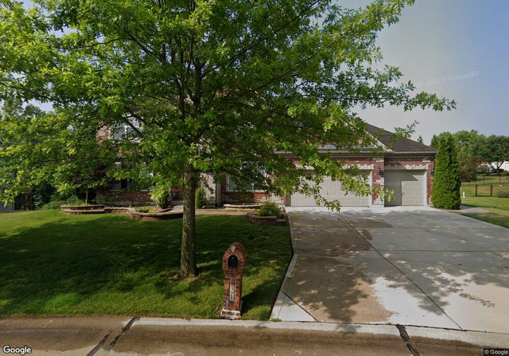
31 Orchard Trace Ln Grover, MO 63040
Estimated Value: $806,000 - $942,000
4
Beds
5
Baths
5,462
Sq Ft
$159/Sq Ft
Est. Value
About This Home
This home is located at 31 Orchard Trace Ln, Grover, MO 63040 and is currently estimated at $867,524, approximately $158 per square foot. 31 Orchard Trace Ln is a home located in St. Louis County with nearby schools including Fairway Elementary School, Wildwood Middle School, and Eureka Senior High School.
Ownership History
Date
Name
Owned For
Owner Type
Purchase Details
Closed on
Jul 25, 2006
Sold by
The Jones Co Homes Llc
Bought by
Rawls Douglas A and Rawls Stacia L
Current Estimated Value
Home Financials for this Owner
Home Financials are based on the most recent Mortgage that was taken out on this home.
Original Mortgage
$88,390
Interest Rate
6.62%
Mortgage Type
Credit Line Revolving
Create a Home Valuation Report for This Property
The Home Valuation Report is an in-depth analysis detailing your home's value as well as a comparison with similar homes in the area
Home Values in the Area
Average Home Value in this Area
Purchase History
| Date | Buyer | Sale Price | Title Company |
|---|---|---|---|
| Rawls Douglas A | $631,741 | Commerce Title Company |
Source: Public Records
Mortgage History
| Date | Status | Borrower | Loan Amount |
|---|---|---|---|
| Previous Owner | Rawls Douglas A | $88,390 | |
| Previous Owner | Rawls Douglas A | $417,000 |
Source: Public Records
Tax History
| Year | Tax Paid | Tax Assessment Tax Assessment Total Assessment is a certain percentage of the fair market value that is determined by local assessors to be the total taxable value of land and additions on the property. | Land | Improvement |
|---|---|---|---|---|
| 2025 | $10,026 | $156,310 | $39,140 | $117,170 |
| 2024 | $10,026 | $144,190 | $23,480 | $120,710 |
| 2023 | $10,018 | $144,190 | $23,480 | $120,710 |
| 2022 | $8,942 | $119,530 | $13,680 | $105,850 |
| 2021 | $8,875 | $119,530 | $13,680 | $105,850 |
| 2020 | $9,642 | $123,810 | $15,490 | $108,320 |
| 2019 | $9,681 | $123,810 | $15,490 | $108,320 |
| 2018 | $10,994 | $132,580 | $18,920 | $113,660 |
| 2016 | $7,893 | $93,780 | $18,920 | $74,860 |
Source: Public Records
Map
Nearby Homes
- 422 Blackwolf Run Dr
- 16042 Nantucket Island Dr
- 16090 Nantucket Island Dr
- 16270 Audubon Village Dr
- 16175 Port of Nantucket Dr
- 400 Hunters Crossing Ct
- 1570 Old State Rd
- 16518 Victoria Crossing Dr Unit B
- 3325 Pine Cliff Rd
- 16500 Victoria Crossing Dr
- 134 Jubilee Hill Dr Unit K
- 16512 Carriage View Ct
- 114 Carriage View Dr
- 16500 Jubilee Hill Spur Unit A
- 326 Waterside Dr Unit E12
- 2625 Grover Crossing Way
- 2736 Grover Crossing Dr
- 2639 Rockwood Pointe Ct
- 2601 East Ave
- 2517 Newpoint Dr
- 27 Orchard Trace Ln
- 35 Orchard Trace Ln
- 30 Orchard Trace Ln
- 23 Orchard Trace Ln
- 466 Blackwolf Run Dr
- 22 Orchard Trace Ln
- 450 Blackwolf Run Dr
- 458 Blackwolf Run Dr
- 462 Blackwolf Run Dr
- 470 Blackwolf Run Dr
- 446 Blackwolf Run Dr
- 474 Blackwolf Run Dr
- 18 Orchard Trace Ln
- 442 Blackwolf Run Dr
- 15 Orchard Trace Ln
- 461 Blackwolf Run Dr
- 438 Blackwolf Run Dr
- 478 Blackwolf Run Dr
- 453 Blackwolf Run Dr
- 4 Blackwolf Run Ct
Your Personal Tour Guide
Ask me questions while you tour the home.