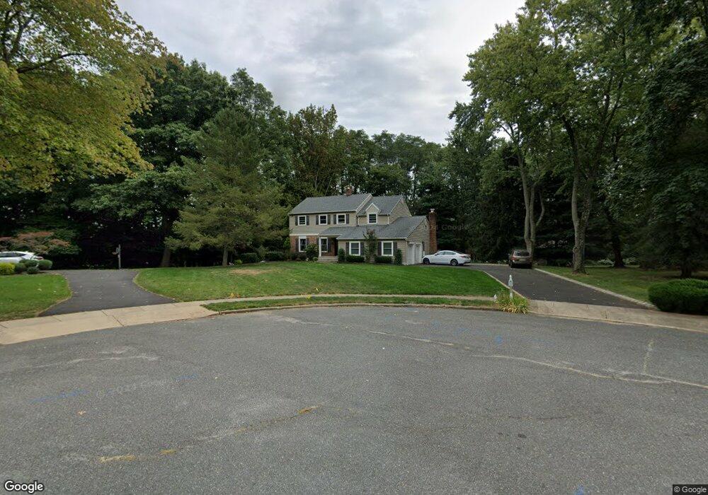
31 Packard Dr Middletown, NJ 07748
New Monmouth NeighborhoodEstimated Value: $1,061,076 - $1,182,000
4
Beds
3
Baths
2,419
Sq Ft
$461/Sq Ft
Est. Value
About This Home
This home is located at 31 Packard Dr, Middletown, NJ 07748 and is currently estimated at $1,116,019, approximately $461 per square foot. 31 Packard Dr is a home located in Monmouth County with nearby schools including Middletown Village Elementary School, Thompson Middle School, and Middletown High School North.
Ownership History
Date
Name
Owned For
Owner Type
Purchase Details
Closed on
Apr 18, 1997
Sold by
Hamilton William
Bought by
Sheridan Patrick and Sheridan Diane
Current Estimated Value
Home Financials for this Owner
Home Financials are based on the most recent Mortgage that was taken out on this home.
Original Mortgage
$125,000
Outstanding Balance
$16,105
Interest Rate
7.85%
Estimated Equity
$1,099,914
Purchase Details
Closed on
Nov 28, 1994
Sold by
Ilch David
Bought by
Hamilton William and Hamilton Rosalie
Home Financials for this Owner
Home Financials are based on the most recent Mortgage that was taken out on this home.
Original Mortgage
$305,000
Interest Rate
8.81%
Create a Home Valuation Report for This Property
The Home Valuation Report is an in-depth analysis detailing your home's value as well as a comparison with similar homes in the area
Home Values in the Area
Average Home Value in this Area
Purchase History
| Date | Buyer | Sale Price | Title Company |
|---|---|---|---|
| Sheridan Patrick | $336,000 | -- | |
| Hamilton William | $339,900 | -- |
Source: Public Records
Mortgage History
| Date | Status | Borrower | Loan Amount |
|---|---|---|---|
| Open | Sheridan Patrick | $125,000 | |
| Previous Owner | Hamilton William | $305,000 |
Source: Public Records
Tax History
| Year | Tax Paid | Tax Assessment Tax Assessment Total Assessment is a certain percentage of the fair market value that is determined by local assessors to be the total taxable value of land and additions on the property. | Land | Improvement |
|---|---|---|---|---|
| 2025 | $15,200 | $958,500 | $455,300 | $503,200 |
| 2024 | $14,213 | $924,000 | $415,500 | $508,500 |
| 2023 | $14,213 | $817,800 | $393,600 | $424,200 |
| 2022 | $13,682 | $720,900 | $317,000 | $403,900 |
| 2021 | $13,682 | $657,800 | $293,700 | $364,100 |
| 2020 | $13,604 | $636,300 | $280,400 | $355,900 |
| 2019 | $13,354 | $632,300 | $273,700 | $358,600 |
| 2018 | $12,530 | $578,200 | $263,700 | $314,500 |
| 2017 | $12,171 | $573,000 | $263,700 | $309,300 |
| 2016 | $11,859 | $556,500 | $288,700 | $267,800 |
| 2015 | $11,423 | $534,800 | $268,700 | $266,100 |
| 2014 | $11,459 | $523,500 | $258,700 | $264,800 |
Source: Public Records
Map
Nearby Homes
- 34 Southview Terrace S
- 4 Packard Dr
- 7 Shire Way
- 164 Heights Terrace
- 44 Tall Tree Rd
- 111 Heights Terrace
- 77 Bunker Hill Dr
- 4 the Lenape Trail
- 62 Cypress Neck Rd
- 58 Fish Hawk Dr
- 35 Woodland Dr
- 0 Hamiltonian Dr Unit 22600718
- 63 Pate Dr
- 27 Pate Dr
- 2103 Buckingham Cir
- 6 Linder Ct Unit 189
- 10 Waller Dr
- 8 Meehan Ct
- 7 Meehan Ct
- 4 Del Ray Ct
- 29 Packard Dr
- 32 Packard Dr
- 28 Packard Dr
- 9 Wychwood Rd
- 7 Wychwood Rd
- 126 Church St
- 26 Packard Dr
- 5 Wychwood Rd
- 2185 Middletown Lincroft Rd
- 2185 Middletown Rd Unit Middletown-lincroft
- 24 Packard Dr
- 8 Wychwood Rd
- 6 Wychwood Rd
- 4 Wychwood Rd
- 3 Wychwood Rd
- 22 Packard Dr
- 21 Packard Dr
- 2 Holland Rd
- 4 Holland Rd
- 14 Southview Terrace S
Your Personal Tour Guide
Ask me questions while you tour the home.