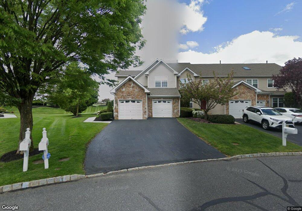
31 Palmer Dr Unit 75 Moorestown, NJ 08057
Estimated Value: $587,332 - $653,000
3
Beds
3
Baths
2,236
Sq Ft
$273/Sq Ft
Est. Value
About This Home
This home is located at 31 Palmer Dr Unit 75, Moorestown, NJ 08057 and is currently estimated at $611,333, approximately $273 per square foot. 31 Palmer Dr Unit 75 is a home located in Burlington County with nearby schools including South Valley Elementary School, Moorestown Upper Elementary School, and William Allen Middle School.
Ownership History
Date
Name
Owned For
Owner Type
Purchase Details
Closed on
Mar 1, 2006
Sold by
Neczypor Stephen A and Neczypor Felicia
Bought by
Carpino Glen Ellen
Current Estimated Value
Home Financials for this Owner
Home Financials are based on the most recent Mortgage that was taken out on this home.
Original Mortgage
$330,000
Outstanding Balance
$190,118
Interest Rate
6.5%
Mortgage Type
Fannie Mae Freddie Mac
Estimated Equity
$421,215
Purchase Details
Closed on
Dec 17, 2004
Sold by
Kenny Virginia B and Young Robert G
Bought by
Neczypor Stephen A and Neczypor Felicia
Purchase Details
Closed on
Dec 18, 1998
Sold by
Laurel Creek Lp
Bought by
Kenny Virginia B
Purchase Details
Closed on
Aug 13, 1998
Sold by
Laurel Creek Lp
Bought by
Suppa Anthony C and Suppa Marion D
Create a Home Valuation Report for This Property
The Home Valuation Report is an in-depth analysis detailing your home's value as well as a comparison with similar homes in the area
Home Values in the Area
Average Home Value in this Area
Purchase History
| Date | Buyer | Sale Price | Title Company |
|---|---|---|---|
| Carpino Glen Ellen | $451,000 | Park Avenue Title Agency | |
| Neczypor Stephen A | $380,000 | Victorian Title Agency Inc | |
| Kenny Virginia B | $251,659 | -- | |
| Suppa Anthony C | $234,799 | -- |
Source: Public Records
Mortgage History
| Date | Status | Borrower | Loan Amount |
|---|---|---|---|
| Open | Carpino Glen Ellen | $330,000 |
Source: Public Records
Tax History Compared to Growth
Tax History
| Year | Tax Paid | Tax Assessment Tax Assessment Total Assessment is a certain percentage of the fair market value that is determined by local assessors to be the total taxable value of land and additions on the property. | Land | Improvement |
|---|---|---|---|---|
| 2025 | $9,396 | $331,200 | $90,000 | $241,200 |
| 2024 | $9,111 | $331,200 | $90,000 | $241,200 |
| 2023 | $9,111 | $331,200 | $90,000 | $241,200 |
| 2022 | $9,019 | $331,200 | $90,000 | $241,200 |
| 2021 | $8,054 | $331,200 | $90,000 | $241,200 |
| 2020 | $8,843 | $331,200 | $90,000 | $241,200 |
| 2019 | $8,687 | $331,200 | $90,000 | $241,200 |
| 2018 | $8,518 | $331,200 | $90,000 | $241,200 |
| 2017 | $8,510 | $331,200 | $90,000 | $241,200 |
| 2016 | $8,495 | $331,200 | $90,000 | $241,200 |
| 2015 | $8,393 | $331,200 | $90,000 | $241,200 |
| 2014 | $7,969 | $331,200 | $90,000 | $241,200 |
Source: Public Records
Map
Nearby Homes
- 40 Palmer Dr Unit 110
- 158 Sarazen Dr
- 39 Bramley Rd
- 127 Oakmont Dr
- 97 Brooks Rd
- 5 Murray Rd
- 14 Baltusrol Terrace
- 901 Mcelwee Rd
- 57 Brooks Rd
- 950 Bortons Landing Rd
- 482 Monte Farm Rd
- 69 Sister's Farmstead Rd
- 22 Cardinal Way
- 107 Hartford Rd
- 12 Cove Rd
- 801 Cox Rd
- 700 Bentley Ct
- 7503A Normandy Dr Unit 7503
- 20 Starboard Way
- 712 Kimberly Dr
- 29 Palmer Dr Unit 76
- 27 Palmer Dr Unit 77
- 33 Palmer Dr Unit 74
- 25 Palmer Dr Unit 78
- 35 Palmer Dr Unit 73
- 37 Palmer Dr Unit 72
- 26 Palmer Dr Unit 103
- 39 Palmer Dr Unit 71
- 23 Palmer Dr Unit 79
- 28 Palmer Dr Unit 28
- 30 Palmer Dr Unit 105
- 19 Palmer Dr Unit 81
- 32 Palmer Dr Unit 106
- 41 Palmer Dr Unit 70
- 24 Palmer Dr Unit 102
- 17 Palmer Dr Unit 82
- 43 Palmer Dr Unit 69
- 22 Palmer Dr
- 45 Palmer Dr
- 20 Palmer Dr Unit 20