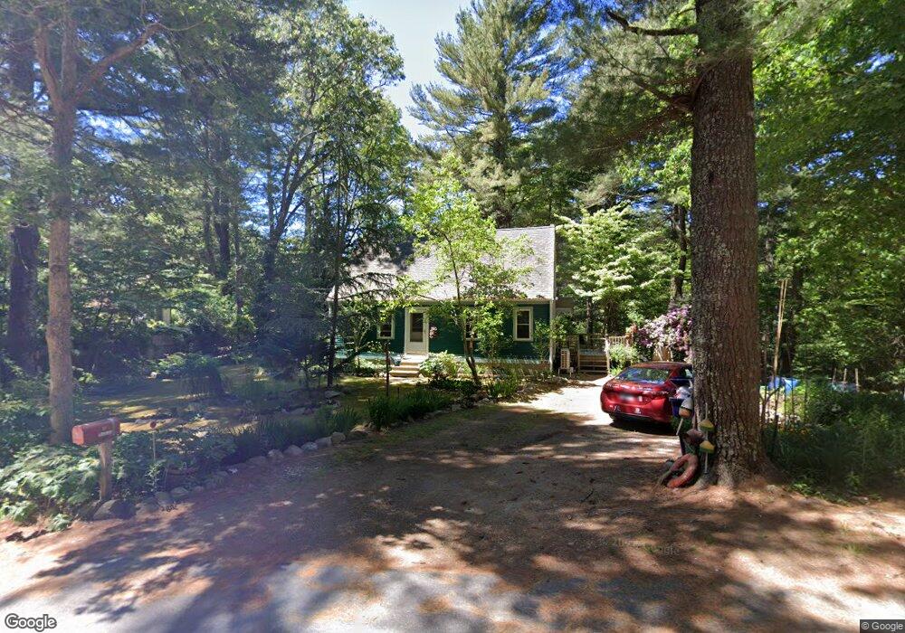
31 Pinkham Rd Sandwich, MA 02563
Estimated Value: $488,000 - $719,000
4
Beds
2
Baths
1,201
Sq Ft
$491/Sq Ft
Est. Value
About This Home
This home is located at 31 Pinkham Rd, Sandwich, MA 02563 and is currently estimated at $589,147, approximately $490 per square foot. 31 Pinkham Rd is a home located in Barnstable County with nearby schools including Sandwich Middle High School, Sandwich Montessori School, and Riverview School.
Ownership History
Date
Name
Owned For
Owner Type
Purchase Details
Closed on
Oct 3, 1996
Sold by
Fleet Natl Bk
Bought by
Chesky Michael J and Chesky Maria A
Current Estimated Value
Home Financials for this Owner
Home Financials are based on the most recent Mortgage that was taken out on this home.
Original Mortgage
$105,060
Outstanding Balance
$9,484
Interest Rate
7.9%
Mortgage Type
Purchase Money Mortgage
Estimated Equity
$579,663
Purchase Details
Closed on
Jun 28, 1996
Sold by
Frabetti William P
Bought by
Fleet National Bk
Create a Home Valuation Report for This Property
The Home Valuation Report is an in-depth analysis detailing your home's value as well as a comparison with similar homes in the area
Home Values in the Area
Average Home Value in this Area
Purchase History
| Date | Buyer | Sale Price | Title Company |
|---|---|---|---|
| Chesky Michael J | $103,000 | -- | |
| Fleet National Bk | $65,000 | -- |
Source: Public Records
Mortgage History
| Date | Status | Borrower | Loan Amount |
|---|---|---|---|
| Open | Chesky Michael J | $105,060 | |
| Closed | Chesky Michael J | $1,448 |
Source: Public Records
Tax History Compared to Growth
Tax History
| Year | Tax Paid | Tax Assessment Tax Assessment Total Assessment is a certain percentage of the fair market value that is determined by local assessors to be the total taxable value of land and additions on the property. | Land | Improvement |
|---|---|---|---|---|
| 2025 | $4,561 | $431,500 | $147,300 | $284,200 |
| 2024 | $4,316 | $399,600 | $131,500 | $268,100 |
| 2023 | $4,216 | $366,600 | $119,600 | $247,000 |
| 2022 | $4,027 | $306,000 | $106,800 | $199,200 |
| 2021 | $3,902 | $283,400 | $106,300 | $177,100 |
| 2020 | $3,924 | $274,200 | $106,200 | $168,000 |
| 2019 | $3,748 | $261,700 | $104,200 | $157,500 |
| 2018 | $3,452 | $241,600 | $95,100 | $146,500 |
| 2017 | $3,416 | $228,800 | $92,000 | $136,800 |
| 2016 | $3,214 | $222,100 | $88,900 | $133,200 |
| 2015 | $3,011 | $203,200 | $72,400 | $130,800 |
Source: Public Records
Map
Nearby Homes
- 58 Southpoint Dr Unit J
- 59 Southpoint Dr Unit 59
- 186 Quaker Meeting House Rd
- 5 Aviators Ln
- 185 Cotuit Rd Unit BE4
- 185 Cotuit Rd Unit JP1
- 77 Kiahs Way
- 10 Wintergreen Ln
- 3 Glenwood Ln
- 15 Hunters Tr
- 15 Hunters Trail
- 93 Deerfield Rd
- 22 Sconset Cir
- 84 Harlow Rd
- 7 Open Trail Rd
- 23 Old Fields Rd
- 3 Anne Cir
- 7 Highfield Dr