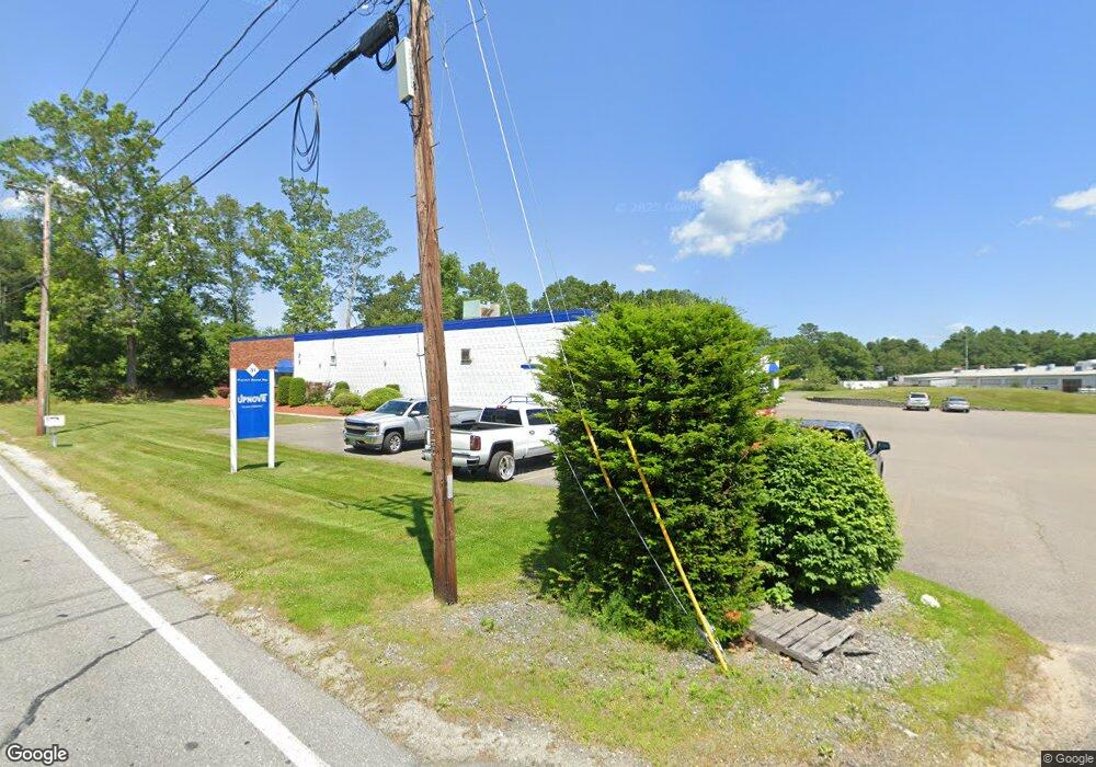
31 Pulpit Rock Rd Unit 31 A Pelham, NH 03076
Estimated Value: $2,675,084
Studio
2
Baths
10,000
Sq Ft
$268/Sq Ft
Est. Value
About This Home
This home is located at 31 Pulpit Rock Rd Unit 31 A, Pelham, NH 03076 and is currently estimated at $2,675,084, approximately $267 per square foot. 31 Pulpit Rock Rd Unit 31 A is a home located in Hillsborough County with nearby schools including Pelham Elementary School, Pelham Memorial School, and Pelham High School.
Ownership History
Date
Name
Owned For
Owner Type
Purchase Details
Closed on
May 27, 2010
Sold by
Red Dog Realty Corp
Bought by
Nash Properties Inc
Current Estimated Value
Home Financials for this Owner
Home Financials are based on the most recent Mortgage that was taken out on this home.
Original Mortgage
$325,000
Outstanding Balance
$213,618
Interest Rate
5.13%
Mortgage Type
Commercial
Estimated Equity
$2,461,466
Purchase Details
Closed on
Jul 7, 2000
Sold by
Jm & D Rlty Llc
Bought by
Red Dog Rlty Corp
Home Financials for this Owner
Home Financials are based on the most recent Mortgage that was taken out on this home.
Original Mortgage
$500,000
Interest Rate
8.55%
Mortgage Type
Commercial
Create a Home Valuation Report for This Property
The Home Valuation Report is an in-depth analysis detailing your home's value as well as a comparison with similar homes in the area
Home Values in the Area
Average Home Value in this Area
Purchase History
| Date | Buyer | Sale Price | Title Company |
|---|---|---|---|
| Nash Properties Inc | $1,225,000 | -- | |
| Red Dog Rlty Corp | $800,000 | -- |
Source: Public Records
Mortgage History
| Date | Status | Borrower | Loan Amount |
|---|---|---|---|
| Open | Red Dog Rlty Corp | $325,000 | |
| Previous Owner | Red Dog Rlty Corp | $500,000 |
Source: Public Records
Tax History
| Year | Tax Paid | Tax Assessment Tax Assessment Total Assessment is a certain percentage of the fair market value that is determined by local assessors to be the total taxable value of land and additions on the property. | Land | Improvement |
|---|---|---|---|---|
| 2025 | $27,568 | $1,444,100 | $438,700 | $1,005,400 |
| 2024 | $26,485 | $1,444,100 | $438,700 | $1,005,400 |
| 2023 | $26,268 | $1,444,100 | $438,700 | $1,005,400 |
| 2022 | $25,156 | $1,444,100 | $438,700 | $1,005,400 |
| 2021 | $23,048 | $1,444,100 | $438,700 | $1,005,400 |
| 2020 | $25,066 | $1,240,900 | $438,700 | $802,200 |
| 2019 | $26,190 | $1,350,000 | $438,700 | $911,300 |
| 2018 | $26,190 | $1,220,400 | $438,700 | $781,700 |
| 2017 | $26,178 | $1,220,400 | $438,700 | $781,700 |
| 2016 | $25,567 | $1,220,400 | $438,700 | $781,700 |
| 2015 | $25,784 | $1,108,500 | $438,700 | $669,800 |
| 2014 | $25,351 | $1,108,500 | $438,700 | $669,800 |
| 2013 | $25,351 | $1,108,500 | $438,700 | $669,800 |
Source: Public Records
Map
Nearby Homes
- 5 Lori Ln
- 45 Currier Rd
- 4 Wilshire Ln Unit 4
- 6 Wilshire Ln Unit 6
- 126 Marsh Rd
- 9 Cornstalk Ln
- 5 Lisa Terrace
- 50 Frank St Unit 50
- 4 Andover St
- 27 Haystack Cir
- 69 Springdale Ave
- 116 Westfall Rd
- 4 Haystack Cir
- 1430 Mammoth Rd
- 16 Proctor St
- 1905 Lakeview Ave
- 53 Vinal St
- 315 Broadway Rd Unit 1
- 240 Main St
- 43 & 53 5th St
- 31 Pulpit Rock Rd
- 45 Bridge St
- 30 Pulpit Rock Rd
- 24 Pulpit Rock Rd
- 20 Pulpit Rock Rd
- 43 Bridge St
- 16 Pulpit Rock Rd Unit 2
- 16 Pulpit Rock Rd
- 47 Bridge St
- 49 Bridge St
- 12 Pulpit Rock Rd
- 35 Bridge St
- 8 Pulpit Rock Rd
- 6-A B Pulpit Rock Rd
- 7 Lori Ln
- 6 Lori Ln
- 1 Coburn Ave
- 63 Bridge St
- 63 Bridge St
- 30 Bridge St
Your Personal Tour Guide
Ask me questions while you tour the home.