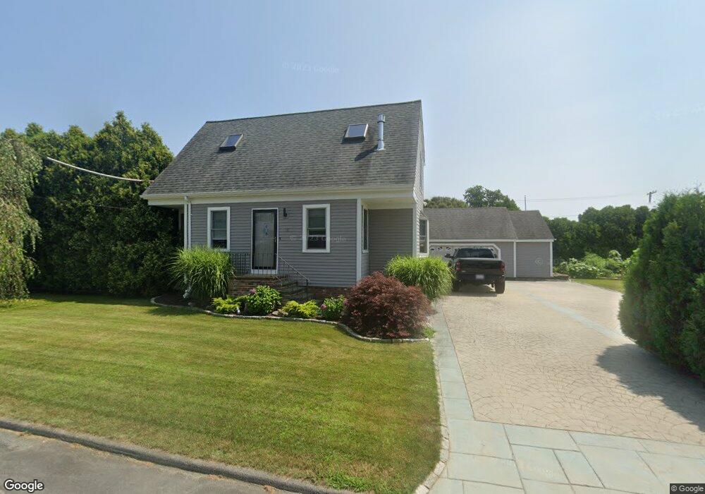
31 Raymond St Fairhaven, MA 02719
Sconticut Neck NeighborhoodEstimated Value: $491,000 - $723,000
2
Beds
2
Baths
1,622
Sq Ft
$372/Sq Ft
Est. Value
About This Home
This home is located at 31 Raymond St, Fairhaven, MA 02719 and is currently estimated at $603,123, approximately $371 per square foot. 31 Raymond St is a home located in Bristol County with nearby schools including Fairhaven High School, City On A Hill Charter Public School New Bedford, and St. Joseph School.
Ownership History
Date
Name
Owned For
Owner Type
Purchase Details
Closed on
Aug 21, 1991
Sold by
Avila Frank and Avila Betty M
Bought by
Swain Jeffrey F and Swain Kelly A
Current Estimated Value
Home Financials for this Owner
Home Financials are based on the most recent Mortgage that was taken out on this home.
Original Mortgage
$84,100
Interest Rate
9.55%
Mortgage Type
Purchase Money Mortgage
Create a Home Valuation Report for This Property
The Home Valuation Report is an in-depth analysis detailing your home's value as well as a comparison with similar homes in the area
Home Values in the Area
Average Home Value in this Area
Purchase History
| Date | Buyer | Sale Price | Title Company |
|---|---|---|---|
| Swain Jeffrey F | $93,500 | -- |
Source: Public Records
Mortgage History
| Date | Status | Borrower | Loan Amount |
|---|---|---|---|
| Open | Swain Jeffrey F | $124,902 | |
| Closed | Swain Jeffrey F | $84,100 | |
| Previous Owner | Swain Jeffrey F | $64,868 |
Source: Public Records
Tax History
| Year | Tax Paid | Tax Assessment Tax Assessment Total Assessment is a certain percentage of the fair market value that is determined by local assessors to be the total taxable value of land and additions on the property. | Land | Improvement |
|---|---|---|---|---|
| 2025 | $43 | $466,300 | $251,100 | $215,200 |
| 2024 | $4,206 | $455,700 | $251,100 | $204,600 |
| 2023 | $4,064 | $408,400 | $216,600 | $191,800 |
| 2022 | $3,899 | $381,500 | $197,300 | $184,200 |
| 2021 | $3,763 | $333,300 | $179,300 | $154,000 |
| 2020 | $3,686 | $333,300 | $179,300 | $154,000 |
| 2019 | $3,411 | $292,300 | $153,700 | $138,600 |
| 2018 | $3,283 | $279,400 | $146,200 | $133,200 |
| 2017 | $3,215 | $267,000 | $140,700 | $126,300 |
| 2016 | $3,107 | $255,100 | $138,000 | $117,100 |
| 2015 | $3,079 | $253,400 | $138,000 | $115,400 |
Source: Public Records
Map
Nearby Homes
- 5 Reservation Rd
- 8 Sunset Beach Rd
- 190 Sconticut Neck Rd
- 3.5 Golf St
- 15 Bayview Ave
- 27 Bayview Ave
- 58 Bayview Ave
- 00 Huttleston Ave
- 00 Copeland St
- 2 Washburn Ave
- 33 Narragansett Blvd
- 8 Manor Dr
- 11 Lawton St
- 28 Brant Beach Ave
- 32 Cedar St
- 181 Washington St
- 32 Green St
- 20 Nantucket Dr
- 145 Pleasant St
- 58 Washington St
- 30 Raymond St
- 334 Sconticut Neck Rd
- 32 Bernese St
- 332 Sconticut Neck Rd
- 17 Raymond St
- 21 Gilbert St
- 331 Sconticut Neck Rd
- 31 Bernese St
- 335 Sconticut Neck Rd
- 16 Raymond St
- 19 Gilbert St
- 24 Bernese St
- 342 Sconticut Neck Rd
- 339 Sconticut Neck Rd
- 18 Gilbert St
- 11 Gilbert St
- 346 Sconticut Neck Rd
- 325 Sconticut Neck Rd
- 10 Raymond St
- 321 Sconticut Neck Rd
Your Personal Tour Guide
Ask me questions while you tour the home.