Estimated Value: $211,000 - $273,000
Studio
2
Baths
1,702
Sq Ft
$146/Sq Ft
Est. Value
About This Home
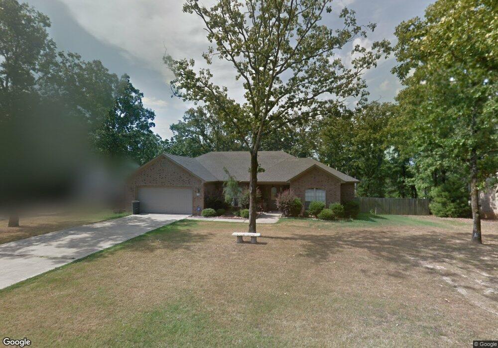
This home is located at 31 Ridge Rd, Cabot, AR 72023 and is currently estimated at $248,104, approximately $145 per square foot. 31 Ridge Rd is a home located in Lonoke County with nearby schools including Northside Elementary School, Cabot Junior High North, and Cabot Middle School North.
Ownership History
Date
Name
Owned For
Owner Type
Purchase Details
Closed on
Nov 4, 2005
Bought by
Delatorre and Delatorre Wf
Current Estimated Value
Purchase Details
Closed on
Nov 1, 2005
Bought by
Delatorre and Delatorre Wf
Purchase Details
Closed on
Apr 14, 2005
Bought by
Maxwell and Maxwell Hollingshead
Purchase Details
Closed on
Apr 12, 2005
Bought by
Maxwell and Maxwell Hollingshead
Purchase Details
Closed on
Apr 5, 2005
Bought by
Moore
Purchase Details
Closed on
Mar 29, 2005
Bought by
Moore
Purchase Details
Closed on
Oct 23, 2003
Bought by
Fresneda and Fresneda Wf
Create a Home Valuation Report for This Property
The Home Valuation Report is an in-depth analysis detailing your home's value as well as a comparison with similar homes in the area
Purchase History
| Date | Buyer | Sale Price | Title Company |
|---|---|---|---|
| Delatorre | $148,000 | -- | |
| Delatorre | $148,000 | -- | |
| Maxwell | $25,000 | -- | |
| Maxwell | $25,000 | -- | |
| Moore | $18,000 | -- | |
| Moore | $18,000 | -- | |
| Fresneda | $17,000 | -- |
Source: Public Records
Tax History
| Year | Tax Paid | Tax Assessment Tax Assessment Total Assessment is a certain percentage of the fair market value that is determined by local assessors to be the total taxable value of land and additions on the property. | Land | Improvement |
|---|---|---|---|---|
| 2025 | $1,276 | $33,410 | $3,800 | $29,610 |
| 2024 | $1,276 | $33,410 | $3,800 | $29,610 |
| 2023 | $1,276 | $33,410 | $3,800 | $29,610 |
| 2022 | $1,326 | $33,410 | $3,800 | $29,610 |
| 2021 | $1,326 | $33,410 | $3,800 | $29,610 |
| 2020 | $1,260 | $32,130 | $3,800 | $28,330 |
| 2019 | $1,260 | $32,130 | $3,800 | $28,330 |
| 2018 | $1,237 | $32,130 | $3,800 | $28,330 |
| 2017 | $1,475 | $32,130 | $3,800 | $28,330 |
| 2016 | $1,237 | $32,130 | $3,800 | $28,330 |
| 2015 | $1,218 | $31,780 | $3,800 | $27,980 |
| 2014 | $1,570 | $31,780 | $3,800 | $27,980 |
Source: Public Records
Map
Nearby Homes
- 24 Sunset Ln
- 41 Sunset Ln
- 40 Sunset Ln
- 0 Tract F Hwy 89
- 0 Tract G Hwy 89
- 0 Tract E Hwy 89
- 0 Tract C Hwy 89
- 3A W Main St
- 00 W Main St
- 0 N Rockwood Rd Unit W. Main Street
- 18 Suncrest Dr
- 0 W Main St Unit 23029338
- 26 Calvados Ct
- 55 Mount Tabor W
- 35 N Sunland Dr
- 505 Sweet Gum Ct
- 582 Crepe Myrtle Loop
- 519 Crepe Myrtle Loop
- 509 Crepe Myrtle Loop
- 21 Blanchard Dr
Your Personal Tour Guide
Ask me questions while you tour the home.