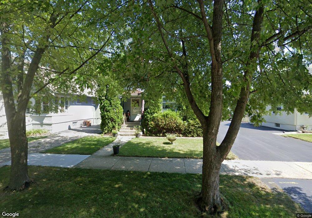
31 S Fulton Ave Waukegan, IL 60085
West Waukegan NeighborhoodEstimated Value: $191,000 - $248,000
3
Beds
1
Bath
1,566
Sq Ft
$137/Sq Ft
Est. Value
About This Home
This home is located at 31 S Fulton Ave, Waukegan, IL 60085 and is currently estimated at $215,159, approximately $137 per square foot. 31 S Fulton Ave is a home located in Lake County with nearby schools including Washington Elementary School, Robert E. Abbott Middle School, and Waukegan High School.
Ownership History
Date
Name
Owned For
Owner Type
Purchase Details
Closed on
Mar 8, 2003
Sold by
Lauritsen Nick A
Bought by
Lauritsen Nick and Lauritsen Agnes
Current Estimated Value
Purchase Details
Closed on
Oct 17, 1997
Sold by
Tiernan Paul L and Jakubisin Charlene J
Bought by
Lauritsen Nick A
Home Financials for this Owner
Home Financials are based on the most recent Mortgage that was taken out on this home.
Original Mortgage
$60,000
Outstanding Balance
$10,752
Interest Rate
8.75%
Estimated Equity
$204,407
Create a Home Valuation Report for This Property
The Home Valuation Report is an in-depth analysis detailing your home's value as well as a comparison with similar homes in the area
Home Values in the Area
Average Home Value in this Area
Purchase History
| Date | Buyer | Sale Price | Title Company |
|---|---|---|---|
| Lauritsen Nick | -- | -- | |
| Lauritsen Nick A | $50,000 | -- |
Source: Public Records
Mortgage History
| Date | Status | Borrower | Loan Amount |
|---|---|---|---|
| Open | Lauritsen Nick A | $60,000 |
Source: Public Records
Tax History Compared to Growth
Tax History
| Year | Tax Paid | Tax Assessment Tax Assessment Total Assessment is a certain percentage of the fair market value that is determined by local assessors to be the total taxable value of land and additions on the property. | Land | Improvement |
|---|---|---|---|---|
| 2024 | $3,848 | $54,567 | $6,780 | $47,787 |
| 2023 | $3,761 | $48,811 | $6,065 | $42,746 |
| 2022 | $3,761 | $44,470 | $5,384 | $39,086 |
| 2021 | $3,248 | $37,157 | $4,632 | $32,525 |
| 2020 | $3,244 | $34,616 | $4,315 | $30,301 |
| 2019 | $3,212 | $31,720 | $3,954 | $27,766 |
| 2018 | $2,182 | $23,254 | $5,596 | $17,658 |
| 2017 | $2,073 | $20,573 | $4,951 | $15,622 |
| 2016 | $1,835 | $17,877 | $4,302 | $13,575 |
| 2015 | $1,717 | $16,000 | $3,850 | $12,150 |
| 2014 | $2,680 | $21,380 | $4,089 | $17,291 |
| 2012 | $2,645 | $23,165 | $4,431 | $18,734 |
Source: Public Records
Map
Nearby Homes
- 1521 Catalpa Ave
- 49 S Lewis Ave
- 132 Dorchester Ct
- 1416 Hamilton Ct
- 23 N Jackson St
- 446 S Jackson St
- 304 Powell Ave
- 28 N Saint James St
- 12601 W Atlantic Ave
- 2116 & 2101 Williamsburg Dr
- 613 Washington St
- 610 Bluff St
- 305 Besley Place
- 2115 Lydia St
- 613 Clarke Ave
- 408 Besley Place
- 557 W Water St
- 215 S Park Ave
- 0 Brookside Ave
- 615 Tiffany Dr
- 27 S Fulton Ave
- 33 S Fulton Ave
- 25 S Fulton Ave
- 19 S Fulton Ave
- 32 Washington Park
- 28 Washington Park
- 34 Washington Park
- 38 Washington Park
- 17 S Fulton Ave
- 24 Washington Park
- 43 S Fulton Ave
- 40 Washington Park
- 22 Washington Park
- 32 S Fulton Ave
- 28 S Fulton Ave Unit 2
- 15 S Fulton Ave
- 47 S Fulton Ave
- 26 S Fulton Ave
- 38 S Fulton Ave
- 44 Washington Park