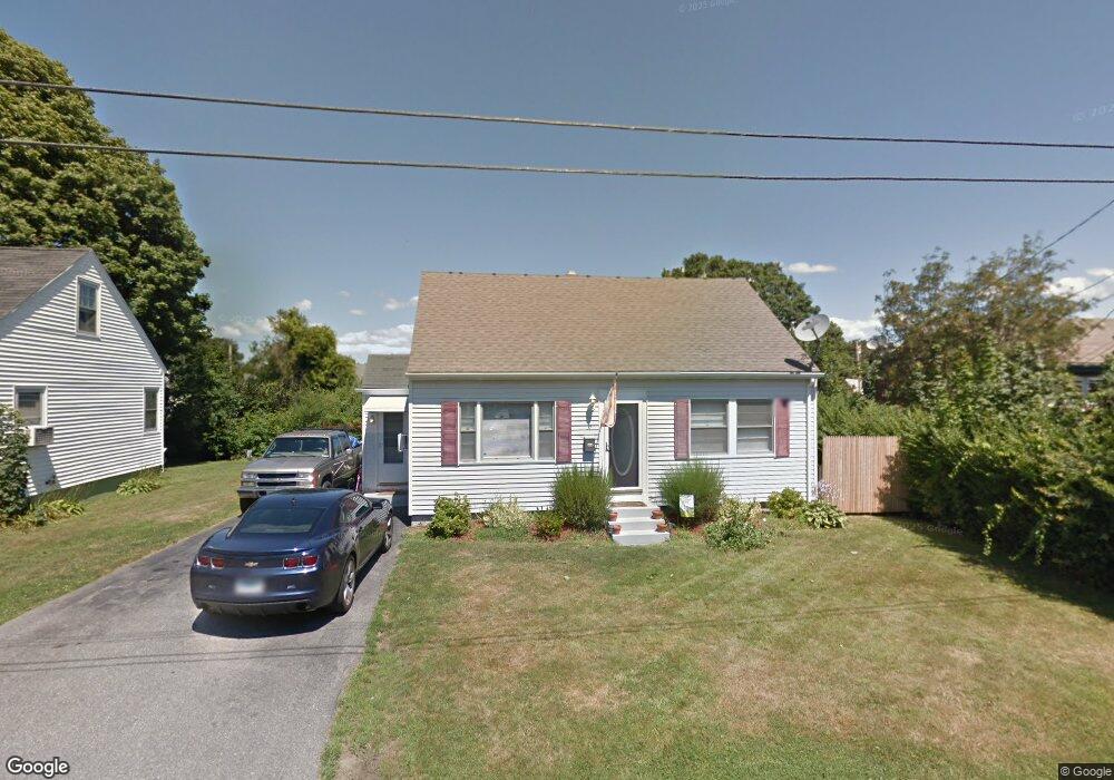
31 Smythe St Middletown, RI 02842
Estimated Value: $485,000 - $625,000
3
Beds
1
Bath
1,800
Sq Ft
$308/Sq Ft
Est. Value
About This Home
This home is located at 31 Smythe St, Middletown, RI 02842 and is currently estimated at $554,169, approximately $307 per square foot. 31 Smythe St is a home located in Newport County with nearby schools including Middletown High School and All Saints STEAM Academy.
Ownership History
Date
Name
Owned For
Owner Type
Purchase Details
Closed on
Aug 27, 1997
Sold by
Mid First Bank
Bought by
Housing & Urban Dev
Current Estimated Value
Purchase Details
Closed on
May 8, 1990
Sold by
Oflaherty Michael
Bought by
Searcy Sheila
Create a Home Valuation Report for This Property
The Home Valuation Report is an in-depth analysis detailing your home's value as well as a comparison with similar homes in the area
Home Values in the Area
Average Home Value in this Area
Purchase History
| Date | Buyer | Sale Price | Title Company |
|---|---|---|---|
| Housing & Urban Dev | $122,000 | -- | |
| Searcy Sheila | $130,000 | -- |
Source: Public Records
Mortgage History
| Date | Status | Borrower | Loan Amount |
|---|---|---|---|
| Open | Searcy Sheila | $212,784 | |
| Closed | Searcy Sheila | $35,000 |
Source: Public Records
Tax History Compared to Growth
Tax History
| Year | Tax Paid | Tax Assessment Tax Assessment Total Assessment is a certain percentage of the fair market value that is determined by local assessors to be the total taxable value of land and additions on the property. | Land | Improvement |
|---|---|---|---|---|
| 2025 | $5,054 | $428,700 | $259,600 | $169,100 |
| 2024 | $4,827 | $428,700 | $259,600 | $169,100 |
| 2023 | $3,839 | $304,900 | $167,500 | $137,400 |
| 2022 | $3,665 | $304,900 | $167,500 | $137,400 |
| 2021 | $3,665 | $304,900 | $167,500 | $137,400 |
| 2020 | $3,282 | $238,500 | $123,800 | $114,700 |
| 2018 | $3,279 | $238,500 | $123,800 | $114,700 |
| 2016 | $3,230 | $209,500 | $102,400 | $107,100 |
| 2015 | $3,151 | $209,500 | $102,400 | $107,100 |
| 2014 | $3,209 | $199,700 | $93,000 | $106,700 |
| 2013 | $3,137 | $199,700 | $93,000 | $106,700 |
Source: Public Records
Map
Nearby Homes
- 65 Maple Ave
- 16 King Rd
- 17 Underwood Ln
- 114 Maple Ave
- 67 Linden St
- 17 Mariner Way
- 149 W Main Rd
- 231 Maple Ave Unit 204
- 117 W Main Rd
- 74 Valley Rd
- 66 Girard Ave Unit 401
- 6 Wabasso Terrace
- 138 Green End Ave
- 1 Shangri-La Ln
- 5 Elliot Place
- 19 Princeton St Unit 21
- 155 Evarts St
- 1 Arnold Ave
- 7 Sheffield Ave
- 521 Forest Park