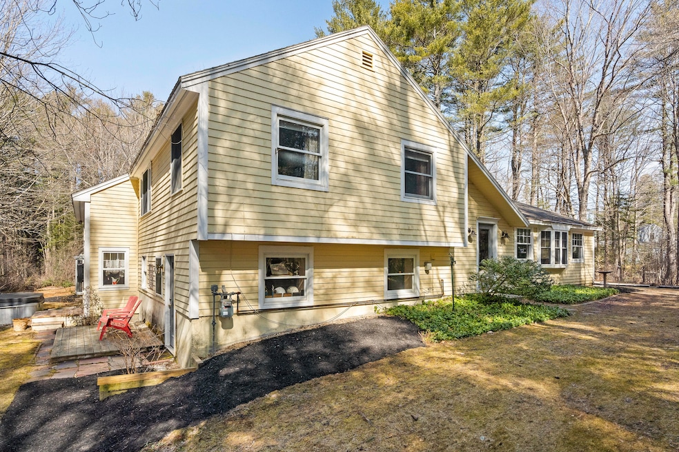
31 Stony Brook Ln Yarmouth, ME 04096
Estimated payment $4,555/month
Highlights
- View of Trees or Woods
- 1.67 Acre Lot
- Wood Flooring
- William H. Rowe School Rated A-
- Wooded Lot
- 1 Fireplace
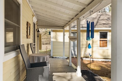
About This Home
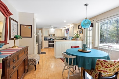
Tucked away on 1.67 acres at the end of a private road, this property offers ultimate privacy while still enjoying easy access to sidewalks that lead directly to Yarmouth Village and around Town. Bordered on two sides by the Applewood Farm's open space, the setting feels both secluded and connected. The multi-level home offers a versatile layout with 4 bedrooms, 3.5 bathrooms, and 2,794 square feet of living space, allowing the potential for multi-generational living. Located in the heart of Yarmouth, you'll enjoy a vibrant community with parks, restaurants, a charming library, the Yarmouth History Center, and the beloved annual Clam Festival, among many other local attractions.

Home Details
Home Type
- Single Family
Est. Annual Taxes
- $10,672
Year Built
- Built in 1984
Lot Details
- 1.67 Acre Lot
- Landscaped
- Wooded Lot
- Property is zoned MDR
Parking
- 2 Car Detached Garage
- Gravel Driveway
Home Design
- Slab Foundation
- Wood Frame Construction
- Shingle Roof
- Radon Mitigation System
- Clapboard
Interior Spaces
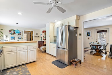
- 1 Fireplace
- Views of Woods
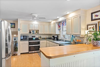
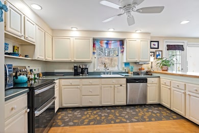
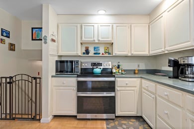
Kitchen
- Electric Range
- Dishwasher
Flooring
- Wood
- Carpet
- Laminate
- Tile
Bedrooms and Bathrooms
- 4 Bedrooms
Laundry
- Dryer
- Washer
Finished Basement
- Interior Basement Entry
- Natural lighting in basement
Outdoor Features
- Patio
- Shed
Utilities
- No Cooling
- Baseboard Heating
- Hot Water Heating System
Community Details
- No Home Owners Association
- Near Conservation Area
Listing and Financial Details
- Tax Lot 11A
- Assessor Parcel Number YMTH-000014-000011-A000000
Map
Home Values in the Area
Average Home Value in this Area
Tax History
| Year | Tax Paid | Tax Assessment Tax Assessment Total Assessment is a certain percentage of the fair market value that is determined by local assessors to be the total taxable value of land and additions on the property. | Land | Improvement |
|---|---|---|---|---|
| 2024 | $10,394 | $404,900 | $178,300 | $226,600 |
| 2023 | $9,531 | $404,900 | $178,300 | $226,600 |
| 2022 | $8,754 | $404,900 | $178,300 | $226,600 |
| 2021 | $8,017 | $404,900 | $178,300 | $226,600 |
| 2020 | $7,936 | $404,900 | $178,300 | $226,600 |
| 2019 | $7,636 | $404,900 | $178,300 | $226,600 |
| 2018 | $7,207 | $404,900 | $178,300 | $226,600 |
| 2017 | $6,948 | $404,900 | $178,300 | $226,600 |
| 2016 | $4,498 | $404,900 | $178,300 | $226,600 |
| 2015 | $5,879 | $272,700 | $88,600 | $184,100 |
| 2014 | $5,890 | $272,700 | $88,600 | $184,100 |
| 2013 | $5,999 | $272,700 | $0 | $0 |
Property History
| Date | Event | Price | List to Sale | Price per Sq Ft |
|---|---|---|---|---|
| 10/30/2025 10/30/25 | Price Changed | $699,000 | -6.7% | $250 / Sq Ft |
| 10/10/2025 10/10/25 | For Sale | $749,000 | -- | $268 / Sq Ft |
Purchase History
| Date | Type | Sale Price | Title Company |
|---|---|---|---|
| Warranty Deed | -- | -- | |
| Warranty Deed | -- | -- |
Mortgage History
| Date | Status | Loan Amount | Loan Type |
|---|---|---|---|
| Open | $324,558 | FHA | |
| Previous Owner | $170,000 | FHA |
Source: Maine Listings
MLS Number: 1640477
APN: YMTH-000014-000011-A000000
Disclaimer: Certain information contained herein is derived from information provided by parties other than Homes.com. All information provided is deemed reliable, but is not guaranteed to be accurate and should be independently verified.
![]() Listing data is derived in whole or in part from Maine Real Estate Information System, Inc. (d/b/a Maine Listings) and is for consumers' personal, noncommercial use only. Dimensions are approximate and not guaranteed. All data should be independently verified.
Listing data is derived in whole or in part from Maine Real Estate Information System, Inc. (d/b/a Maine Listings) and is for consumers' personal, noncommercial use only. Dimensions are approximate and not guaranteed. All data should be independently verified.
© 2025 Maine Real Estate Information System, Inc. All Rights Reserved. Equal Housing Opportunity.
Homes.com, LLC, 17600 Laguna Canyon Rd Irvine, CA 92618 (888)-952-6393
![]()
- 9 Newell Rd
- 90 W Main St
- 25 Meadowbrook Ln
- 37 South St
- 309 Main St Unit A
- 1 Railroad Square Unit Townhome C
- 1 Railroad Square Unit 103
- 1 Railroad Square Unit 205
- 1 Railroad Square Unit 305
- 1 Railroad Square Unit 403
- 1 Railroad Square Unit 101
- 44 Ellen Cir
- 294 Greely Rd
- 70 Main St
- 51 Pleasant St
- 13 Hedgerow Dr
- 39 Harris Rd
- 86 Pleasant St
- 149 E Main St Unit 7
- 0 Bayview St
- 30 E Elm St Unit B
- 298 Main St
- 6 Bennett Rd Unit A
- 8 Osterville Ct
- 106 Burnell Dr
- 74 Main St Unit 4
- 70 Main St
- 70 Main St
- 6 Prince St
- 3 Crystal Ln
- 363 Tuttle Rd
- 1 Juniper Dr
- 3 Chelsea Way
- 2 Conway St
- 93 Falmouth Rd Unit A
- 100 Clearwater Dr
- 18 Sandy Beach Rd
- 37 Brentwood Rd Unit ID1255706P
- 1619 Washington Ave
- 131 Durham Rd Unit B