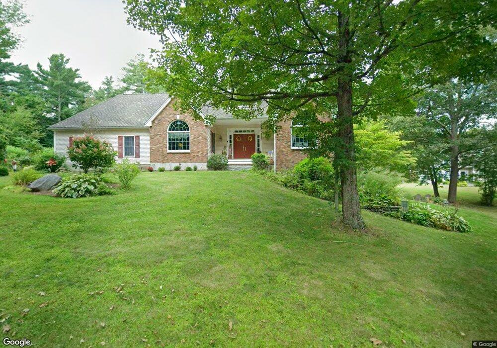
31 The Ln Lunenburg, MA 01462
Estimated Value: $653,000 - $718,000
3
Beds
3
Baths
1,970
Sq Ft
$347/Sq Ft
Est. Value
About This Home
This home is located at 31 The Ln, Lunenburg, MA 01462 and is currently estimated at $683,284, approximately $346 per square foot. 31 The Ln is a home located in Worcester County with nearby schools including Lunenburg Primary School and Lunenburg High School.
Ownership History
Date
Name
Owned For
Owner Type
Purchase Details
Closed on
Jun 3, 2020
Sold by
Anderson Ruth L
Bought by
Anderson Karin J and Anderson Ruth L
Current Estimated Value
Purchase Details
Closed on
May 25, 2020
Sold by
Anderson Karin and Anderson Jeffrey D
Bought by
Anderson Ruth L
Purchase Details
Closed on
Dec 10, 2019
Sold by
Anderson Ruth L
Bought by
Anderson Karin J
Purchase Details
Closed on
Mar 17, 1981
Bought by
Anderson Henry A and Anderson Ruth L
Create a Home Valuation Report for This Property
The Home Valuation Report is an in-depth analysis detailing your home's value as well as a comparison with similar homes in the area
Home Values in the Area
Average Home Value in this Area
Purchase History
| Date | Buyer | Sale Price | Title Company |
|---|---|---|---|
| Anderson Karin J | -- | None Available | |
| Anderson Ruth L | -- | None Available | |
| Anderson Karin J | -- | None Available | |
| Anderson Henry A | $16,000 | -- |
Source: Public Records
Tax History Compared to Growth
Tax History
| Year | Tax Paid | Tax Assessment Tax Assessment Total Assessment is a certain percentage of the fair market value that is determined by local assessors to be the total taxable value of land and additions on the property. | Land | Improvement |
|---|---|---|---|---|
| 2025 | $8,866 | $617,400 | $163,300 | $454,100 |
| 2024 | $8,397 | $595,500 | $147,100 | $448,400 |
| 2023 | $7,965 | $544,800 | $133,800 | $411,000 |
| 2022 | $7,292 | $424,200 | $111,700 | $312,500 |
| 2020 | $7,871 | $434,400 | $111,300 | $323,100 |
| 2019 | $7,606 | $407,200 | $107,500 | $299,700 |
| 2018 | $7,043 | $357,500 | $107,500 | $250,000 |
| 2017 | $7,001 | $350,400 | $109,800 | $240,600 |
| 2016 | $6,595 | $336,300 | $100,600 | $235,700 |
| 2015 | $6,018 | $328,500 | $96,000 | $232,500 |
Source: Public Records
Map
Nearby Homes
- 1790 Massachusetts Ave Unit 25
- 1790 Massachusetts Ave Unit 22
- 166 Elmwood Rd
- 330 Arbor St
- 22 Townsend Rd
- 372 Townsend Harbor Rd
- 11 Longwood Dr
- 44 Hemlock Dr
- 61 Parker Rd
- 110 Burrage St
- 49 Parker Rd
- 185 Hemlock Dr
- 43 Longley Rd
- 167 S Row Rd
- 111 Squannacook Rd
- Lot 10 Christian Cir
- 59 Squannacook Rd
- 45 Spring St
- 91 Valley Rd
- 35 Leominster Rd
- 41 The Ln
- 34 The Ln
- 45 The Ln
- 28 The Ln
- 1882 Massachusetts Ave
- 22 The Ln
- 15 The Ln
- 16 The Ln
- 1868 Massachusetts Ave
- 1864 Massachusetts Ave
- 25 The Ln
- 1862 Massachusetts Ave
- 265 Elmwood Rd
- 271 Elmwood Rd
- 281 Elmwood Rd
- 281 Elmwood Rd Unit 1
- 1860 Massachusetts Ave
- 283 Elmwood Rd
- 283 Elmwood Rd Unit 1
- 19 The Ln