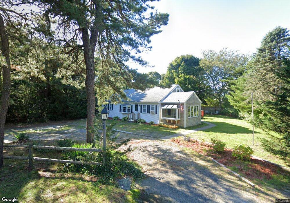
31 Thomas Path West Yarmouth, MA 02673
West Yarmouth NeighborhoodEstimated Value: $489,347 - $693,000
3
Beds
1
Bath
1,092
Sq Ft
$508/Sq Ft
Est. Value
About This Home
This home is located at 31 Thomas Path, West Yarmouth, MA 02673 and is currently estimated at $554,587, approximately $507 per square foot. 31 Thomas Path is a home located in Barnstable County with nearby schools including Dennis-Yarmouth Regional High School, Barnstable Community Horace Mann Charter Public School, and Sturgis Charter Public School.
Ownership History
Date
Name
Owned For
Owner Type
Purchase Details
Closed on
Jun 1, 2018
Sold by
Whipple John D and Clarkson Pamela
Bought by
Whipple John D and Whipple Marlene E
Current Estimated Value
Purchase Details
Closed on
May 23, 2017
Sold by
Dfr Llc
Bought by
Whipple John D and Clarkson Pamela
Purchase Details
Closed on
Dec 14, 2012
Sold by
Donald F Rugg Lt
Bought by
Dfr Llc
Purchase Details
Closed on
Oct 24, 2011
Sold by
Whipple Susan M
Bought by
Clarkson Pamela A and Whipple John D
Purchase Details
Closed on
Jul 25, 2011
Sold by
Whipple Susan M
Bought by
Whipple Susan M and Clackson Pamela A
Purchase Details
Closed on
Feb 13, 2009
Sold by
Rugg Donald F
Bought by
Donald F Rugg Lt
Purchase Details
Closed on
Oct 25, 2006
Sold by
Rugg Paul M
Bought by
Rugg Donald F and Whipple Susan M
Create a Home Valuation Report for This Property
The Home Valuation Report is an in-depth analysis detailing your home's value as well as a comparison with similar homes in the area
Home Values in the Area
Average Home Value in this Area
Purchase History
| Date | Buyer | Sale Price | Title Company |
|---|---|---|---|
| Whipple John D | -- | -- | |
| Whipple John D | $75,000 | -- | |
| Dfr Llc | -- | -- | |
| Clarkson Pamela A | -- | -- | |
| Whipple Susan M | -- | -- | |
| Donald F Rugg Lt | -- | -- | |
| Rugg Donald F | -- | -- |
Source: Public Records
Tax History Compared to Growth
Tax History
| Year | Tax Paid | Tax Assessment Tax Assessment Total Assessment is a certain percentage of the fair market value that is determined by local assessors to be the total taxable value of land and additions on the property. | Land | Improvement |
|---|---|---|---|---|
| 2025 | $2,802 | $395,700 | $159,100 | $236,600 |
| 2024 | $2,624 | $355,500 | $138,400 | $217,100 |
| 2023 | $2,646 | $326,300 | $125,800 | $200,500 |
| 2022 | $2,604 | $283,700 | $120,100 | $163,600 |
| 2021 | $2,468 | $258,200 | $120,100 | $138,100 |
| 2020 | $2,549 | $254,900 | $127,100 | $127,800 |
| 2019 | $2,382 | $235,800 | $127,100 | $108,700 |
| 2018 | $2,208 | $214,600 | $105,900 | $108,700 |
| 2017 | $2,182 | $217,800 | $105,900 | $111,900 |
| 2016 | $2,089 | $209,300 | $97,400 | $111,900 |
| 2015 | $1,954 | $194,600 | $93,200 | $101,400 |
Source: Public Records
Map
Nearby Homes
- 32 Wimbledon Dr
- 21 Schooner St
- 38 Traders Ln
- 25 & 27 Merrymount Rd
- 25-27 Merrymount Rd
- 107 Wimbledon Dr
- 38 Traders Ln
- 85 Baker Rd
- 10 Standish Way
- 12 Denver Dr
- 24 Valley Rd
- 503 Route 28 Unit 15
- 503 Route 28 Unit 5
- 503 Route 28 Unit 25
- 130 Wimbledon Dr
- 90 Broadway St Unit 92
- 90 Broadway St Unit 90
- 33 Hedge Row
- 13 Webster Rd
- 48 Jerusha Ln