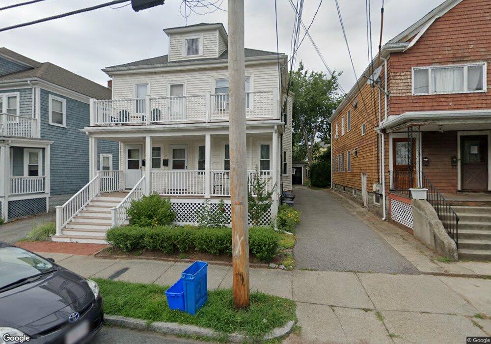
31 Thorndike St Unit 33 Arlington, MA 02474
East Arlington NeighborhoodEstimated Value: $1,272,000 - $1,378,000
4
Beds
2
Baths
2,390
Sq Ft
$556/Sq Ft
Est. Value
About This Home
This home is located at 31 Thorndike St Unit 33, Arlington, MA 02474 and is currently estimated at $1,329,335, approximately $556 per square foot. 31 Thorndike St Unit 33 is a home located in Middlesex County with nearby schools including Hardy Elementary School, Ottoson Middle School, and Arlington High School.
Ownership History
Date
Name
Owned For
Owner Type
Purchase Details
Closed on
Nov 29, 2011
Sold by
Lim Lee C Est and Ryan
Bought by
Valentine Thomas
Current Estimated Value
Home Financials for this Owner
Home Financials are based on the most recent Mortgage that was taken out on this home.
Original Mortgage
$400,000
Outstanding Balance
$275,068
Interest Rate
4.12%
Mortgage Type
Purchase Money Mortgage
Estimated Equity
$1,054,267
Create a Home Valuation Report for This Property
The Home Valuation Report is an in-depth analysis detailing your home's value as well as a comparison with similar homes in the area
Home Values in the Area
Average Home Value in this Area
Purchase History
| Date | Buyer | Sale Price | Title Company |
|---|---|---|---|
| Valentine Thomas | $550,000 | -- |
Source: Public Records
Mortgage History
| Date | Status | Borrower | Loan Amount |
|---|---|---|---|
| Open | Valentine Thomas | $400,000 |
Source: Public Records
Tax History Compared to Growth
Tax History
| Year | Tax Paid | Tax Assessment Tax Assessment Total Assessment is a certain percentage of the fair market value that is determined by local assessors to be the total taxable value of land and additions on the property. | Land | Improvement |
|---|---|---|---|---|
| 2025 | $11,791 | $1,094,800 | $561,700 | $533,100 |
| 2024 | $10,892 | $1,028,500 | $534,700 | $493,800 |
| 2023 | $10,979 | $979,400 | $448,300 | $531,100 |
| 2022 | $10,945 | $958,400 | $432,100 | $526,300 |
| 2021 | $10,597 | $934,500 | $432,100 | $502,400 |
| 2020 | $10,336 | $934,500 | $432,000 | $502,500 |
| 2019 | $9,399 | $834,700 | $459,100 | $375,600 |
| 2018 | $8,617 | $710,400 | $334,800 | $375,600 |
| 2017 | $8,071 | $642,600 | $291,600 | $351,000 |
| 2016 | $7,672 | $599,400 | $248,400 | $351,000 |
| 2015 | $7,530 | $555,700 | $243,000 | $312,700 |
Source: Public Records
Map
Nearby Homes
- 3 Seagrave Rd
- 128 Thorndike St Unit 2
- 137-139 Thorndike St Unit 2
- 215 Massachusetts Ave Unit 19 (34)
- 23 Brookford St
- 23 Brookford St Unit 2
- 23 Brookford St Unit 1
- 230 Massachusetts Ave Unit 6
- 19 Cottage Park Ave
- 57 Garrison Ave
- 127 Harvey St
- 127 Harvey St Unit 127
- 112 Jackson St
- 97 Elmwood St Unit 313
- 97 Elmwood St Unit 110
- 97 Elmwood St Unit 310
- 69 Harvey St Unit 1
- 124 Jackson St
- 49 Clifton St
- 69 Clarendon Ave Unit A
- 35 Thorndike St Unit 37
- 27 Thorndike St Unit 29
- 37 Thorndike St Unit 2
- 37 Thorndike St Unit 37
- 37 Thorndike St
- 37 Thorndike St
- 23 Thorndike St Unit 25
- 25 Thorndike St Unit B
- 25 Thorndike St
- 23-25 Thorndike St Unit 23
- 39 Thorndike St Unit 41
- 39 Thorndike St Unit 39
- 30-32 Thorndike St Unit 1
- 30-32 Thorndike St
- 30 Magnolia St Unit 2
- 30 Magnolia St
- 34 Thorndike St Unit 36
- 24 Magnolia St Unit 2
- 24 Magnolia St Unit 1
- 28 Magnolia St Unit 28A