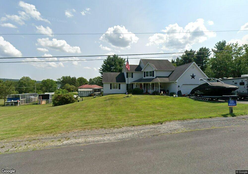
31 Todd Dr Lehighton, PA 18235
Estimated Value: $432,061 - $632,000
4
Beds
4
Baths
2,900
Sq Ft
$171/Sq Ft
Est. Value
About This Home
This home is located at 31 Todd Dr, Lehighton, PA 18235 and is currently estimated at $497,015, approximately $171 per square foot. 31 Todd Dr is a home located in Carbon County with nearby schools including Lehighton Area High School, Sts. Peter & Paul School, and Valley Ridge Academy.
Ownership History
Date
Name
Owned For
Owner Type
Purchase Details
Closed on
Jan 31, 2020
Sold by
Balir John and Balir Robyn
Bought by
Schwoyer Robert Jay and Schwoyer Melissa
Current Estimated Value
Home Financials for this Owner
Home Financials are based on the most recent Mortgage that was taken out on this home.
Original Mortgage
$294,820
Outstanding Balance
$261,537
Interest Rate
3.7%
Mortgage Type
FHA
Estimated Equity
$235,478
Purchase Details
Closed on
Mar 29, 2007
Sold by
Armbruster Joseph J and Armbruster Betty J
Bought by
Blair John and Blair Robyn
Home Financials for this Owner
Home Financials are based on the most recent Mortgage that was taken out on this home.
Original Mortgage
$110,000
Interest Rate
6.25%
Mortgage Type
New Conventional
Create a Home Valuation Report for This Property
The Home Valuation Report is an in-depth analysis detailing your home's value as well as a comparison with similar homes in the area
Home Values in the Area
Average Home Value in this Area
Purchase History
| Date | Buyer | Sale Price | Title Company |
|---|---|---|---|
| Schwoyer Robert Jay | $305,000 | Penn Title Company | |
| Blair John | $280,000 | None Available |
Source: Public Records
Mortgage History
| Date | Status | Borrower | Loan Amount |
|---|---|---|---|
| Open | Schwoyer Robert Jay | $294,820 | |
| Previous Owner | Blair John | $110,000 |
Source: Public Records
Tax History
| Year | Tax Paid | Tax Assessment Tax Assessment Total Assessment is a certain percentage of the fair market value that is determined by local assessors to be the total taxable value of land and additions on the property. | Land | Improvement |
|---|---|---|---|---|
| 2025 | $7,499 | $98,000 | $8,400 | $89,600 |
| 2024 | $7,205 | $98,000 | $8,400 | $89,600 |
| 2023 | $7,131 | $98,000 | $8,400 | $89,600 |
| 2022 | $7,033 | $98,000 | $8,400 | $89,600 |
| 2021 | $6,825 | $98,000 | $8,400 | $89,600 |
| 2020 | $6,652 | $98,000 | $8,400 | $89,600 |
| 2019 | $6,309 | $98,000 | $8,400 | $89,600 |
| 2018 | $6,236 | $98,000 | $8,400 | $89,600 |
| 2017 | $6,236 | $98,000 | $8,400 | $89,600 |
| 2016 | -- | $98,000 | $8,400 | $89,600 |
| 2015 | -- | $98,000 | $8,400 | $89,600 |
| 2014 | -- | $98,000 | $8,400 | $89,600 |
Source: Public Records
Map
Nearby Homes
- 558 Mahoning Dr E
- 106 N 12th St
- 0 Fredericks Grove Rd Unit 691615
- 410 S 8th St
- 0 Pine Hollow Dr Unit PACC2006714
- 635 Coal St
- 7 Robert Henry Cir
- 8 Taylor Nicole Cir
- 460 S 3rd St
- 2093 Mahoning Dr E
- 0 Sage Ct Unit Lot 7
- 0 Sage Ct Unit Lot 6
- 0 Sage Ct Unit Lot 5
- 0 Sage Ct Unit 749012
- Lot 7 Sage Ct
- 0 Sage Ct Unit 749116
- Lot 5 Sage Ct
- 87 Sage Ct Unit Lot 2
- 98 Sage Ct
- 7 Sage Ct
- 31 Todd Dr
- 109 Washington Rd
- 0 Washington Rd
- 67 Todd Ln
- 209 Washington Rd
- 108 Washington Rd
- 110 Washington Rd
- 155 Rudelitsch Rd
- 184 Washington Rd
- 179 Rudelitsch Rd
- 109 Rudelitsch Rd
- 233 Birchwood Dr
- 166 Washington Rd
- 708 Mahoning Dr E
- 203 Birchwood Dr
- 640 Mahoning Dr E
- 308 Birchwood Dr
- 346 Birchwood Dr
- 232 Birchwood Dr
- 201 Birchwood Dr
Your Personal Tour Guide
Ask me questions while you tour the home.