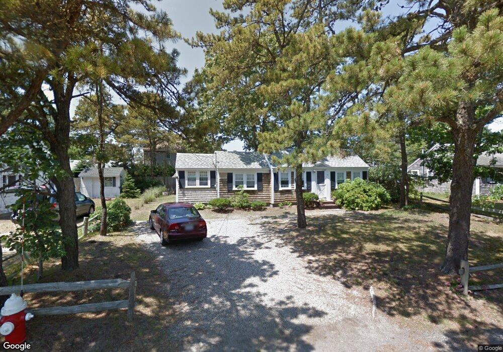
31 Uncle Rolf Rd Dennis Port, MA 02639
Dennis Port NeighborhoodEstimated Value: $469,000 - $611,155
2
Beds
1
Bath
1,001
Sq Ft
$559/Sq Ft
Est. Value
About This Home
This home is located at 31 Uncle Rolf Rd, Dennis Port, MA 02639 and is currently estimated at $559,539, approximately $558 per square foot. 31 Uncle Rolf Rd is a home located in Barnstable County with nearby schools including Dennis-Yarmouth Regional High School and St. Pius X. School.
Ownership History
Date
Name
Owned For
Owner Type
Purchase Details
Closed on
Mar 25, 1996
Sold by
Duffee Denise T and Duffee Glenn A
Bought by
Pigott Daniel J and Walz-Pigott Lisa
Current Estimated Value
Home Financials for this Owner
Home Financials are based on the most recent Mortgage that was taken out on this home.
Original Mortgage
$75,600
Outstanding Balance
$2,954
Interest Rate
6.99%
Mortgage Type
Purchase Money Mortgage
Estimated Equity
$556,585
Purchase Details
Closed on
Feb 6, 1990
Sold by
Jagel William R
Bought by
Duffee Denise T
Home Financials for this Owner
Home Financials are based on the most recent Mortgage that was taken out on this home.
Original Mortgage
$97,300
Interest Rate
9.59%
Mortgage Type
Purchase Money Mortgage
Create a Home Valuation Report for This Property
The Home Valuation Report is an in-depth analysis detailing your home's value as well as a comparison with similar homes in the area
Home Values in the Area
Average Home Value in this Area
Purchase History
| Date | Buyer | Sale Price | Title Company |
|---|---|---|---|
| Pigott Daniel J | $94,500 | -- | |
| Duffee Denise T | $121,700 | -- |
Source: Public Records
Mortgage History
| Date | Status | Borrower | Loan Amount |
|---|---|---|---|
| Open | Pigott Daniel J | $75,600 | |
| Previous Owner | Duffee Denise T | $97,300 |
Source: Public Records
Tax History Compared to Growth
Tax History
| Year | Tax Paid | Tax Assessment Tax Assessment Total Assessment is a certain percentage of the fair market value that is determined by local assessors to be the total taxable value of land and additions on the property. | Land | Improvement |
|---|---|---|---|---|
| 2025 | $2,207 | $509,800 | $283,900 | $225,900 |
| 2024 | $2,073 | $472,200 | $273,000 | $199,200 |
| 2023 | $1,967 | $421,200 | $248,200 | $173,000 |
| 2022 | $1,825 | $325,900 | $195,600 | $130,300 |
| 2021 | $1,797 | $298,000 | $191,800 | $106,200 |
| 2020 | $1,758 | $288,200 | $191,800 | $96,400 |
| 2019 | $3,336 | $290,000 | $204,200 | $85,800 |
| 2018 | $1,733 | $273,400 | $194,400 | $79,000 |
| 2017 | $1,571 | $255,500 | $179,000 | $76,500 |
| 2016 | $1,530 | $234,300 | $168,800 | $65,500 |
| 2015 | $1,500 | $234,300 | $168,800 | $65,500 |
| 2014 | $1,423 | $224,100 | $158,600 | $65,500 |
Source: Public Records
Map
Nearby Homes
- 64 Beaten Rd
- 37 Ocean Dr Unit 2
- 154 Old Wharf Rd Unit 26
- 154 Old Wharf Rd Unit 14
- 112 Old Wharf Rd Unit E4
- 112 Old Wharf Rd Unit E1
- 120 Old Wharf Rd Unit 11
- 217 Old Wharf Rd Unit 64
- 241 Old Wharf Rd Unit 82
- 241 Old Wharf Rd Unit 127
- 241 Old Wharf Rd Unit 90
- 31 Easy St
- 80 Michaels Ave
- 262 Old Wharf Rd Unit 67
- 262 Old Wharf Rd Unit 5
- 262 Old Wharf Rd Unit 5
- 262 Old Wharf Rd Unit 20
- 262 Old Wharf Rd Unit 87
- 37 Beach Hills Rd
- 37-A Beach Hills Rd
- 33 Uncle Rolf Rd
- 27 Uncle Rolf Rd
- 28 Bain Rd
- 32 Bain Rd
- 32 Uncle Rolf Rd
- 30 Uncle Rolf Rd
- 37 Uncle Rolf Rd
- 25 Uncle Rolf Rd
- 24 Bain Rd
- 34 Bain Rd
- 26 Uncle Rolf Rd
- 38 Uncle Rolf Rd
- 149 Captain Chase Rd
- 39 Uncle Rolf Rd
- 143 Captain Chase Rd
- 20 Bain Rd
- 23 Uncle Rolf Rd
- 38 Bain Rd
- 25 Bain Rd
- 139 Captain Chase Rd