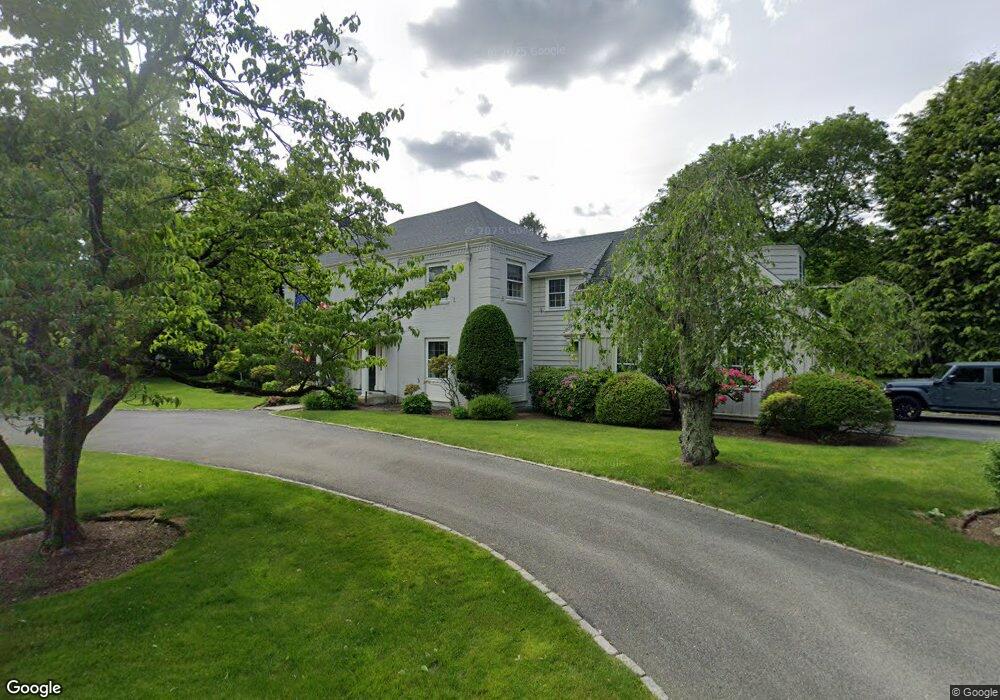
31 Wampatuck Rd Dedham, MA 02026
Dexter NeighborhoodEstimated Value: $2,106,692 - $2,223,000
About This Home
This home is located at 31 Wampatuck Rd, Dedham, MA 02026 and is currently estimated at $2,149,923, approximately $523 per square foot. 31 Wampatuck Rd is a home located in Norfolk County with nearby schools including Riverdale Elementary School, Dedham Middle School, and Dedham High School.
Ownership History
We collect this data history from publicly available records. To have your information removed, we recommend requesting removal directly through your county’s website.
Purchase Details
Home Values in the Area
Average Home Value in this Area
Purchase History
We collect this data history from publicly available records. To have your information removed, we recommend requesting removal directly through your county’s website.
| Date | Buyer | Sale Price | Title Company |
|---|---|---|---|
| -- | -- |
Mortgage History
We collect this data history from publicly available records. To have your information removed, we recommend requesting removal directly through your county’s website.
| Date | Status | Borrower | Loan Amount |
|---|---|---|---|
| Closed | $100,000 |
Tax History
We collect this data history from publicly available records. To have your information removed, we recommend requesting removal directly through your county’s website.
| Year | Tax Paid | Tax Assessment Tax Assessment Total Assessment is a certain percentage of the fair market value that is determined by local assessors to be the total taxable value of land and additions on the property. | Land | Improvement |
|---|---|---|---|---|
| 2025 | $24,961 | $1,977,900 | $558,800 | $1,419,100 |
| 2024 | $22,676 | $1,814,100 | $485,400 | $1,328,700 |
| 2023 | $20,066 | $1,562,800 | $419,900 | $1,142,900 |
| 2022 | $18,888 | $1,414,800 | $419,900 | $994,900 |
| 2021 | $17,254 | $1,262,200 | $380,500 | $881,700 |
| 2020 | $17,312 | $1,261,800 | $383,100 | $878,700 |
| 2019 | $17,311 | $1,223,400 | $403,500 | $819,900 |
| 2018 | $18,333 | $1,260,000 | $440,100 | $819,900 |
| 2017 | $16,530 | $1,119,900 | $347,100 | $772,800 |
| 2016 | $15,949 | $1,029,600 | $303,700 | $725,900 |
| 2015 | $16,624 | $1,047,500 | $400,100 | $647,400 |
| 2014 | $16,260 | $1,011,200 | $400,100 | $611,100 |
Map
- 800 High St
- 570 Bridge St
- 17 Highland St
- 139 Stoney Lea Rd
- 20 Shuttleworth Place
- 20-35 Shuttleworth Place
- 35 Shuttleworth Place
- 47 Bemis Rd
- 555 Washington St
- 441 Washington St Unit 305
- 441 Washington St Unit 203
- 277 Court St
- 65 Deerpath Rd
- 113 Ames St
- 223 Robert Rd
- 122 Sandy Valley Rd
- 262 Meadowbrook Rd
- 213 Sandy Valley Rd
- 250 Meadowbrook Rd
- 47 Bingham Ave
- 3 Wampatuck Rd
- 177 Lowder St
- 26 Wampatuck Rd
- 38 Wampatuck Rd
- 191 Lowder St
- 6 Wampatuck Rd
- 22 Wampatuck Rd
- 1 Wampatuck Rd
- 199 Lowder St
- 17 Rodman Place
- 159 Lowder St
- 25 Allindale Way
- 14 Allindale Way
- 20 Rodman Place
- 2 Wampatuck Rd
- 15 Rodman Place
- 218 Lowder St
- 12 Rodman Place
- 12 Rodman Place
- 188 Village Ave
Ask me questions while you tour the home.