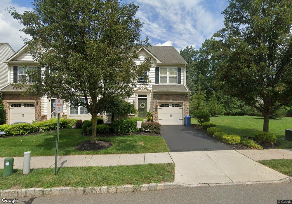
31 Weber Ave Hillsborough, NJ 08844
Estimated Value: $550,000 - $625,275
3
Beds
4
Baths
1,888
Sq Ft
$307/Sq Ft
Est. Value
About This Home
This home is located at 31 Weber Ave, Hillsborough, NJ 08844 and is currently estimated at $580,319, approximately $307 per square foot. 31 Weber Ave is a home located in Somerset County with nearby schools including Hillsborough High School.
Ownership History
Date
Name
Owned For
Owner Type
Purchase Details
Closed on
Mar 1, 2010
Sold by
Messerlie Christopher L and Messerlie Joanne M
Bought by
Kathenes Joan C
Current Estimated Value
Home Financials for this Owner
Home Financials are based on the most recent Mortgage that was taken out on this home.
Original Mortgage
$229,250
Outstanding Balance
$150,186
Interest Rate
4.75%
Mortgage Type
New Conventional
Estimated Equity
$430,133
Purchase Details
Closed on
Nov 28, 2006
Sold by
Nvr Inc
Bought by
Messerlie Christopher L and Messerlie Joanne M
Home Financials for this Owner
Home Financials are based on the most recent Mortgage that was taken out on this home.
Original Mortgage
$344,000
Interest Rate
6.4%
Purchase Details
Closed on
Mar 10, 2006
Sold by
Atlantic Equity Westmeade Llc
Bought by
Nvr Inc
Create a Home Valuation Report for This Property
The Home Valuation Report is an in-depth analysis detailing your home's value as well as a comparison with similar homes in the area
Home Values in the Area
Average Home Value in this Area
Purchase History
| Date | Buyer | Sale Price | Title Company |
|---|---|---|---|
| Kathenes Joan C | $327,500 | New Jersey Title Ins Co | |
| Messerlie Christopher L | $430,000 | -- | |
| Nvr Inc | $158,000 | -- |
Source: Public Records
Mortgage History
| Date | Status | Borrower | Loan Amount |
|---|---|---|---|
| Open | Kathenes Joan C | $229,250 | |
| Previous Owner | Messerlie Christopher L | $344,000 |
Source: Public Records
Tax History Compared to Growth
Tax History
| Year | Tax Paid | Tax Assessment Tax Assessment Total Assessment is a certain percentage of the fair market value that is determined by local assessors to be the total taxable value of land and additions on the property. | Land | Improvement |
|---|---|---|---|---|
| 2025 | $9,624 | $480,100 | $210,000 | $270,100 |
| 2024 | $9,624 | $449,100 | $195,000 | $254,100 |
| 2023 | $8,500 | $394,800 | $145,000 | $249,800 |
| 2022 | $8,510 | $381,100 | $130,000 | $251,100 |
| 2021 | $8,016 | $367,600 | $115,000 | $252,600 |
| 2020 | $8,795 | $368,900 | $115,000 | $253,900 |
| 2019 | $8,796 | $365,900 | $110,000 | $255,900 |
| 2018 | $8,735 | $361,100 | $100,000 | $261,100 |
| 2017 | $8,643 | $357,900 | $95,000 | $262,900 |
| 2016 | $8,352 | $346,000 | $95,000 | $251,000 |
| 2015 | $7,996 | $335,400 | $95,000 | $240,400 |
| 2014 | $7,796 | $334,000 | $99,000 | $235,000 |
Source: Public Records
Map
Nearby Homes
- 73 Weston Rd
- 230 Sunnymeade Rd
- 1327 Dominic St
- 4 Leidl Cir
- 6 Leidl Cir
- 8 Leidl Cir
- 86 Norton Rd
- 910 Newark Ave
- 315 Czaplicki St
- 77 Norton Rd
- 1911 W Camplain Rd
- 152 S 20th Ave
- 226 S 16th Ave
- 1612 W Camplain Rd
- 42 Falcon Rd
- Kinsley Plan at Greens at Royce Brook - Preserve Collection
- Cornelia Plan at Greens at Royce Brook - Preserve Collection
- Rossland Plan at Greens at Royce Brook - Preserve Collection
- Kentland Plan at Greens at Royce Brook - Retreat Collection
- Ballamore Plan at Greens at Royce Brook - Retreat Collection