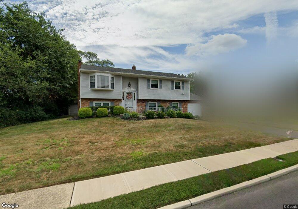
31 Westbrook Rd Howell, NJ 07731
Candlewood NeighborhoodEstimated Value: $692,479 - $731,000
4
Beds
2
Baths
2,172
Sq Ft
$329/Sq Ft
Est. Value
About This Home
This home is located at 31 Westbrook Rd, Howell, NJ 07731 and is currently estimated at $714,370, approximately $328 per square foot. 31 Westbrook Rd is a home located in Monmouth County with nearby schools including Taunton School, Aldrich School, and Howell Township Middle School South.
Ownership History
Date
Name
Owned For
Owner Type
Purchase Details
Closed on
Jul 28, 2011
Sold by
Slocum Carol A and Slocum Thomas E
Bought by
Slocum Carol A
Current Estimated Value
Create a Home Valuation Report for This Property
The Home Valuation Report is an in-depth analysis detailing your home's value as well as a comparison with similar homes in the area
Home Values in the Area
Average Home Value in this Area
Purchase History
| Date | Buyer | Sale Price | Title Company |
|---|---|---|---|
| Slocum Carol A | -- | None Available |
Source: Public Records
Tax History Compared to Growth
Tax History
| Year | Tax Paid | Tax Assessment Tax Assessment Total Assessment is a certain percentage of the fair market value that is determined by local assessors to be the total taxable value of land and additions on the property. | Land | Improvement |
|---|---|---|---|---|
| 2025 | $10,218 | $624,200 | $382,400 | $241,800 |
| 2024 | $9,197 | $574,700 | $337,400 | $237,300 |
| 2023 | $9,197 | $494,200 | $262,400 | $231,800 |
| 2022 | $7,077 | $379,600 | $158,900 | $220,700 |
| 2021 | $7,077 | $348,700 | $152,400 | $196,300 |
| 2020 | $7,781 | $335,100 | $144,800 | $190,300 |
| 2019 | $8,314 | $351,400 | $147,400 | $204,000 |
| 2018 | $7,903 | $331,900 | $137,400 | $194,500 |
| 2017 | $8,023 | $333,200 | $144,600 | $188,600 |
| 2016 | $7,551 | $310,500 | $126,600 | $183,900 |
| 2015 | $7,182 | $302,500 | $123,400 | $179,100 |
| 2014 | $7,117 | $278,200 | $135,800 | $142,400 |
Source: Public Records
Map
Nearby Homes
- 45 Springhill Dr
- 30 Forrest Hill Dr
- 19 Kensington Dr
- 111 S Durham Dr
- 107 S Durham Dr
- 147 Newbury Rd
- 28 Salem Hill Rd
- 20 Nottingham Dr
- 15 Windsor Rd
- 134 Darien Rd
- 28 Princeton Dr
- 10 Pepperridge Rd
- 15 N Longview Rd
- 17 N Longview Rd
- 20 N Longview Rd
- 17 Sugarbush Rd
- 47 Yellowstone Ln
- 307 Princeton Dr
- 51 Hedgewood Rd
- 409 Aldrich Rd
- 29 Westbrook Rd
- 33 Westbrook Rd
- 27 Westbrook Rd
- 35 Westbrook Rd
- 30 Springhill Dr
- 30 Westbrook Rd
- 32 Westbrook Rd
- 32 Springhill Dr
- 25 Westbrook Rd
- 28 Springhill Dr
- 6 Stockport Way
- 28 Westbrook Rd
- 37 Westbrook Rd
- 29 Springhill Dr
- 23 Westbrook Rd
- 36 Westbrook Rd
- 26 Springhill Dr
- 26 Westbrook Rd
- 27 Springhill Dr
- 38 Westbrook Rd