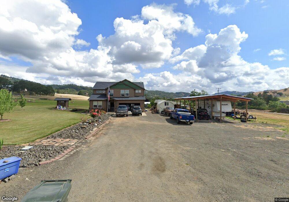
31 Westview Dr Roseburg, OR 97471
Estimated Value: $552,000 - $815,000
4
Beds
3
Baths
2,663
Sq Ft
$263/Sq Ft
Est. Value
About This Home
This home is located at 31 Westview Dr, Roseburg, OR 97471 and is currently estimated at $701,589, approximately $263 per square foot. 31 Westview Dr is a home with nearby schools including Hucrest Elementary School, Joseph Lane Middle School, and Roseburg High School.
Ownership History
Date
Name
Owned For
Owner Type
Purchase Details
Closed on
Sep 2, 2020
Sold by
Mapes Charles Wooddell
Bought by
Mapes Charles Wooddell and Mapes Kristie E
Current Estimated Value
Home Financials for this Owner
Home Financials are based on the most recent Mortgage that was taken out on this home.
Original Mortgage
$305,000
Interest Rate
2.8%
Mortgage Type
New Conventional
Purchase Details
Closed on
Jul 26, 2013
Sold by
Mapes Michelle Lynn and Mapes Charles Woodell
Bought by
Mapes Charles Wooddell
Purchase Details
Closed on
Sep 30, 2009
Sold by
Mapes C W and Mapes Ann L
Bought by
Mapes Charles W and Mapes Michelle L
Create a Home Valuation Report for This Property
The Home Valuation Report is an in-depth analysis detailing your home's value as well as a comparison with similar homes in the area
Home Values in the Area
Average Home Value in this Area
Purchase History
| Date | Buyer | Sale Price | Title Company |
|---|---|---|---|
| Mapes Charles Wooddell | -- | Servicelink | |
| Mapes Charles Wooddell | $50,000 | None Available | |
| Mapes Charles W | -- | None Available |
Source: Public Records
Mortgage History
| Date | Status | Borrower | Loan Amount |
|---|---|---|---|
| Closed | Mapes Charles Wooddell | $305,000 |
Source: Public Records
Tax History Compared to Growth
Tax History
| Year | Tax Paid | Tax Assessment Tax Assessment Total Assessment is a certain percentage of the fair market value that is determined by local assessors to be the total taxable value of land and additions on the property. | Land | Improvement |
|---|---|---|---|---|
| 2024 | $4,179 | $416,953 | -- | -- |
| 2023 | $4,059 | $404,809 | $0 | $0 |
| 2022 | $3,943 | $393,019 | $0 | $0 |
| 2021 | $3,830 | $381,572 | $0 | $0 |
| 2020 | $3,859 | $370,459 | $0 | $0 |
| 2019 | $3,788 | $359,669 | $0 | $0 |
| 2018 | $3,633 | $349,194 | $0 | $0 |
| 2017 | $4,153 | $339,024 | $0 | $0 |
| 2016 | $3,461 | $329,150 | $0 | $0 |
| 2015 | $3,407 | $319,564 | $0 | $0 |
| 2014 | $3,257 | $306,019 | $0 | $0 |
| 2013 | -- | $290,159 | $0 | $0 |
Source: Public Records
Map
Nearby Homes
- 3314 Fisher Rd
- 270 Glenwood Ct
- 1645 Brozio Rd
- 305 Laraut Ln
- 804 N Bank Rd
- 331 Hemlock Ln
- 550 Pioneer Way
- 0 Pioneer Way Unit 24035561
- 0 Umpqua College Rd
- 119 Oakbourne Ln
- 368 Page Rd
- 1346 Fisher Rd
- 101 Aster St
- 126 Songbird Ct
- 1081 Umpqua College Rd
- 161 Single Pine Ln
- 237 Country Ln
- 214 Gray Squirrel Ct
- 159 Live Oak Ct
- 125 NE Zachary
- 2330 Wilbur Rd
- 40 Westview Dr
- 1903 Del Rio Rd
- 78 Westview Dr
- 2157 Wilbur Rd
- 138 Westview Dr
- 2018 Del Rio Rd
- 1960 Del Rio Rd
- 1865 Del Rio Rd
- 2066 Del Rio Rd
- 1986 Del Rio Rd
- 162 Clearview Dr
- 2020 Del Rio Rd
- 206 Westview Dr
- 2100 Del Rio Rd
- 250 Westview Dr
- 273 Westview Dr
- 88 Clearview Dr
- 142 Westview Dr
- 2126 Del Rio Rd