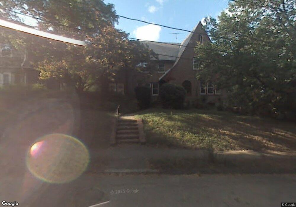
31 Weybridge Rd Brookline, MA 02445
Washington Square NeighborhoodEstimated Value: $2,427,941 - $2,982,000
4
Beds
4
Baths
2,599
Sq Ft
$1,039/Sq Ft
Est. Value
About This Home
This home is located at 31 Weybridge Rd, Brookline, MA 02445 and is currently estimated at $2,701,235, approximately $1,039 per square foot. 31 Weybridge Rd is a home located in Norfolk County with nearby schools including Pierce School, Brookline High School, and St. Mary of the Assumption Elementary School.
Ownership History
Date
Name
Owned For
Owner Type
Purchase Details
Closed on
Feb 25, 2025
Sold by
Christine G Mcardle Ft and Mcardle
Bought by
Christine G Mcardle T G and Christine Mcardle
Current Estimated Value
Purchase Details
Closed on
Mar 11, 2005
Sold by
Mcardle Christine and Mcardle Colin R
Bought by
Christine G Mcardle Rt and Mcardle
Purchase Details
Closed on
Jul 24, 1978
Bought by
Grizel-Mcardle C
Create a Home Valuation Report for This Property
The Home Valuation Report is an in-depth analysis detailing your home's value as well as a comparison with similar homes in the area
Home Values in the Area
Average Home Value in this Area
Purchase History
| Date | Buyer | Sale Price | Title Company |
|---|---|---|---|
| Christine G Mcardle T G | -- | None Available | |
| Christine G Mcardle Rt | -- | -- | |
| Christine G Mcardle Rt | -- | -- | |
| Grizel-Mcardle C | $83,000 | -- |
Source: Public Records
Tax History
| Year | Tax Paid | Tax Assessment Tax Assessment Total Assessment is a certain percentage of the fair market value that is determined by local assessors to be the total taxable value of land and additions on the property. | Land | Improvement |
|---|---|---|---|---|
| 2025 | $22,745 | $2,304,500 | $1,624,900 | $679,600 |
| 2024 | $21,663 | $2,217,300 | $1,562,300 | $655,000 |
| 2023 | $19,384 | $1,944,200 | $1,255,800 | $688,400 |
| 2022 | $18,867 | $1,851,500 | $1,195,900 | $655,600 |
| 2021 | $17,447 | $1,780,300 | $1,149,900 | $630,400 |
| 2020 | $15,751 | $1,666,800 | $1,045,400 | $621,400 |
| 2019 | $14,874 | $1,587,400 | $995,600 | $591,800 |
| 2018 | $13,351 | $1,411,300 | $829,600 | $581,700 |
| 2017 | $13,154 | $1,331,400 | $782,800 | $548,600 |
| 2016 | $12,966 | $1,244,300 | $731,600 | $512,700 |
| 2015 | $12,420 | $1,162,900 | $683,700 | $479,200 |
| 2014 | $11,666 | $1,024,200 | $569,700 | $454,500 |
Source: Public Records
Map
Nearby Homes
- 401 Washington St Unit 6
- 70 Park St Unit 17
- 71 Greenough St Unit 71-1
- 75 Greenough St Unit 2
- 80 Vernon St Unit PHB
- 80 Vernon St Unit 1-A
- 80 Vernon St Unit 2B
- 80 Vernon St Unit PHA
- 80 Vernon St Unit 3A
- 370 Washington St
- 11 Goodwin Place Unit 1
- 11 Goodwin Place Unit 11-1
- 11 Goodwin Place Unit 11-2
- 12 Goodwin Place Unit 12-1
- 12 Goodwin Place Unit 12-2
- 1495 Beacon St Unit G
- 1407 Beacon St Unit 8
- 1517 Beacon St Unit 4
- 12 Thayer St
- 125 Park St Unit 2
- 35 Weybridge Rd
- 25 Weybridge Rd
- 26 Weybridge Rd
- 15 Weybridge Rd
- 21 Somerset Rd
- 9 Somerset Rd
- 0 Somerset Rd
- 17 Weybridge Ln
- 27 Somerset Rd
- 22 Hancock Rd
- 7 Weybridge Rd
- 17 Hancock Rd
- 1 Somerset Rd
- 454 Washington St
- 18 Somerset Rd
- 14 Somerset Rd
- 15 Greenough St
- 33 Somerset Rd
- 24 Somerset Rd
- 28 Somerset Rd
Your Personal Tour Guide
Ask me questions while you tour the home.