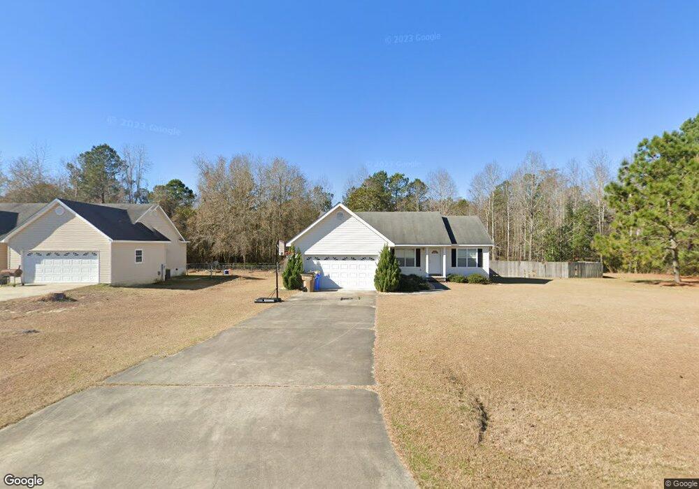
31 William H Cir Tifton, GA 31793
Estimated Value: $210,000 - $275,000
3
Beds
2
Baths
1,465
Sq Ft
$164/Sq Ft
Est. Value
About This Home
This home is located at 31 William H Cir, Tifton, GA 31793 and is currently estimated at $239,582, approximately $163 per square foot. 31 William H Cir is a home located in Tift County with nearby schools including Annie Belle Clark Primary School, Matt Wilson Elementary School, and J.T. Reddick School.
Ownership History
Date
Name
Owned For
Owner Type
Purchase Details
Closed on
Oct 2, 2008
Sold by
Green Industries Inc
Bought by
Golson James Bernard and Golson Vasalaki A
Current Estimated Value
Home Financials for this Owner
Home Financials are based on the most recent Mortgage that was taken out on this home.
Original Mortgage
$129,972
Outstanding Balance
$86,054
Interest Rate
6.34%
Mortgage Type
FHA
Estimated Equity
$153,528
Purchase Details
Closed on
May 12, 1998
Bought by
Green Industries Inc
Create a Home Valuation Report for This Property
The Home Valuation Report is an in-depth analysis detailing your home's value as well as a comparison with similar homes in the area
Home Values in the Area
Average Home Value in this Area
Purchase History
| Date | Buyer | Sale Price | Title Company |
|---|---|---|---|
| Golson James Bernard | $131,000 | -- | |
| Green Industries Inc | -- | -- |
Source: Public Records
Mortgage History
| Date | Status | Borrower | Loan Amount |
|---|---|---|---|
| Open | Golson James Bernard | $129,972 |
Source: Public Records
Tax History Compared to Growth
Tax History
| Year | Tax Paid | Tax Assessment Tax Assessment Total Assessment is a certain percentage of the fair market value that is determined by local assessors to be the total taxable value of land and additions on the property. | Land | Improvement |
|---|---|---|---|---|
| 2024 | $1,502 | $68,412 | $12,000 | $56,412 |
| 2023 | $1,574 | $44,852 | $5,000 | $39,852 |
| 2022 | $1,314 | $44,852 | $5,000 | $39,852 |
| 2021 | $1,321 | $44,852 | $5,000 | $39,852 |
| 2020 | $1,344 | $44,852 | $5,000 | $39,852 |
| 2019 | $1,339 | $44,852 | $5,000 | $39,852 |
| 2018 | $1,339 | $44,852 | $5,000 | $39,852 |
| 2017 | $1,346 | $44,852 | $5,000 | $39,852 |
| 2016 | $1,348 | $44,852 | $5,000 | $39,852 |
| 2015 | $1,347 | $44,852 | $5,000 | $39,852 |
| 2014 | $1,349 | $44,852 | $5,000 | $39,852 |
| 2013 | -- | $44,852 | $5,000 | $39,852 |
Source: Public Records
Map
Nearby Homes
- 7 Deborah Dr
- 31 Henry Way
- 26 Alan Ln
- 0 W Hutchinson Rd
- W Hutchinson Rd
- 1808 Rutland Rd
- 100 Elizabeth Dr
- 577 Zion Hope Rd
- 639 Zion Hope Rd
- 131 Oak Point Ave
- Tract 1 Whiddon Mill Rd
- 106 Mill Ridge Cir
- 1901 Melba Dr
- 51 Logan Dr
- 1610 Mallard Ln
- 1607 Mallard Ln
- 9 Country Club Place
- 0 Carpenter Rd
- 523 Alabama Dr Unit 15 & PT 16
- 523 Alabama Dr
- 24 William H Cir
- 3 Faye Ct
- 23 William H Cir
- 19 William H Cir
- 36 William H Cir
- 35 William H Cir
- 42 William H Cir
- 16 William H Cir
- 15 William H Cir
- 15 Faye Ct
- TBD Spring Creek
- 7 Faye Ct
- 147 Pebble Hill Dr N
- 39 William H Cir
- 141 Pebble Hill Dr N
- 10 Faye Ct
- 141 Pebble Hill Dr S
- 14 Faye Ct
- 157 Pebble Hill Dr N
- 151 Pebble Hill Dr N