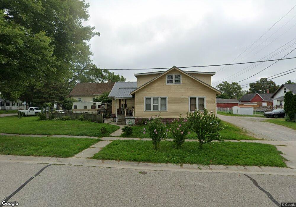
310 14th St Port Huron, MI 48060
Estimated Value: $120,000 - $143,000
4
Beds
1
Bath
1,590
Sq Ft
$85/Sq Ft
Est. Value
About This Home
This home is located at 310 14th St, Port Huron, MI 48060 and is currently estimated at $134,464, approximately $84 per square foot. 310 14th St is a home located in St. Clair County with nearby schools including Michigamme Elementary School, Holland Woods Middle School, and Port Huron High School.
Ownership History
Date
Name
Owned For
Owner Type
Purchase Details
Closed on
May 1, 2017
Sold by
M & M Investment Llc
Bought by
Ross Casie L
Current Estimated Value
Purchase Details
Closed on
Nov 30, 2010
Sold by
Reo Residential Llc
Bought by
M & M Investments Llc
Purchase Details
Closed on
Nov 20, 2008
Sold by
Us Bank National Association
Bought by
Reo Residential Llc
Purchase Details
Closed on
Feb 15, 2007
Sold by
Wendell Clarence J
Bought by
Us Bank National Association
Create a Home Valuation Report for This Property
The Home Valuation Report is an in-depth analysis detailing your home's value as well as a comparison with similar homes in the area
Home Values in the Area
Average Home Value in this Area
Purchase History
| Date | Buyer | Sale Price | Title Company |
|---|---|---|---|
| Ross Casie L | $25,000 | None Available | |
| M & M Investments Llc | $3,500 | None Available | |
| Reo Residential Llc | $3,500 | None Available | |
| Us Bank National Association | $119,053 | None Available |
Source: Public Records
Tax History Compared to Growth
Tax History
| Year | Tax Paid | Tax Assessment Tax Assessment Total Assessment is a certain percentage of the fair market value that is determined by local assessors to be the total taxable value of land and additions on the property. | Land | Improvement |
|---|---|---|---|---|
| 2025 | $1,621 | $58,800 | $0 | $0 |
| 2024 | $1,205 | $53,500 | $0 | $0 |
| 2023 | $1,138 | $46,700 | $0 | $0 |
| 2022 | $1,145 | $39,700 | $0 | $0 |
| 2021 | $1,088 | $35,500 | $0 | $0 |
| 2020 | $1,100 | $33,300 | $33,300 | $0 |
| 2019 | $1,081 | $23,900 | $0 | $0 |
| 2018 | $1,057 | $23,900 | $0 | $0 |
| 2017 | $945 | $22,300 | $0 | $0 |
| 2016 | $800 | $22,300 | $0 | $0 |
| 2015 | $835 | $22,400 | $22,400 | $0 |
| 2014 | $835 | $23,300 | $23,300 | $0 |
| 2013 | -- | $23,300 | $0 | $0 |
Source: Public Records
Map
Nearby Homes