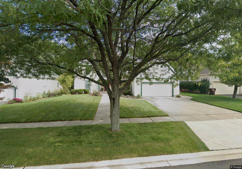
310 Barn Swallow Dr Woodstock, IL 60098
Estimated Value: $362,728 - $400,000
3
Beds
--
Bath
2,590
Sq Ft
$150/Sq Ft
Est. Value
About This Home
This home is located at 310 Barn Swallow Dr, Woodstock, IL 60098 and is currently estimated at $388,932, approximately $150 per square foot. 310 Barn Swallow Dr is a home located in McHenry County with nearby schools including Olson Elementary School, Northwood Middle School, and Woodstock North High School.
Ownership History
Date
Name
Owned For
Owner Type
Purchase Details
Closed on
Oct 31, 2000
Sold by
Harris Bank Woodstock
Bought by
Rinker Carl D and Rinker Patricia L
Current Estimated Value
Home Financials for this Owner
Home Financials are based on the most recent Mortgage that was taken out on this home.
Original Mortgage
$75,000
Outstanding Balance
$27,616
Interest Rate
7.87%
Estimated Equity
$361,316
Purchase Details
Closed on
Jan 24, 2000
Sold by
Harris Bank Woodstock
Bought by
Harris Bank Woodstock
Create a Home Valuation Report for This Property
The Home Valuation Report is an in-depth analysis detailing your home's value as well as a comparison with similar homes in the area
Home Values in the Area
Average Home Value in this Area
Purchase History
| Date | Buyer | Sale Price | Title Company |
|---|---|---|---|
| Rinker Carl D | $222,862 | Fox Title | |
| Harris Bank Woodstock | -- | Fox Title Company |
Source: Public Records
Mortgage History
| Date | Status | Borrower | Loan Amount |
|---|---|---|---|
| Open | Rinker Carl D | $75,000 |
Source: Public Records
Tax History Compared to Growth
Tax History
| Year | Tax Paid | Tax Assessment Tax Assessment Total Assessment is a certain percentage of the fair market value that is determined by local assessors to be the total taxable value of land and additions on the property. | Land | Improvement |
|---|---|---|---|---|
| 2024 | $7,224 | $93,622 | $25,355 | $68,267 |
| 2023 | $6,884 | $85,617 | $23,187 | $62,430 |
| 2022 | $6,882 | $76,932 | $20,835 | $56,097 |
| 2021 | $6,480 | $71,578 | $19,385 | $52,193 |
| 2020 | $6,194 | $67,866 | $18,380 | $49,486 |
| 2019 | $5,902 | $63,898 | $17,305 | $46,593 |
| 2018 | $5,554 | $59,947 | $16,235 | $43,712 |
| 2017 | $5,990 | $56,262 | $15,237 | $41,025 |
| 2016 | $6,015 | $52,818 | $14,304 | $38,514 |
| 2013 | -- | $52,327 | $14,171 | $38,156 |
Source: Public Records
Map
Nearby Homes
- 214 Raffel Rd
- 1721 Yasgur Dr
- 109 Raffel Rd
- 1832 Yasgur Dr
- 1819 Woodside Dr
- 1530 Hickory Rd Unit A
- 871 Hickman Ln
- 908 Hickory Rd
- 905 Hickory Rd
- 709 Mchenry Ave
- Roosevelt II - Ranch Plan at Fairview Estates
- Adams III - Ranch Plan at Fairview Estates
- McMahon - Ranch Plan at Fairview Estates
- Marino - Ranch Plan at Fairview Estates
- Kennedy - Ranch Plan at Fairview Estates
- Lincoln - Ranch Plan at Fairview Estates
- Newport - Two-story Plan at Fairview Estates
- Monroe II - Two-story Plan at Fairview Estates
- Elway - Ranch Plan at Fairview Estates
- Roosevelt - Ranch Plan at Fairview Estates
- 320 Barn Swallow Dr
- 300 Barn Swallow Dr
- 311 Tanager Dr
- 301 Tanager Dr
- 321 Tanager Dr
- 361 Tanager Dr
- 261 Tanager Dr
- 311 Barn Swallow Dr
- 301 Barn Swallow Dr
- 321 Barn Swallow Dr
- 261 Barn Swallow Dr
- 250 Barn Swallow Dr Unit 3
- 251 Tanager Dr Unit 3
- 331 Barn Swallow Dr
- 251 Barn Swallow Dr
- 341 Barn Swallow Dr
- 300 Redwing Dr
- 290 Redwing Dr
- 241 Tanager Dr
- 310 Tanager Dr