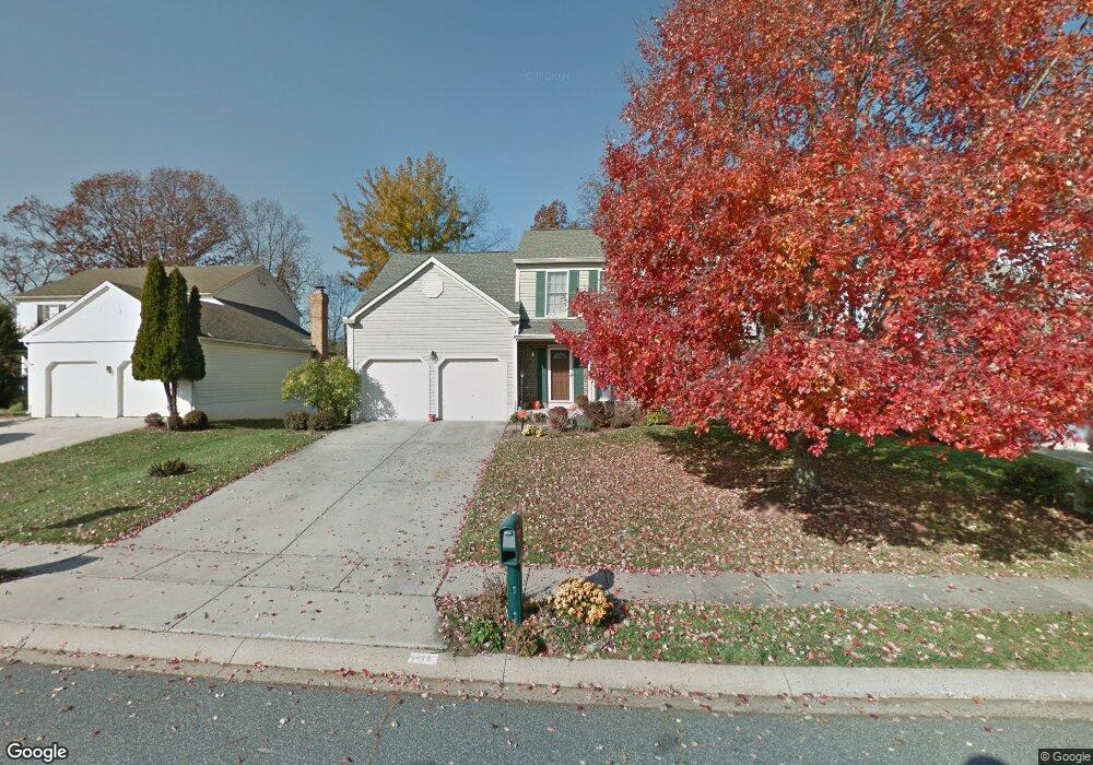
310 Boeing Ct Abingdon, MD 21009
Estimated Value: $512,000 - $581,000
Studio
3
Baths
2,200
Sq Ft
$248/Sq Ft
Est. Value
About This Home
This home is located at 310 Boeing Ct, Abingdon, MD 21009 and is currently estimated at $545,626, approximately $248 per square foot. 310 Boeing Ct is a home located in Harford County with nearby schools including Homestead-Wakefield Elementary School, Patterson Mill Middle School, and Patterson Mill High School.
Ownership History
Date
Name
Owned For
Owner Type
Purchase Details
Closed on
Jun 26, 1997
Sold by
Renehan Richard J
Bought by
Renehan Richard J and Renehan Sarah L
Current Estimated Value
Purchase Details
Closed on
Feb 26, 1997
Sold by
Mcbride Kevin P
Bought by
Renehan Richard J and Renehan Sarah L
Purchase Details
Closed on
Jul 29, 1994
Sold by
Payne J K
Bought by
Mcbride Kevin P
Home Financials for this Owner
Home Financials are based on the most recent Mortgage that was taken out on this home.
Original Mortgage
$180,000
Interest Rate
8.25%
Create a Home Valuation Report for This Property
The Home Valuation Report is an in-depth analysis detailing your home's value as well as a comparison with similar homes in the area
Home Values in the Area
Average Home Value in this Area
Purchase History
| Date | Buyer | Sale Price | Title Company |
|---|---|---|---|
| Renehan Richard J | -- | -- | |
| Renehan Richard J | $203,000 | -- | |
| Mcbride Kevin P | $200,000 | -- |
Source: Public Records
Mortgage History
| Date | Status | Borrower | Loan Amount |
|---|---|---|---|
| Previous Owner | Mcbride Kevin P | $180,000 | |
| Closed | Renehan Richard J | -- |
Source: Public Records
Tax History Compared to Growth
Tax History
| Year | Tax Paid | Tax Assessment Tax Assessment Total Assessment is a certain percentage of the fair market value that is determined by local assessors to be the total taxable value of land and additions on the property. | Land | Improvement |
|---|---|---|---|---|
| 2025 | $3,988 | $390,500 | $0 | $0 |
| 2024 | $3,988 | $365,900 | $0 | $0 |
| 2023 | $3,720 | $341,300 | $116,100 | $225,200 |
| 2022 | $3,657 | $335,533 | $0 | $0 |
| 2021 | $3,739 | $329,767 | $0 | $0 |
| 2020 | $3,739 | $324,000 | $116,100 | $207,900 |
| 2019 | $3,680 | $318,867 | $0 | $0 |
| 2018 | $3,588 | $313,733 | $0 | $0 |
| 2017 | $3,529 | $308,600 | $0 | $0 |
| 2016 | -- | $305,567 | $0 | $0 |
| 2015 | $4,138 | $302,533 | $0 | $0 |
| 2014 | $4,138 | $299,500 | $0 | $0 |
Source: Public Records
Map
Nearby Homes
- 2608 Laurel Valley Garth
- 745 Dowers Rd
- 741 Burgh Westra Way
- 2765 Oatgrass Ct
- 2961 Harrogate Way
- 2521 Merrick Ct
- 2543 Merrick Ct
- 2000 Treese Unit DEVONSHIRE
- 2000 Treese Unit SAVANNAH
- 2000 Treese Unit MAGNOLIA
- 2000 Treese Unit COVINGTON
- 108 Laurel Valley Ct
- 2921 Shelley Ct
- Augusta Plan at Laurel Oaks
- Woodford Plan at Laurel Oaks
- Savannah Plan at Laurel Oaks
- Hawthorne Plan at Laurel Oaks
- Sebastian Plan at Laurel Oaks
- Devonshire Plan at Laurel Oaks
- Addison Plan at Laurel Oaks
- 312 Boeing Ct
- 308 Boeing Ct
- 314 Boeing Ct
- 306 Boeing Ct
- 2623 E Rhododendron Dr
- 2621 E Rhododendron Dr
- 305 Boeing Ct
- 2625 E Rhododendron Dr
- 307 Boeing Ct
- 316 Boeing Ct
- 2619 E Rhododendron Dr
- 304 Boeing Ct
- 303 Boeing Ct
- 309 Boeing Ct
- 2627 E Rhododendron Dr
- 318 Boeing Ct
- 304 Overview Dr
- 302 Boeing Ct
- 311 Boeing Ct
- 2617 E Rhododendron Dr
