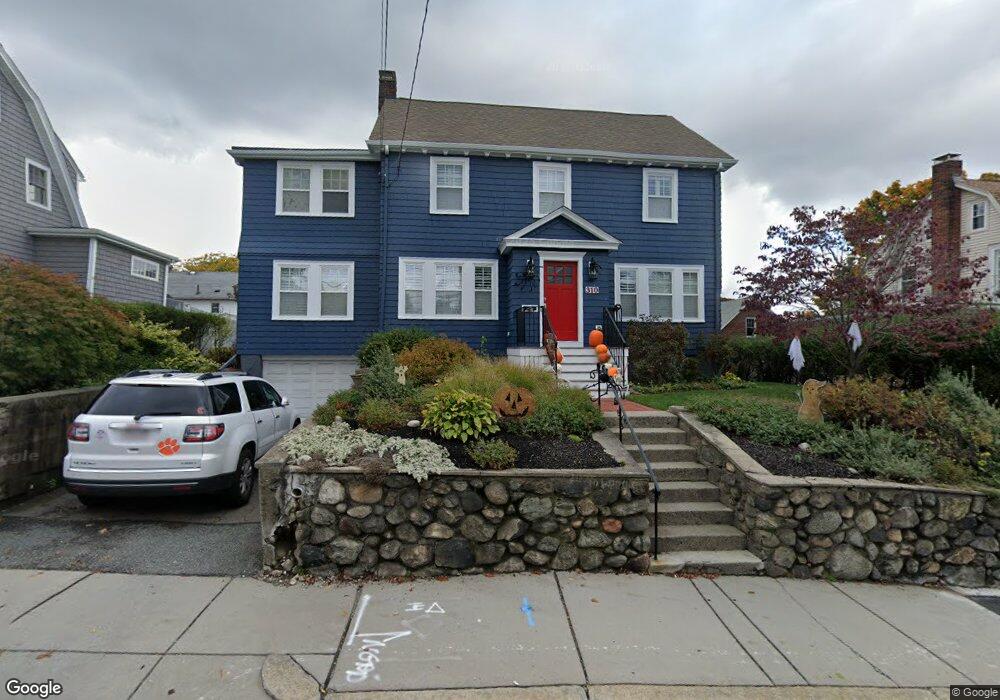
310 Common St Watertown, MA 02472
West Watertown NeighborhoodEstimated Value: $1,142,000 - $1,235,000
3
Beds
3
Baths
1,937
Sq Ft
$607/Sq Ft
Est. Value
About This Home
This home is located at 310 Common St, Watertown, MA 02472 and is currently estimated at $1,174,942, approximately $606 per square foot. 310 Common St is a home located in Middlesex County with nearby schools including The Kendall School and Beacon High School.
Ownership History
Date
Name
Owned For
Owner Type
Purchase Details
Closed on
Feb 27, 2007
Sold by
Campana Anthony M and Campana Wendy L
Bought by
Sasser Kathryn O and Sasser William E
Current Estimated Value
Purchase Details
Closed on
Mar 31, 1997
Sold by
Bernstein Nicole F
Bought by
Campana Anthony M and Shaw Wendy
Purchase Details
Closed on
Nov 29, 1988
Sold by
Vanvantran Liem Van
Bought by
Bernstein Nicole F
Create a Home Valuation Report for This Property
The Home Valuation Report is an in-depth analysis detailing your home's value as well as a comparison with similar homes in the area
Home Values in the Area
Average Home Value in this Area
Purchase History
| Date | Buyer | Sale Price | Title Company |
|---|---|---|---|
| Sasser Kathryn O | $560,500 | -- | |
| Campana Anthony M | $233,000 | -- | |
| Bernstein Nicole F | $198,000 | -- |
Source: Public Records
Mortgage History
| Date | Status | Borrower | Loan Amount |
|---|---|---|---|
| Open | Bernstein Nicole F | $411,500 | |
| Closed | Bernstein Nicole F | $415,500 | |
| Closed | Bernstein Nicole F | $417,000 |
Source: Public Records
Tax History Compared to Growth
Tax History
| Year | Tax Paid | Tax Assessment Tax Assessment Total Assessment is a certain percentage of the fair market value that is determined by local assessors to be the total taxable value of land and additions on the property. | Land | Improvement |
|---|---|---|---|---|
| 2025 | $10,802 | $924,800 | $500,900 | $423,900 |
| 2024 | $10,192 | $871,100 | $486,200 | $384,900 |
| 2023 | $10,993 | $809,500 | $464,500 | $345,000 |
| 2022 | $10,085 | $761,100 | $428,200 | $332,900 |
| 2021 | $8,789 | $717,500 | $384,600 | $332,900 |
| 2020 | $8,534 | $703,000 | $370,100 | $332,900 |
| 2019 | $7,984 | $619,900 | $355,600 | $264,300 |
| 2018 | $7,791 | $578,400 | $348,300 | $230,100 |
| 2017 | $8,034 | $578,400 | $348,300 | $230,100 |
| 2016 | $7,352 | $537,400 | $326,600 | $210,800 |
| 2015 | $7,640 | $508,300 | $297,500 | $210,800 |
| 2014 | $7,604 | $508,300 | $297,500 | $210,800 |
Source: Public Records
Map
Nearby Homes
- 532 Belmont St
- 30 Merrill Rd
- 125 Trapelo Rd Unit 23
- 125 Trapelo Rd Unit 21
- 456 Belmont St Unit 10
- 46 Hall Ave Unit 2
- 11 Payson Rd Unit 11
- 91 Standish Rd
- 7 Pine St
- 152 Bellevue Rd
- 88 Palfrey Rd Unit 88
- 52-54 Vincent Ave
- 18 Wilson Ave Unit 2
- 121 Channing Rd
- 50 Hammond Rd
- 2 Bartlett Ave Unit 1
- 47 Fuller Rd Unit 47
- 68 Payson Rd
- 50 York Ave Unit 50
- 59-61 Gilbert Rd
- 306 Common St
- 316 Common St
- 182 Lovell Rd
- 176 Lovell Rd
- 188 Lovell Rd
- 313 Common St Unit 2
- 313 Common St Unit 1
- 300 Common St
- 324 Common St
- 317 Common St
- 317 Common St Unit 2
- 317 Common St Unit 3
- 174 Lovell Rd
- 5 Sunset Rd
- 322 Common St
- 192 Lovell Rd
- 294 Common St
- 183 Lovell Rd
- 12 Sunset Rd
- 301 Common St