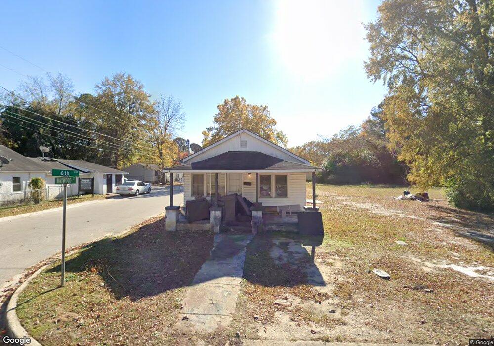
310 E 6th Ave Red Springs, NC 28377
Estimated Value: $45,168 - $72,000
2
Beds
1
Bath
720
Sq Ft
$87/Sq Ft
Est. Value
About This Home
This home is located at 310 E 6th Ave, Red Springs, NC 28377 and is currently estimated at $62,792, approximately $87 per square foot. 310 E 6th Ave is a home with nearby schools including Peterson Elementary School, Parkton Elementary School, and Red Springs Middle School.
Ownership History
Date
Name
Owned For
Owner Type
Purchase Details
Closed on
Mar 26, 2020
Sold by
Peterkin Timothy J
Bought by
Mclean Jantzen Freerar Camika
Current Estimated Value
Purchase Details
Closed on
Feb 26, 2020
Sold by
Terry Doreatha and Terry Betty
Bought by
Peterkin Timothy J and Betty Terry & Doreatha Terry Supplementa
Purchase Details
Closed on
Feb 20, 2020
Sold by
Rogers Thurman L
Bought by
Terry Doreatha and Terry Betty
Purchase Details
Closed on
Dec 20, 2018
Sold by
Terry Doreatha and Terry Betty
Bought by
Rogers Thurman L
Create a Home Valuation Report for This Property
The Home Valuation Report is an in-depth analysis detailing your home's value as well as a comparison with similar homes in the area
Home Values in the Area
Average Home Value in this Area
Purchase History
| Date | Buyer | Sale Price | Title Company |
|---|---|---|---|
| Mclean Jantzen Freerar Camika | $17,000 | None Available | |
| Peterkin Timothy J | -- | None Available | |
| Terry Doreatha | -- | None Available | |
| Rogers Thurman L | $40,000 | None Available |
Source: Public Records
Tax History
| Year | Tax Paid | Tax Assessment Tax Assessment Total Assessment is a certain percentage of the fair market value that is determined by local assessors to be the total taxable value of land and additions on the property. | Land | Improvement |
|---|---|---|---|---|
| 2025 | $389 | $22,200 | $6,600 | $15,600 |
| 2024 | $384 | $22,200 | $6,600 | $15,600 |
| 2023 | $369 | $21,400 | $6,000 | $15,400 |
| 2022 | $369 | $21,400 | $6,000 | $15,400 |
| 2021 | $369 | $21,400 | $6,000 | $15,400 |
| 2020 | $355 | $21,400 | $6,000 | $15,400 |
| 2018 | $800 | $36,300 | $8,800 | $27,500 |
| 2017 | $692 | $36,300 | $8,800 | $27,500 |
| 2016 | $692 | $36,300 | $8,800 | $27,500 |
| 2015 | $692 | $36,300 | $8,800 | $27,500 |
| 2014 | $692 | $36,300 | $8,800 | $27,500 |
Source: Public Records
Map
Nearby Homes
- Lot 18 Daniel McLeod Rd
- Lot 2 Daniel McLeod Rd
- Lot 17 Daniel McLeod Rd
- Lot 8 Daniel McLeod Rd
- Lot 5 Daniel McLeod Rd
- Lot 6 Daniel McLeod Rd
- Lot 4 Daniel McLeod Rd
- Lot 3 Daniel McLeod Rd
- Lot 15 Daniel McLeod Rd
- Lot 16 Daniel McLeod Rd
- Lot 1 Daniel McLeod Rd
- Lot 7 Daniel McLeod Rd
- Lot 14 Daniel McLeod Rd
- 400 Mcleod Rd
- 127 E 8th Ave
- 103 W Sunset Dr
- Lot 2 N Carolina 710
- 103 Spring St
- 201 N College St
- 0 Hwy 211 Unit 742487
Your Personal Tour Guide
Ask me questions while you tour the home.