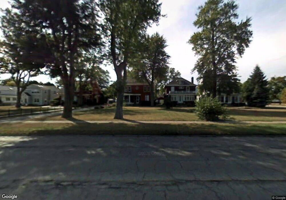
310 E Perry St Port Clinton, OH 43452
Estimated Value: $399,000 - $573,000
4
Beds
2
Baths
2,664
Sq Ft
$181/Sq Ft
Est. Value
About This Home
This home is located at 310 E Perry St, Port Clinton, OH 43452 and is currently estimated at $483,281, approximately $181 per square foot. 310 E Perry St is a home located in Ottawa County with nearby schools including Bataan Memorial Primary School, Bataan Memorial Intermediate School, and Port Clinton Middle School.
Ownership History
Date
Name
Owned For
Owner Type
Purchase Details
Closed on
Jul 1, 1997
Sold by
Krofft Deborah J
Bought by
Wharton Betty A
Current Estimated Value
Home Financials for this Owner
Home Financials are based on the most recent Mortgage that was taken out on this home.
Original Mortgage
$75,000
Outstanding Balance
$9,305
Interest Rate
8%
Mortgage Type
New Conventional
Estimated Equity
$473,976
Create a Home Valuation Report for This Property
The Home Valuation Report is an in-depth analysis detailing your home's value as well as a comparison with similar homes in the area
Home Values in the Area
Average Home Value in this Area
Purchase History
| Date | Buyer | Sale Price | Title Company |
|---|---|---|---|
| Wharton Betty A | $210,000 | -- |
Source: Public Records
Mortgage History
| Date | Status | Borrower | Loan Amount |
|---|---|---|---|
| Open | Wharton Betty A | $75,000 |
Source: Public Records
Tax History
| Year | Tax Paid | Tax Assessment Tax Assessment Total Assessment is a certain percentage of the fair market value that is determined by local assessors to be the total taxable value of land and additions on the property. | Land | Improvement |
|---|---|---|---|---|
| 2024 | $5,624 | $165,659 | $73,245 | $92,414 |
| 2023 | $5,739 | $111,087 | $48,829 | $62,258 |
| 2022 | $4,308 | $111,087 | $48,829 | $62,258 |
| 2021 | $4,304 | $111,090 | $48,830 | $62,260 |
| 2020 | $3,178 | $85,910 | $34,880 | $51,030 |
| 2019 | $3,145 | $85,910 | $34,880 | $51,030 |
| 2018 | $3,140 | $85,910 | $34,880 | $51,030 |
| 2017 | $3,079 | $82,900 | $34,880 | $48,020 |
| 2016 | $3,086 | $82,900 | $34,880 | $48,020 |
| 2015 | $3,097 | $82,900 | $34,880 | $48,020 |
| 2014 | $1,562 | $82,900 | $34,880 | $48,020 |
| 2013 | $3,130 | $82,900 | $34,880 | $48,020 |
Source: Public Records
Map
Nearby Homes
- 122 Washington St
- 2621 N Peachtree Lane # Sublot 1
- 2453 N Peachtree Lane # Sublot 7
- 2481 N Peachtree Lane # Sublot 6
- 2565 N Peachtree Lane # Sublot 3
- 0 Mouse Island Unit 20252634
- 2369 N Peachtree Lane # Sublot 10
- 2397 N Peachtree Lane # Sublot 9
- 2509 N Peachtree Lane # Sublot 5
- 0 Mouse Island Unit 5139279
- 2425 N Peachtree Lane # Sublot 8
- 521 E 2nd St
- 525 E 2nd St
- 302 W 2nd St
- 801 E 3rd St
- 218 Elm St
- 322 E 6th St
- 229 W 4th St
- 1011 E 2nd St
- 413 W 3rd St
- 306 E Perry St
- 318 E Perry St
- 111 Adams St
- 302 E Perry St
- 322 E Perry St
- 115 Adams St
- 326 E Perry St
- 110 Washington St
- 330 E Perry St
- 114 Washington St
- 118 Washington St
- 317 E 2nd St
- 4655 W State Route 163
- 1 W State Route 163
- 3965 W State Route 163
- 2653 W State Route 163
- 323 E 2nd St
- 402 E Perry St
- 0 W State Route 163
- 2598 E Harbor (Sr 163) Rd
Your Personal Tour Guide
Ask me questions while you tour the home.