Estimated Value: $189,000 - $239,000
4
Beds
2
Baths
1,363
Sq Ft
$158/Sq Ft
Est. Value
About This Home
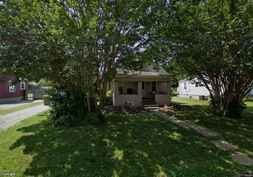
This home is located at 310 E Riverside Dr, Salem, VA 24153 and is currently estimated at $216,011, approximately $158 per square foot. 310 E Riverside Dr is a home located in Salem City with nearby schools including East Salem Elementary School, Andrew Lewis Middle School, and Salem High School.
Ownership History
Date
Name
Owned For
Owner Type
Purchase Details
Closed on
Mar 18, 2010
Sold by
Nationstar Mortgage Llc
Bought by
St Clair Shaun G
Current Estimated Value
Home Financials for this Owner
Home Financials are based on the most recent Mortgage that was taken out on this home.
Original Mortgage
$75,605
Outstanding Balance
$51,394
Interest Rate
5.5%
Mortgage Type
FHA
Estimated Equity
$164,617
Purchase Details
Closed on
Apr 7, 2009
Sold by
Winkler Robert John and Kazabeer Sandra
Bought by
National Mortgage Llc
Purchase Details
Closed on
Nov 22, 2005
Sold by
Shifflett Marty T
Bought by
Winkler Robert John
Home Financials for this Owner
Home Financials are based on the most recent Mortgage that was taken out on this home.
Original Mortgage
$102,600
Interest Rate
8.87%
Mortgage Type
Adjustable Rate Mortgage/ARM
Create a Home Valuation Report for This Property
The Home Valuation Report is an in-depth analysis detailing your home's value as well as a comparison with similar homes in the area
Home Values in the Area
Average Home Value in this Area
Purchase History
| Date | Buyer | Sale Price | Title Company |
|---|---|---|---|
| St Clair Shaun G | $77,000 | None Available | |
| National Mortgage Llc | $133,023 | None Available | |
| Winkler Robert John | -- | None Available |
Source: Public Records
Mortgage History
| Date | Status | Borrower | Loan Amount |
|---|---|---|---|
| Open | St Clair Shaun G | $75,605 | |
| Previous Owner | Winkler Robert John | $102,600 |
Source: Public Records
Tax History
| Year | Tax Paid | Tax Assessment Tax Assessment Total Assessment is a certain percentage of the fair market value that is determined by local assessors to be the total taxable value of land and additions on the property. | Land | Improvement |
|---|---|---|---|---|
| 2025 | $625 | $106,000 | $29,600 | $76,400 |
| 2024 | $593 | $98,900 | $28,300 | $70,600 |
| 2023 | $1,070 | $89,200 | $26,100 | $63,100 |
| 2022 | $1,013 | $84,400 | $22,700 | $61,700 |
| 2021 | $983 | $81,900 | $21,500 | $60,400 |
| 2020 | $958 | $79,800 | $21,500 | $58,300 |
| 2019 | $931 | $77,600 | $21,500 | $56,100 |
| 2018 | $906 | $76,800 | $21,500 | $55,300 |
| 2017 | $886 | $75,100 | $21,500 | $53,600 |
| 2016 | $886 | $75,100 | $21,500 | $53,600 |
| 2015 | $896 | $75,900 | $21,000 | $54,900 |
| 2014 | $896 | $75,900 | $21,000 | $54,900 |
Source: Public Records
Map
Nearby Homes
- 303 Riverland Dr
- 234 Kimball Ave
- 407 Kimball Ave
- 409 Kimball Ave
- 411 Kimball Ave
- 414 Kimball Ave
- 402 E 7th St
- 1504 Eddy Ave
- 916 Homestead Dr
- 912 Homestead Dr
- 1114 Carolina Ave
- 137 Parker Ln
- 656 Pyrtle Dr
- 1025 Fisher Ave
- 134 Parker Ln
- 130 Parker Ln
- 122 Parker Ln
- 938 Roanoke Blvd
- 903 Bowman Ave
- 559 Roanoke Blvd Unit 561
- 306 E Riverside Dr
- 316 E Riverside Dr
- 300 E Riverside Dr
- 322 E Riverside Dr Unit 326
- 315 Riverland Dr
- 317 Riverland Dr
- 309 Riverland Dr
- 321 Riverland Dr
- 328 E Riverside Dr
- 327 Riverland Dr
- 329 Riverland Dr
- 334 E Riverside Dr
- 331 Riverland Dr
- 515 King St
- 210 Riverland Dr
- 303 Apperson Dr
- 400 E Riverside Dr
- 335 Riverland Dr
- 332 Riverland Dr
- 1406 S Colorado St
Your Personal Tour Guide
Ask me questions while you tour the home.