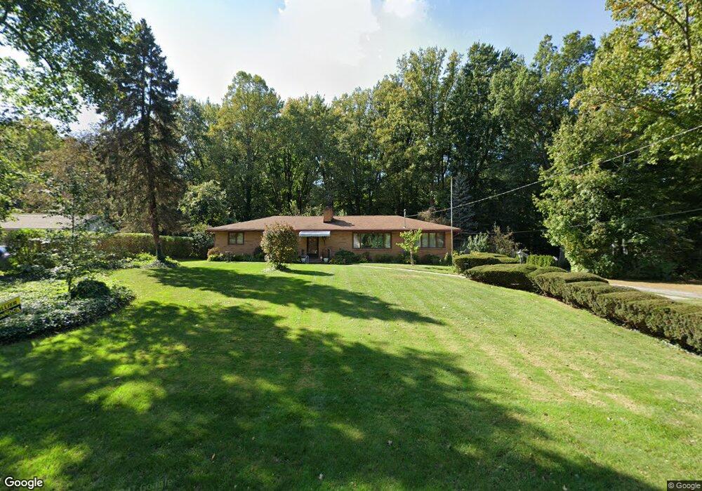
310 Fairfield Rd Painesville, OH 44077
Estimated Value: $257,849 - $314,000
3
Beds
3
Baths
1,782
Sq Ft
$165/Sq Ft
Est. Value
About This Home
This home is located at 310 Fairfield Rd, Painesville, OH 44077 and is currently estimated at $294,212, approximately $165 per square foot. 310 Fairfield Rd is a home located in Lake County with nearby schools including Henry F. Lamuth Middle School, Riverside Junior/Senior High School, and Hershey Montessori Elementary School.
Ownership History
Date
Name
Owned For
Owner Type
Purchase Details
Closed on
Sep 18, 2001
Sold by
Rand Robert S and Rand Maureen C
Bought by
Edmonds Earl and Edmonds Virginia
Current Estimated Value
Home Financials for this Owner
Home Financials are based on the most recent Mortgage that was taken out on this home.
Original Mortgage
$235,500
Interest Rate
6.61%
Purchase Details
Closed on
Apr 2, 1985
Bought by
Rand Robert S
Create a Home Valuation Report for This Property
The Home Valuation Report is an in-depth analysis detailing your home's value as well as a comparison with similar homes in the area
Home Values in the Area
Average Home Value in this Area
Purchase History
| Date | Buyer | Sale Price | Title Company |
|---|---|---|---|
| Edmonds Earl | $171,000 | Enterprise Title Agency Inc | |
| Rand Robert S | -- | -- |
Source: Public Records
Mortgage History
| Date | Status | Borrower | Loan Amount |
|---|---|---|---|
| Closed | Edmonds Earl | $235,500 | |
| Closed | Edmonds Earl | $43,800 |
Source: Public Records
Tax History Compared to Growth
Tax History
| Year | Tax Paid | Tax Assessment Tax Assessment Total Assessment is a certain percentage of the fair market value that is determined by local assessors to be the total taxable value of land and additions on the property. | Land | Improvement |
|---|---|---|---|---|
| 2024 | -- | $73,680 | $25,690 | $47,990 |
| 2023 | $6,557 | $60,170 | $20,520 | $39,650 |
| 2022 | $3,058 | $60,170 | $20,520 | $39,650 |
| 2021 | $3,069 | $60,170 | $20,520 | $39,650 |
| 2020 | $2,948 | $52,320 | $17,840 | $34,480 |
| 2019 | $2,971 | $52,320 | $17,840 | $34,480 |
| 2018 | $2,980 | $43,580 | $15,520 | $28,060 |
| 2017 | $2,468 | $43,580 | $15,520 | $28,060 |
| 2016 | $2,179 | $43,580 | $15,520 | $28,060 |
| 2015 | $1,994 | $43,580 | $15,520 | $28,060 |
| 2014 | $2,027 | $43,580 | $15,520 | $28,060 |
| 2013 | $1,981 | $43,580 | $15,520 | $28,060 |
Source: Public Records
Map
Nearby Homes
- 339 Barrington Ridge Rd
- 2051 Kingsborough Dr
- 6677 Stratford Rd
- 135 Nantucket Cir
- 2155 Ridgebury Dr
- 6624 Belvoir Ct
- 81 Fairfield Rd
- 10257 Prouty Rd
- 7069 Brightwood Dr
- 7065 Brightwood Dr
- 9846 Old Johnnycake Ridge Rd
- 6769 Melridge Dr
- 9820 Old Johnnycake Ridge Rd Unit 5
- 6931 Chairmans Ct
- 1651 Mentor Ave Unit 2008
- 1651 Mentor Ave Unit 912
- 1651 Mentor Ave Unit 2804
- 1651 Mentor Ave Unit 106
- 1651 Mentor Ave Unit 1706
- 1936 Mentor Ave
- 326 Fairfield Rd
- 318 Fairfield Rd
- 340 Fairfield Rd
- 321 Fairfield Rd
- 307 Fairfield Rd
- 296 Fairfield Rd
- 335 Fairfield Rd
- 453 Barrington Ridge Rd
- 455 Barrington Ridge Rd
- 291 Fairfield Rd
- 471 Barrington Ridge Rd
- 6822 Fairfield Rd
- 401 Barrington Ridge Rd
- 6818 Fairfield Rd
- 6830 Fairfield Rd
- 6829 Fairfield Rd
- 385 Barrington Ridge Rd
- 420 Barrington Ridge Rd
- 299 Fairfield Rd
- 6836 Fairfield Rd