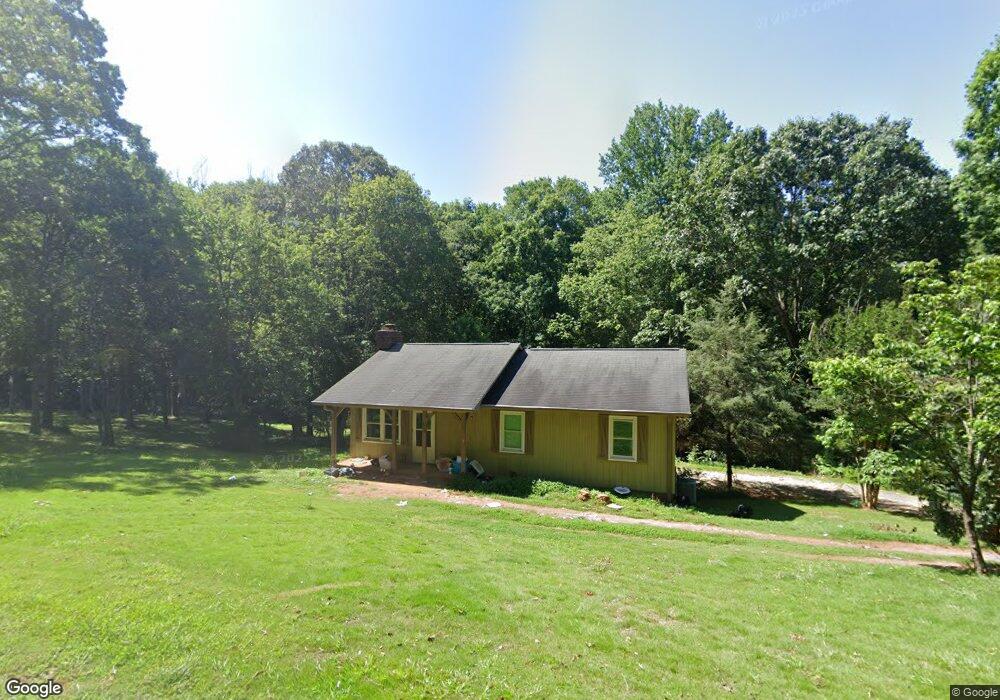
310 Gilstrap Dr Liberty, SC 29657
Estimated Value: $205,356 - $255,000
3
Beds
2
Baths
1,120
Sq Ft
$207/Sq Ft
Est. Value
About This Home
This home is located at 310 Gilstrap Dr, Liberty, SC 29657 and is currently estimated at $232,089, approximately $207 per square foot. 310 Gilstrap Dr is a home located in Pickens County with nearby schools including Liberty Elementary School, Liberty Middle School, and Liberty High School.
Ownership History
Date
Name
Owned For
Owner Type
Purchase Details
Closed on
Apr 27, 2023
Sold by
County Of Pickens
Bought by
Hester Willie B and Wilson An-Toi N
Current Estimated Value
Purchase Details
Closed on
Jun 21, 2011
Sold by
Household Finance Corporation Ii
Bought by
Hester Willie B and Wilson An Toi N
Home Financials for this Owner
Home Financials are based on the most recent Mortgage that was taken out on this home.
Original Mortgage
$83,000
Interest Rate
4.53%
Mortgage Type
VA
Purchase Details
Closed on
Dec 15, 2010
Sold by
Bettis Thomas A and Bettis Thomas Allen
Bought by
Household Finance Corporation Ii
Purchase Details
Closed on
Dec 12, 2005
Sold by
Bowling A Marshall and Bowling Patricia L
Bought by
Bettis Thomas Allen
Home Financials for this Owner
Home Financials are based on the most recent Mortgage that was taken out on this home.
Original Mortgage
$90,000
Interest Rate
7.75%
Mortgage Type
Adjustable Rate Mortgage/ARM
Create a Home Valuation Report for This Property
The Home Valuation Report is an in-depth analysis detailing your home's value as well as a comparison with similar homes in the area
Home Values in the Area
Average Home Value in this Area
Purchase History
| Date | Buyer | Sale Price | Title Company |
|---|---|---|---|
| Hester Willie B | $107,000 | South Carolina Title | |
| Hester Willie B | $83,000 | -- | |
| Household Finance Corporation Ii | $60,000 | -- | |
| Bettis Thomas Allen | $112,500 | None Available |
Source: Public Records
Mortgage History
| Date | Status | Borrower | Loan Amount |
|---|---|---|---|
| Previous Owner | Hester Willie B | $83,000 | |
| Previous Owner | Bettis Thomas Allen | $90,000 |
Source: Public Records
Tax History
| Year | Tax Paid | Tax Assessment Tax Assessment Total Assessment is a certain percentage of the fair market value that is determined by local assessors to be the total taxable value of land and additions on the property. | Land | Improvement |
|---|---|---|---|---|
| 2025 | $2,395 | $8,730 | $1,500 | $7,230 |
| 2024 | $2,456 | $8,730 | $1,500 | $7,230 |
| 2023 | $2,504 | $6,150 | $900 | $5,250 |
| 2022 | $1,729 | $6,150 | $900 | $5,250 |
| 2021 | $1,664 | $6,150 | $900 | $5,250 |
| 2020 | $1,699 | $4,100 | $600 | $3,500 |
| 2019 | $1,691 | $6,150 | $900 | $5,250 |
| 2018 | $1,571 | $5,380 | $900 | $4,480 |
| 2017 | $1,481 | $5,380 | $900 | $4,480 |
| 2015 | $1,418 | $5,380 | $0 | $0 |
| 2008 | -- | $4,120 | $520 | $3,600 |
Source: Public Records
Map
Nearby Homes
- 11 Moorefield Memorial Hwy
- 10 Moorefield Memorial Hwy
- 09 Moorefield Memorial Hwy
- 5298 Moorefield Memorial Hwy
- 03 Moorefield Memorial Hwy
- 12 Moorefield Memorial Hwy
- 01 Moorefield Memorial Hwy
- 02 Moorefield Memorial Hwy
- 05 Moorefield Memorial Hwy
- 426 N Palmetto St
- 01 E Main St
- 17 Southern St
- 125 Towns End Dr
- 103 E Front St
- 121 Forrester Dr
- 714 N Ashton Dr
- 100 Forrester Dr Unit 205 Ashton Drive
- 7 Lee St
- 202 Ashton Dr
- 411 Anderson Dr
Your Personal Tour Guide
Ask me questions while you tour the home.