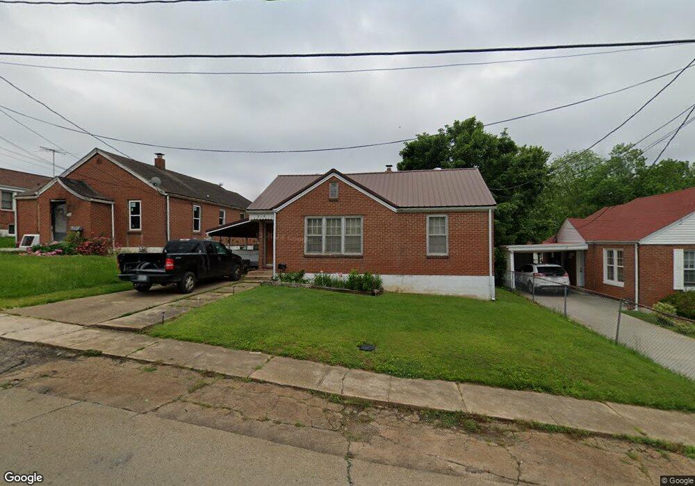
310 High St Fredericktown, MO 63645
Estimated Value: $85,000 - $110,000
2
Beds
--
Bath
776
Sq Ft
$123/Sq Ft
Est. Value
About This Home
This home is located at 310 High St, Fredericktown, MO 63645 and is currently estimated at $95,630, approximately $123 per square foot. 310 High St is a home with nearby schools including Fredericktown Elementary School, Fredericktown Intermediate School, and Kelly A. Burlison Middle School.
Ownership History
Date
Name
Owned For
Owner Type
Purchase Details
Closed on
Dec 12, 2025
Sold by
Thal James C
Bought by
Matthews Russell
Current Estimated Value
Purchase Details
Closed on
Oct 26, 2012
Sold by
Pippin Timothy and Pippin Jo Ann
Bought by
Thal James C and Thal Kathryn L
Home Financials for this Owner
Home Financials are based on the most recent Mortgage that was taken out on this home.
Original Mortgage
$24,000
Interest Rate
3.59%
Mortgage Type
Future Advance Clause Open End Mortgage
Create a Home Valuation Report for This Property
The Home Valuation Report is an in-depth analysis detailing your home's value as well as a comparison with similar homes in the area
Home Values in the Area
Average Home Value in this Area
Purchase History
| Date | Buyer | Sale Price | Title Company |
|---|---|---|---|
| Matthews Russell | -- | True Title | |
| Thal James C | $30,000 | None Available |
Source: Public Records
Mortgage History
| Date | Status | Borrower | Loan Amount |
|---|---|---|---|
| Previous Owner | Thal James C | $24,000 |
Source: Public Records
Tax History
| Year | Tax Paid | Tax Assessment Tax Assessment Total Assessment is a certain percentage of the fair market value that is determined by local assessors to be the total taxable value of land and additions on the property. | Land | Improvement |
|---|---|---|---|---|
| 2025 | $439 | $6,980 | $0 | $0 |
| 2024 | $442 | $6,980 | $0 | $0 |
| 2023 | $439 | $6,980 | $0 | $0 |
| 2022 | $408 | $6,430 | $0 | $0 |
| 2021 | $407 | $6,430 | $0 | $0 |
| 2020 | $422 | $6,300 | $0 | $0 |
| 2019 | $418 | $6,300 | $0 | $0 |
| 2018 | $420 | $6,300 | $0 | $0 |
| 2017 | $410 | $6,300 | $0 | $0 |
| 2016 | $402 | $6,300 | $0 | $0 |
| 2015 | -- | $6,300 | $0 | $0 |
| 2014 | -- | $6,500 | $0 | $0 |
| 2013 | -- | $6,500 | $0 | $0 |
| 2012 | -- | $6,500 | $0 | $0 |
Source: Public Records
Map
Nearby Homes
- 419 Franklin St
- 406 Franklin St
- 504 Albert St
- 502 Saline St
- 318 E Marvin Ave
- 0 S Mine La Motte Ave
- 300 S Mine La Motte Ave
- 410 Lindell St
- 211 S Main St
- 115 Holmes St
- 811 Andrews St
- 000 Cr537_tract 8
- 113 Watson St
- 316 Sherlock Dr
- 700 S Main St
- 408 Park Dr
- 206 Virginia St
- 1261 W Main St
- 133 Madison Cr 411
- 135 Madison Cr 411
Your Personal Tour Guide
Ask me questions while you tour the home.