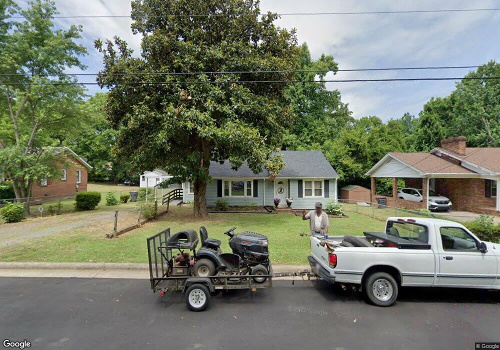
310 Hubbard St Reidsville, NC 27320
Estimated Value: $144,000 - $195,000
--
Bed
--
Bath
1,544
Sq Ft
$113/Sq Ft
Est. Value
About This Home
This home is located at 310 Hubbard St, Reidsville, NC 27320 and is currently estimated at $173,838, approximately $112 per square foot. 310 Hubbard St is a home located in Rockingham County with nearby schools including Reidsville High School, Moss Street Elementary, and Reidsville Middle School.
Ownership History
Date
Name
Owned For
Owner Type
Purchase Details
Closed on
Apr 18, 2023
Sold by
Mcneal Mary Ann
Bought by
Mcneal Mary Ann and Maynard Danielle
Current Estimated Value
Home Financials for this Owner
Home Financials are based on the most recent Mortgage that was taken out on this home.
Original Mortgage
$46,500
Outstanding Balance
$45,208
Interest Rate
6.6%
Mortgage Type
Credit Line Revolving
Estimated Equity
$128,630
Create a Home Valuation Report for This Property
The Home Valuation Report is an in-depth analysis detailing your home's value as well as a comparison with similar homes in the area
Home Values in the Area
Average Home Value in this Area
Purchase History
| Date | Buyer | Sale Price | Title Company |
|---|---|---|---|
| Mcneal Mary Ann | -- | None Listed On Document |
Source: Public Records
Mortgage History
| Date | Status | Borrower | Loan Amount |
|---|---|---|---|
| Open | Mcneal Mary Ann | $46,500 |
Source: Public Records
Tax History Compared to Growth
Tax History
| Year | Tax Paid | Tax Assessment Tax Assessment Total Assessment is a certain percentage of the fair market value that is determined by local assessors to be the total taxable value of land and additions on the property. | Land | Improvement |
|---|---|---|---|---|
| 2025 | $889 | $143,450 | $6,600 | $136,850 |
| 2024 | $889 | $143,450 | $6,600 | $136,850 |
| 2023 | $889 | $79,012 | $6,000 | $73,012 |
| 2022 | $567 | $79,012 | $6,000 | $73,012 |
| 2021 | $1,133 | $79,012 | $6,000 | $73,012 |
| 2020 | $1,133 | $79,012 | $6,000 | $73,012 |
| 2019 | $1,133 | $79,012 | $6,000 | $73,012 |
| 2018 | $1,155 | $80,463 | $10,125 | $70,338 |
| 2017 | $1,155 | $80,463 | $10,125 | $70,338 |
| 2015 | $1,167 | $80,463 | $10,125 | $70,338 |
| 2014 | -- | $80,463 | $10,125 | $70,338 |
Source: Public Records
Map
Nearby Homes
- 00 Robinson Cir
- 315 Hubbard St
- 403 Pennsylvania Ave
- 802 Lawsonville Ave
- 335 S Branch St
- 101 S Branch St
- 312 Church St
- 511 Barnes St
- 515 Barnes St
- 115 N Harris St
- 502 Thomas St
- 612 Thomas St
- 607 Lancaster Dr
- 105 Edna St
- 00 E Morehead St
- 816 Barnes St
- 802 Montgomery St
- 137 Ridge St
- 117 Ridge St
- 304 Roanoke St
- 312 Hubbard St
- 308 Hubbard St
- 832 Robinson Cir
- 314 Hubbard St
- 306 Hubbard St
- 830 Robinson Cir
- 309 Hubbard St
- 311 Hubbard St
- 313 Hubbard St
- 828 Robinson Cir
- 302 Hubbard St
- 307 Hubbard St
- 319 Hubbard St
- 322 Hubbard St
- 808 Robinson Cir
- 303 Hubbard St
- 833 Robinson Cir
- 835 Robinson Cir
- 831 Robinson Cir
- 829 Robinson Cir