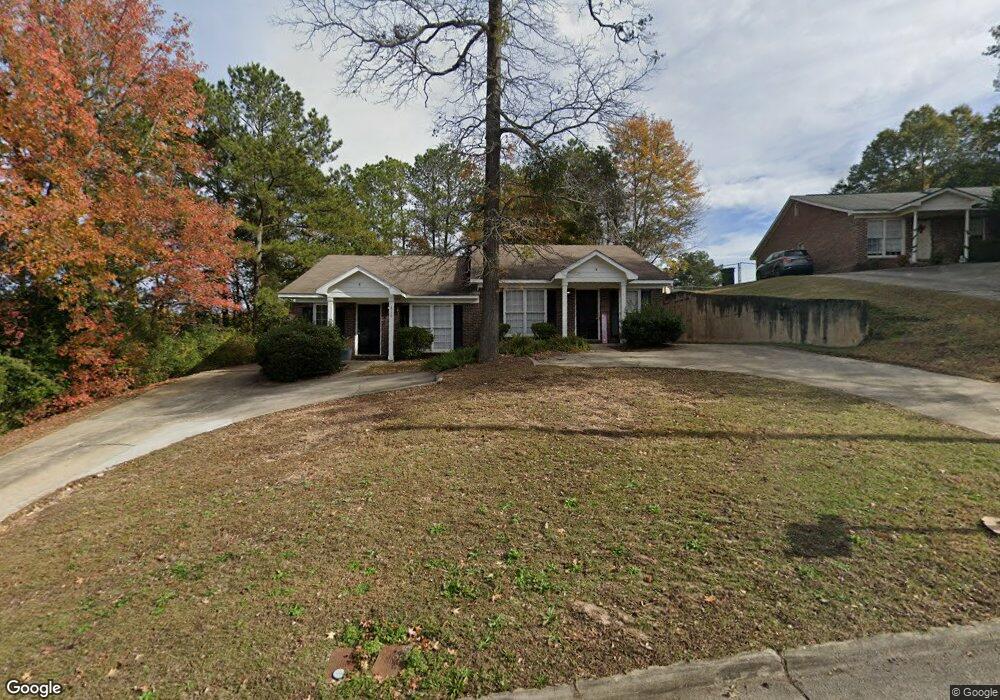
310 Leary Ave Columbus, GA 31907
Eastern Columbus NeighborhoodEstimated Value: $117,000 - $187,000
4
Beds
3
Baths
2,009
Sq Ft
$77/Sq Ft
Est. Value
About This Home
This home is located at 310 Leary Ave, Columbus, GA 31907 and is currently estimated at $153,878, approximately $76 per square foot. 310 Leary Ave is a home located in Muscogee County with nearby schools including St. Mary's Road Magnet Academy, Rothschild Leadership Academy, and Kendrick High School.
Ownership History
Date
Name
Owned For
Owner Type
Purchase Details
Closed on
Oct 25, 2022
Sold by
Young Gene A
Bought by
Prestige Worldwide Rentals Llc
Current Estimated Value
Create a Home Valuation Report for This Property
The Home Valuation Report is an in-depth analysis detailing your home's value as well as a comparison with similar homes in the area
Home Values in the Area
Average Home Value in this Area
Purchase History
| Date | Buyer | Sale Price | Title Company |
|---|---|---|---|
| Prestige Worldwide Rentals Llc | $87,500 | -- |
Source: Public Records
Tax History Compared to Growth
Tax History
| Year | Tax Paid | Tax Assessment Tax Assessment Total Assessment is a certain percentage of the fair market value that is determined by local assessors to be the total taxable value of land and additions on the property. | Land | Improvement |
|---|---|---|---|---|
| 2025 | $1,727 | $51,912 | $6,200 | $45,712 |
| 2024 | $203 | $51,912 | $6,200 | $45,712 |
| 2023 | $1,379 | $35,000 | $4,000 | $31,000 |
| 2022 | $1,563 | $38,288 | $6,200 | $32,088 |
| 2021 | $1,551 | $37,992 | $6,200 | $31,792 |
| 2020 | $1,552 | $37,992 | $6,200 | $31,792 |
| 2019 | $1,557 | $37,992 | $6,200 | $31,792 |
| 2018 | $1,434 | $41,164 | $6,200 | $34,964 |
| 2017 | $1,692 | $41,164 | $6,200 | $34,964 |
| 2016 | $1,356 | $32,876 | $5,572 | $27,304 |
| 2015 | $1,358 | $32,876 | $5,572 | $27,304 |
| 2014 | $1,359 | $32,876 | $5,572 | $27,304 |
| 2013 | -- | $32,876 | $5,572 | $27,304 |
Source: Public Records
Map
Nearby Homes
- 229 N Oakley Dr
- 130 Sycamore Ct
- 3943 Curry St
- 4414 Curry St
- 410 McCartha Dr
- 4534 Sentry St
- 4422 Pate Dr
- 636 Dogwood Dr
- 4437 St Marys Rd
- 392 Olsen Ave
- 3589 Irwin Way
- 391 & 401 Victoria Dr
- 4516 Sims St
- 418 Henson Ave
- 4459 Bermuda St
- 4801 Allen St
- 533 Englewood Dr
- 3510 Califon Ct
- 3402 Montecello Dr
- 4846 Maplewood Dr
- 300 Leary Ave
- 1 Montclair Ct
- 1 Montclair Ct Unit Apartment B
- 0 Leary Ave Unit 7188462
- 0 Leary Ave Unit 8636095
- 4101 Montclair Dr
- 288 Leary Ave Unit A
- 288 Leary Ave
- 323 Leary Ave
- 4107 Montclair Dr Unit A - B
- 4107 Montclair Dr Unit A
- 4113 Montclair Dr
- 4118 Montclair Dr
- 4003 Murrelle St
- 4009 Murrelle St
- 3929 Murrelle St
- 4 Montclair Ct
- 9 Montclair Ct
- 4017 Murrelle St
- 4119 Montclair Dr