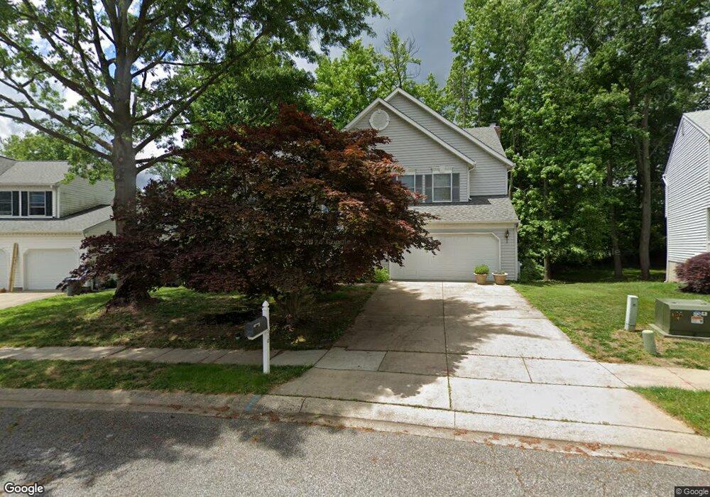
310 Lockhart Ct Havre de Grace, MD 21078
Estimated Value: $462,000 - $555,000
--
Bed
3
Baths
2,824
Sq Ft
$176/Sq Ft
Est. Value
About This Home
This home is located at 310 Lockhart Ct, Havre de Grace, MD 21078 and is currently estimated at $496,797, approximately $175 per square foot. 310 Lockhart Ct is a home located in Harford County with nearby schools including Meadowvale Elementary School, Havre de Grace Middle School, and Havre de Grace High School.
Ownership History
Date
Name
Owned For
Owner Type
Purchase Details
Closed on
Jun 16, 1992
Sold by
Stapf Charles Q & Sons Inc
Bought by
Haller Kevin James and Haller Linda Johnson
Current Estimated Value
Home Financials for this Owner
Home Financials are based on the most recent Mortgage that was taken out on this home.
Original Mortgage
$120,000
Interest Rate
8.54%
Purchase Details
Closed on
Apr 7, 1992
Sold by
Bay View Partnership
Bought by
Stapf Charles Q & Sons Inc
Create a Home Valuation Report for This Property
The Home Valuation Report is an in-depth analysis detailing your home's value as well as a comparison with similar homes in the area
Home Values in the Area
Average Home Value in this Area
Purchase History
| Date | Buyer | Sale Price | Title Company |
|---|---|---|---|
| Haller Kevin James | $169,800 | -- | |
| Stapf Charles Q & Sons Inc | $31,000 | -- |
Source: Public Records
Mortgage History
| Date | Status | Borrower | Loan Amount |
|---|---|---|---|
| Closed | Haller Kevin James | $120,000 |
Source: Public Records
Tax History Compared to Growth
Tax History
| Year | Tax Paid | Tax Assessment Tax Assessment Total Assessment is a certain percentage of the fair market value that is determined by local assessors to be the total taxable value of land and additions on the property. | Land | Improvement |
|---|---|---|---|---|
| 2025 | $3,268 | $362,433 | $0 | $0 |
| 2024 | $3,268 | $342,800 | $83,300 | $259,500 |
| 2023 | $3,070 | $332,400 | $0 | $0 |
| 2022 | $3,509 | $322,000 | $0 | $0 |
| 2021 | $3,035 | $311,600 | $83,300 | $228,300 |
| 2020 | $3,035 | $301,800 | $0 | $0 |
| 2019 | $2,937 | $292,000 | $0 | $0 |
| 2018 | $2,813 | $282,200 | $93,300 | $188,900 |
| 2017 | $2,813 | $282,200 | $0 | $0 |
| 2016 | -- | $282,200 | $0 | $0 |
| 2015 | $2,971 | $285,300 | $0 | $0 |
| 2014 | $2,971 | $285,300 | $0 | $0 |
Source: Public Records
Map
Nearby Homes
- Somerset II - Bulle Rock Plan at Bulle Rock - Single Family
- Chartwell Plan at Bulle Rock - Single Family
- Franklin Plan at Bulle Rock - Single Family
- Hampton II Plan at Bulle Rock - Single Family
- Patton Plan at Bulle Rock - Single Family
- Augusta Plan at Bulle Rock - Single Family
- Alexander II Plan at Bulle Rock - Single Family
- Andrews Plan at Bulle Rock - Single Family
- Somerset Plan at Bulle Rock - Single Family
- 539 Whimsical Dr
- TBB-AUGUSTA Whimsical Dr
- TBB-TOLCHESTER II Whimsical Dr
- TBB-PATTON Whimsical Dr
- TBB-SOMERSET II Whimsical Dr
- 321 Friar Rock Cir
- 101 Susquehanna Ct
- 302 Friar Rock Cir
- 300 Friar Rock Cir
- 330 Friar Rock Cir
- 102 Tidewater Dr
- 312 Lockhart Ct
- 308 Lockhart Ct
- 314 Lockhart Ct
- 303 Lockhart Ct
- 305 Lockhart Ct
- 306 Lockhart Ct
- 316 Lockhart Ct
- 307 Lockhart Ct
- 304 Lockhart Ct
- 301 Lockhart Ct
- 1128 Oak Tree Dr
- 309 Lockhart Ct
- 216 Tidewater Dr
- 318 Lockhart Ct
- 302 Lockhart Ct
- 311 Lockhart Ct
- 330 Hill Ct
- 220 Tidewater Dr
- 336 Goforth Dr
- 320 Lockhart Ct