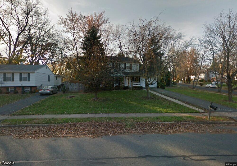
310 N Shamrock Rd Bel Air, MD 21014
Estimated Value: $404,255 - $511,000
--
Bed
3
Baths
1,722
Sq Ft
$262/Sq Ft
Est. Value
About This Home
This home is located at 310 N Shamrock Rd, Bel Air, MD 21014 and is currently estimated at $451,814, approximately $262 per square foot. 310 N Shamrock Rd is a home located in Harford County with nearby schools including Bel Air Elementary School, Bel Air Middle School, and Bel Air High School.
Ownership History
Date
Name
Owned For
Owner Type
Purchase Details
Closed on
Jun 25, 1996
Sold by
Sedney Blaise Carroll
Bought by
Boeri Blane M and Boeri Maria
Current Estimated Value
Purchase Details
Closed on
Sep 10, 1991
Sold by
Mchugh James David
Bought by
Sedney Blaise Carroll
Home Financials for this Owner
Home Financials are based on the most recent Mortgage that was taken out on this home.
Original Mortgage
$127,200
Interest Rate
9.14%
Create a Home Valuation Report for This Property
The Home Valuation Report is an in-depth analysis detailing your home's value as well as a comparison with similar homes in the area
Home Values in the Area
Average Home Value in this Area
Purchase History
| Date | Buyer | Sale Price | Title Company |
|---|---|---|---|
| Boeri Blane M | $144,500 | -- | |
| Sedney Blaise Carroll | $133,900 | -- |
Source: Public Records
Mortgage History
| Date | Status | Borrower | Loan Amount |
|---|---|---|---|
| Previous Owner | Sedney Blaise Carroll | $127,200 | |
| Closed | Boeri Blane M | -- |
Source: Public Records
Tax History Compared to Growth
Tax History
| Year | Tax Paid | Tax Assessment Tax Assessment Total Assessment is a certain percentage of the fair market value that is determined by local assessors to be the total taxable value of land and additions on the property. | Land | Improvement |
|---|---|---|---|---|
| 2025 | $2,559 | $282,200 | $83,900 | $198,300 |
| 2024 | $2,428 | $268,467 | $0 | $0 |
| 2023 | $2,428 | $254,733 | $0 | $0 |
| 2022 | $2,627 | $241,000 | $83,900 | $157,100 |
| 2021 | $2,424 | $241,000 | $83,900 | $157,100 |
| 2020 | $2,424 | $241,000 | $83,900 | $157,100 |
| 2019 | $2,600 | $258,500 | $108,300 | $150,200 |
| 2018 | $2,561 | $256,967 | $0 | $0 |
| 2017 | $2,546 | $258,500 | $0 | $0 |
| 2016 | -- | $253,900 | $0 | $0 |
| 2015 | $2,468 | $251,600 | $0 | $0 |
| 2014 | $2,468 | $249,300 | $0 | $0 |
Source: Public Records
Map
Nearby Homes
- 315 Harlan St
- 216 Wellington Ct
- 734 Reedy Cir
- 106 N Main St
- 207 Kings Crossing Cir Unit 1C
- 421 Giles St
- 240 Crocker Dr Unit 240-F
- 200 Crocker Dr Unit 200-A
- 117 Donzen Dr Unit D
- 224 Crocker Dr Unit 224-F
- 479 Moores Mill Rd
- 483 Moores Mill Rd
- 129 Wallace St
- 1700 Conowingo Rd
- 400 Idlewild Rd
- 913 Todd Rd
- 927 Redfield Rd
- 933 Redfield Rd
- 918 Chesney Ln
- 929 Todd Rd
- 302 Hemingway Dr
- 308 N Shamrock Rd
- 304 Hemingway Dr
- 301 Hemingway Dr
- 303 Hemingway Dr
- 311 N Shamrock Rd
- 309 N Shamrock Rd
- 313 N Shamrock Rd
- 305 Hemingway Dr
- 306 Hemingway Dr
- 401 N Shamrock Rd
- 302 N Shamrock Rd
- 402 N Shamrock Rd
- 307 Hemingway Dr
- 308 Hemingway Dr
- 454 E Broadway
- 452 E Broadway
- 309 Hemingway Dr
- 404 N Shamrock Rd
- 450 E Broadway