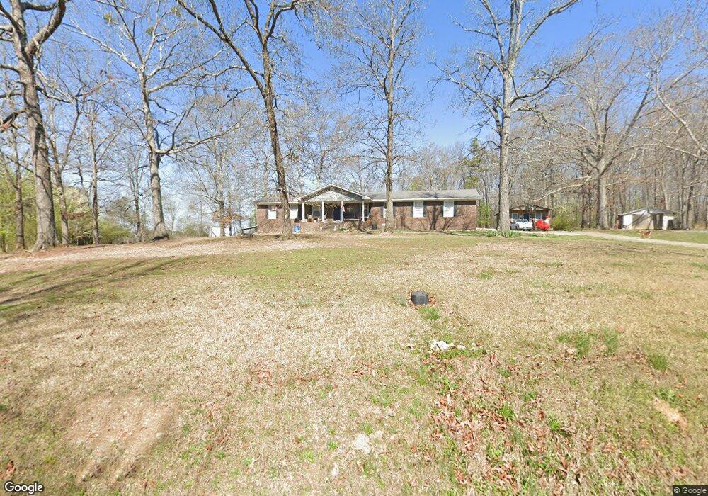
310 New Harmony Rd Cedartown, GA 30125
Estimated Value: $272,000 - $323,000
3
Beds
2
Baths
2,537
Sq Ft
$117/Sq Ft
Est. Value
About This Home
This home is located at 310 New Harmony Rd, Cedartown, GA 30125 and is currently estimated at $295,843, approximately $116 per square foot. 310 New Harmony Rd is a home located in Polk County with nearby schools including Cedar Christian School.
Ownership History
Date
Name
Owned For
Owner Type
Purchase Details
Closed on
Sep 29, 2017
Sold by
Watters Mark
Bought by
Fuller David J
Current Estimated Value
Home Financials for this Owner
Home Financials are based on the most recent Mortgage that was taken out on this home.
Original Mortgage
$117,472
Outstanding Balance
$98,122
Interest Rate
3.82%
Mortgage Type
New Conventional
Estimated Equity
$197,721
Purchase Details
Closed on
Jun 28, 2005
Sold by
Arrington Scott and Arrington Allyn L
Bought by
Watters Kevin and Watters Mark As
Purchase Details
Closed on
Mar 2, 2005
Sold by
Watters Ronnie M
Bought by
Watters Mark
Purchase Details
Closed on
May 4, 1993
Sold by
Arrington Scott E
Bought by
Watters Ronnie and Watters Judy
Purchase Details
Closed on
Mar 11, 1976
Bought by
Watters Ronnie and Watters Jud
Create a Home Valuation Report for This Property
The Home Valuation Report is an in-depth analysis detailing your home's value as well as a comparison with similar homes in the area
Home Values in the Area
Average Home Value in this Area
Purchase History
| Date | Buyer | Sale Price | Title Company |
|---|---|---|---|
| Fuller David J | $115,000 | -- | |
| Watters Kevin | -- | -- | |
| Watters Mark | -- | -- | |
| Watters Ronnie | $800 | -- | |
| Watters Ronnie | -- | -- |
Source: Public Records
Mortgage History
| Date | Status | Borrower | Loan Amount |
|---|---|---|---|
| Open | Fuller David J | $117,472 |
Source: Public Records
Tax History Compared to Growth
Tax History
| Year | Tax Paid | Tax Assessment Tax Assessment Total Assessment is a certain percentage of the fair market value that is determined by local assessors to be the total taxable value of land and additions on the property. | Land | Improvement |
|---|---|---|---|---|
| 2024 | $2,115 | $103,164 | $3,990 | $99,174 |
| 2023 | $1,531 | $66,504 | $3,990 | $62,514 |
| 2022 | $1,282 | $56,035 | $2,660 | $53,375 |
| 2021 | $1,299 | $56,035 | $2,660 | $53,375 |
| 2020 | $1,302 | $56,035 | $2,660 | $53,375 |
| 2019 | $1,330 | $51,527 | $2,660 | $48,867 |
| 2018 | $1,352 | $49,056 | $2,660 | $46,396 |
| 2017 | $837 | $32,758 | $2,660 | $30,098 |
| 2016 | $899 | $35,031 | $4,932 | $30,098 |
| 2015 | $907 | $35,229 | $4,932 | $30,296 |
| 2014 | $914 | $35,229 | $4,932 | $30,296 |
Source: Public Records
Map
Nearby Homes
- 119 New Harmony Rd
- 0 Mountain Home Rd Unit 1020-C 10351948
- 0 Mountain Home Rd Unit 1020-B 10351940
- 0 Mountain Home Rd Unit 1020-A 10351930
- 255 Reynolds Rd
- 151 Friendship Rd
- 35 Harris Loop
- 1849 Prior Station Rd Unit 76 ACRES
- 1849 Prior Station Rd
- 382 5th St
- 293 4th St
- 0 Cornelius Rd Unit 7646589
- 516 Branch St
- 512 Branch St
- 508 Branch St
- 309 Walnut St
- 39 Summerwind Dr
- 605 W Girard Ave
- 28 Summerwind Dr
- 340 New Harmony Rd
- 1107 Prior Station Rd
- 285 New Harmony Rd
- 304 New Harmony Rd
- 255 New Harmony Rd
- 367 New Harmony Rd
- 250 New Harmony Rd
- 279 New Harmony Rd
- 1049 Prior Station Rd
- 1033 Prior Station Rd
- 1086 Prior Station Rd
- 1102 Prior Station Rd
- 1015 Prior Station Rd
- 224 New Harmony Rd
- 1036 Prior Station Rd
- 987 Prior Station Rd
- 1018 Prior Station Rd
- 174 New Harmony Rd
- 191 New Harmony Rd
- 972 Prior Station Rd