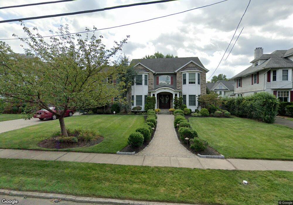
310 S Euclid Ave Westfield, NJ 07090
Estimated Value: $1,575,000 - $2,353,000
--
Bed
--
Bath
3,301
Sq Ft
$584/Sq Ft
Est. Value
About This Home
This home is located at 310 S Euclid Ave, Westfield, NJ 07090 and is currently estimated at $1,928,701, approximately $584 per square foot. 310 S Euclid Ave is a home located in Union County with nearby schools including Washington Elementary School, Roosevelt Intermediate School, and Westfield Senior High School.
Ownership History
Date
Name
Owned For
Owner Type
Purchase Details
Closed on
Jun 28, 2000
Sold by
Dehaas Vincent and Dehaas Patricia
Bought by
Behman Daisy and Sidhom Ibrahim
Current Estimated Value
Home Financials for this Owner
Home Financials are based on the most recent Mortgage that was taken out on this home.
Original Mortgage
$500,000
Outstanding Balance
$172,824
Interest Rate
7.75%
Mortgage Type
Stand Alone First
Estimated Equity
$1,755,877
Purchase Details
Closed on
Aug 18, 1999
Sold by
Messercola Bros Building Co Inc
Bought by
Dehaas Vincent and Dehaas Patricia
Home Financials for this Owner
Home Financials are based on the most recent Mortgage that was taken out on this home.
Original Mortgage
$400,000
Interest Rate
6%
Purchase Details
Closed on
Jun 3, 1998
Sold by
Womans Club Of Westfield Inc
Bought by
Messercola Bros Building Co Inc
Home Financials for this Owner
Home Financials are based on the most recent Mortgage that was taken out on this home.
Original Mortgage
$498,000
Interest Rate
7.09%
Create a Home Valuation Report for This Property
The Home Valuation Report is an in-depth analysis detailing your home's value as well as a comparison with similar homes in the area
Home Values in the Area
Average Home Value in this Area
Purchase History
| Date | Buyer | Sale Price | Title Company |
|---|---|---|---|
| Behman Daisy | $790,000 | Stewart Title Guaranty Compa | |
| Dehaas Vincent | $620,000 | -- | |
| Messercola Bros Building Co Inc | $306,500 | -- |
Source: Public Records
Mortgage History
| Date | Status | Borrower | Loan Amount |
|---|---|---|---|
| Open | Behman Daisy | $500,000 | |
| Previous Owner | Dehaas Vincent | $400,000 | |
| Previous Owner | Messercola Bros Building Co Inc | $498,000 |
Source: Public Records
Tax History Compared to Growth
Tax History
| Year | Tax Paid | Tax Assessment Tax Assessment Total Assessment is a certain percentage of the fair market value that is determined by local assessors to be the total taxable value of land and additions on the property. | Land | Improvement |
|---|---|---|---|---|
| 2025 | $28,247 | $1,254,300 | $808,500 | $445,800 |
| 2024 | $27,670 | $1,254,300 | $808,500 | $445,800 |
| 2023 | $27,670 | $1,254,300 | $808,500 | $445,800 |
| 2022 | $27,093 | $1,254,300 | $808,500 | $445,800 |
| 2021 | $27,131 | $1,254,300 | $808,500 | $445,800 |
| 2020 | $27,068 | $1,254,300 | $808,500 | $445,800 |
| 2019 | $30,302 | $1,409,400 | $808,500 | $600,900 |
| 2018 | $25,102 | $270,000 | $100,900 | $169,100 |
| 2017 | $24,964 | $270,000 | $100,900 | $169,100 |
| 2016 | $24,378 | $270,000 | $100,900 | $169,100 |
| 2015 | $23,892 | $270,000 | $100,900 | $169,100 |
| 2014 | $26,527 | $310,000 | $100,900 | $209,100 |
Source: Public Records
Map
Nearby Homes
- 629 Tremont Ave
- 203 Ross Place
- 215 Ross Place Unit J
- 149 Harrison Ave
- 603 Carleton Rd
- 522 Boulevard
- 112 Windsor Ave
- 529 Benson Place
- 764 Fairacres Ave
- 112 Linden Ave
- 519 3rd Ave
- 613 Maple Ct Unit 613
- 538 Westfield Ave
- 260 Prospect St Unit C15
- 500 Maple Ct Unit 500
- 415 Highland Ave
- 131 Wells St
- 645 Kimball Ave
- 304 E Dudley Ave
- 303 Prospect St
- 304 S Euclid Ave
- 318 S Euclid Ave
- 438 Saint Marks Ave
- 435 Tremont Ave
- 428 Saint Marks Ave
- 425 Tremont Ave
- 309 S Euclid Ave
- 305 S Euclid Ave
- 424 Saint Marks Ave
- 220 S Euclid Ave
- 402 S Euclid Ave
- 419 Tremont Ave
- 439 Saint Marks Ave
- 420 Saint Marks Ave
- 434 Tremont Ave
- 435 Saint Marks Ave
- 514 Saint Marks Ave
- 219 S Euclid Ave
- 416 Saint Marks Ave
- 210 S Euclid Ave