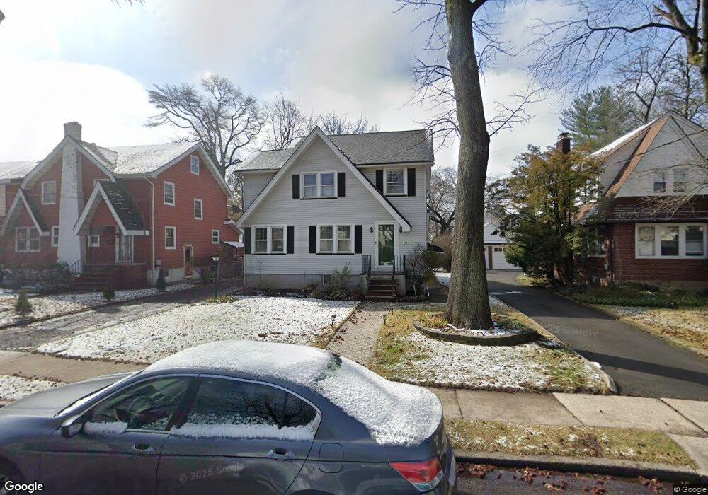
310 Sherman Ave Teaneck, NJ 07666
Estimated Value: $585,000 - $623,000
Studio
--
Bath
1,560
Sq Ft
$390/Sq Ft
Est. Value
About This Home
This home is located at 310 Sherman Ave, Teaneck, NJ 07666 and is currently estimated at $609,105, approximately $390 per square foot. 310 Sherman Ave is a home located in Bergen County with nearby schools including Teaneck Senior High School, Teaneck Community Charter School, and Bogota Middle School.
Ownership History
Date
Name
Owned For
Owner Type
Purchase Details
Closed on
Aug 20, 1998
Sold by
Horner Karen G R
Bought by
Brooks Sydney A and Brooks Sundra C
Current Estimated Value
Home Financials for this Owner
Home Financials are based on the most recent Mortgage that was taken out on this home.
Original Mortgage
$157,000
Outstanding Balance
$32,696
Interest Rate
6.9%
Estimated Equity
$576,409
Purchase Details
Closed on
Oct 28, 1996
Sold by
Howe C Alene
Bought by
Horner Karen G R
Home Financials for this Owner
Home Financials are based on the most recent Mortgage that was taken out on this home.
Original Mortgage
$161,000
Interest Rate
8.1%
Create a Home Valuation Report for This Property
The Home Valuation Report is an in-depth analysis detailing your home's value as well as a comparison with similar homes in the area
Home Values in the Area
Average Home Value in this Area
Purchase History
| Date | Buyer | Sale Price | Title Company |
|---|---|---|---|
| Brooks Sydney A | $187,000 | -- | |
| Horner Karen G R | $169,000 | -- |
Source: Public Records
Mortgage History
| Date | Status | Borrower | Loan Amount |
|---|---|---|---|
| Open | Brooks Sydney A | $157,000 | |
| Previous Owner | Horner Karen G R | $161,000 |
Source: Public Records
Tax History
| Year | Tax Paid | Tax Assessment Tax Assessment Total Assessment is a certain percentage of the fair market value that is determined by local assessors to be the total taxable value of land and additions on the property. | Land | Improvement |
|---|---|---|---|---|
| 2025 | $11,966 | $547,900 | $297,500 | $250,400 |
| 2024 | $10,543 | $547,900 | $297,500 | $250,400 |
| 2023 | $10,336 | $319,300 | $185,000 | $134,300 |
| 2022 | $10,336 | $319,300 | $185,000 | $134,300 |
| 2021 | $10,396 | $319,300 | $185,000 | $134,300 |
| 2020 | $10,326 | $319,300 | $185,000 | $134,300 |
| 2019 | $10,208 | $319,300 | $185,000 | $134,300 |
| 2018 | $9,881 | $311,400 | $185,000 | $126,400 |
| 2017 | $9,787 | $311,400 | $185,000 | $126,400 |
| 2016 | $9,641 | $311,400 | $185,000 | $126,400 |
| 2015 | $9,488 | $311,400 | $185,000 | $126,400 |
| 2014 | $9,487 | $369,000 | $241,000 | $128,000 |
Source: Public Records
Map
Nearby Homes
- 315 Pine St
- 2 Parkside Ln
- 681 Palisade Ave
- 296 Pine St
- 63 Parkside Ln
- 14 Parkside Ln
- 116 E Grove St
- 80 E Grove St
- 166 Herrick Ave
- 746 Queen Anne Rd
- 1 Grange Ct
- 136 Gray St
- 257 Elm Ave
- 134 Highview Place
- 93 Copley Ave
- 264 Merrison St
- 40 Dohrman Ave
- 735 Elm Ave Unit 5F
- 300 Crestview Place
- 566 Teaneck Rd
- 314 Sherman Ave
- 308 Sherman Ave
- 320 Sherman Ave
- 300 Sherman Ave
- 309 Griggs Ave
- 305 Griggs Ave
- 317 Griggs Ave
- 321 Griggs Ave
- 324 Sherman Ave
- 594 Palmer Ave
- 311 Sherman Ave
- 315 Sherman Ave
- 307 Sherman Ave
- 317 Sherman Ave
- 329 Griggs Ave
- 299 Sherman Ave
- 330 Sherman Ave
- 321 Sherman Ave
- 286 Sherman Ave
- 332 Sherman Ave
Your Personal Tour Guide
Ask me questions while you tour the home.