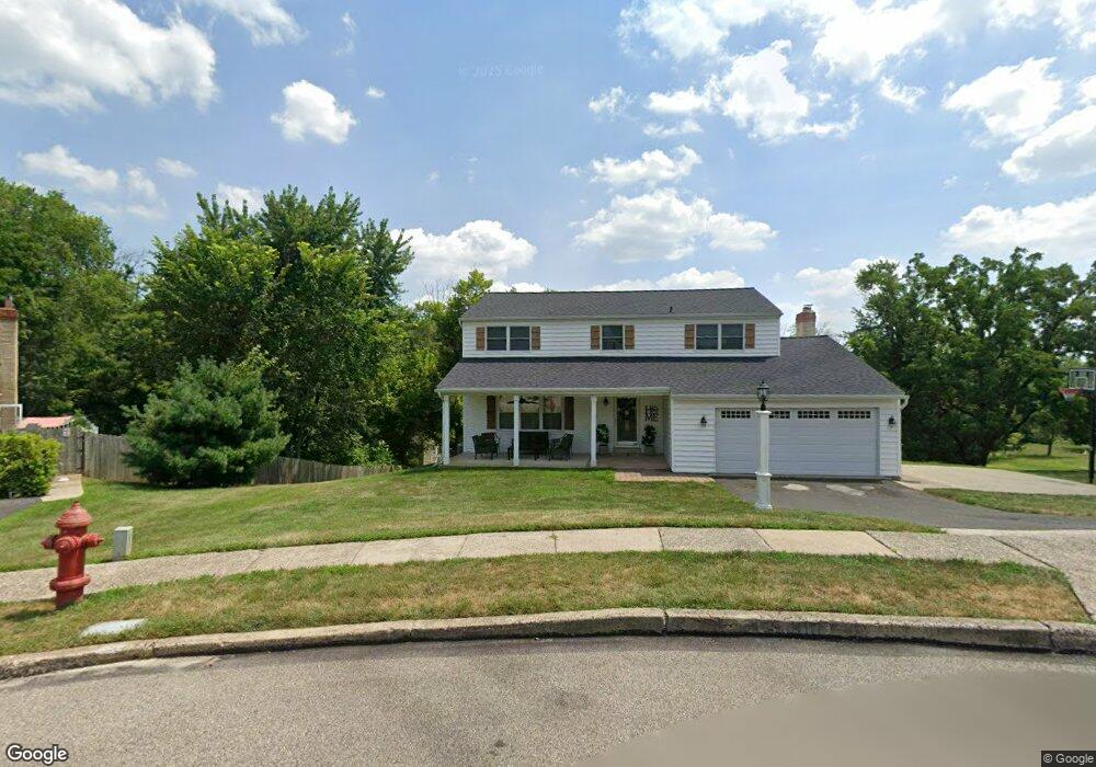
310 Spring Cir Norristown, PA 19403
West Norriton Township NeighborhoodEstimated Value: $521,000 - $575,515
4
Beds
3
Baths
2,512
Sq Ft
$219/Sq Ft
Est. Value
About This Home
This home is located at 310 Spring Cir, Norristown, PA 19403 and is currently estimated at $550,379, approximately $219 per square foot. 310 Spring Cir is a home located in Montgomery County with nearby schools including Whitehall Elementary School, Charles Blockson Middle School, and East Norriton Middle School.
Ownership History
Date
Name
Owned For
Owner Type
Purchase Details
Closed on
Feb 17, 2006
Sold by
Levanios Joan
Bought by
Brandt Stephen T and Brandt Nicole
Current Estimated Value
Home Financials for this Owner
Home Financials are based on the most recent Mortgage that was taken out on this home.
Original Mortgage
$64,980
Outstanding Balance
$36,494
Interest Rate
6.16%
Estimated Equity
$513,885
Create a Home Valuation Report for This Property
The Home Valuation Report is an in-depth analysis detailing your home's value as well as a comparison with similar homes in the area
Home Values in the Area
Average Home Value in this Area
Purchase History
| Date | Buyer | Sale Price | Title Company |
|---|---|---|---|
| Brandt Stephen T | $324,900 | None Available |
Source: Public Records
Mortgage History
| Date | Status | Borrower | Loan Amount |
|---|---|---|---|
| Open | Brandt Stephen T | $64,980 |
Source: Public Records
Tax History Compared to Growth
Tax History
| Year | Tax Paid | Tax Assessment Tax Assessment Total Assessment is a certain percentage of the fair market value that is determined by local assessors to be the total taxable value of land and additions on the property. | Land | Improvement |
|---|---|---|---|---|
| 2025 | $8,845 | $181,040 | -- | -- |
| 2024 | $8,845 | $181,040 | -- | -- |
| 2023 | $8,745 | $181,040 | $0 | $0 |
| 2022 | $8,688 | $181,040 | $0 | $0 |
| 2021 | $8,636 | $181,040 | $0 | $0 |
| 2020 | $8,378 | $181,040 | $0 | $0 |
| 2019 | $8,191 | $181,040 | $0 | $0 |
| 2018 | $6,437 | $181,040 | $0 | $0 |
| 2017 | $7,733 | $181,040 | $0 | $0 |
| 2016 | $7,662 | $181,040 | $0 | $0 |
| 2015 | $6,805 | $173,540 | $0 | $0 |
| 2014 | $6,805 | $173,540 | $0 | $0 |
Source: Public Records
Map
Nearby Homes
- 1613 Countryside Ln
- 2464 Hillendale Dr
- 2504 Rockwood Dr
- 2515 Fieldcrest Ave
- 2158 Alexander Dr
- 930 Heritage Dr
- 2020 Sterigere St
- 801 N Park Ave
- 2939 W Germantown Pike
- 2020 Davis Dr
- 0 Windy Hill Rd Unit METHACTON SD
- 2817 Delta Ln
- 24 Wayne Ave
- 520 Deerfield Dr
- 109 N Park Ave
- 4021 Killington Ct
- 00 Arden Dr Unit METHACTON SCHOOL
- 1104 Arden Dr Unit METHACTON SCHOOL
- 32 Miami Rd
- 1905 Davis Dr
- 314 Spring Cir
- 249 Horseshoe Rd
- 253 Horseshoe Rd
- 313 Spring Cir
- 305 Spring Cir
- 309 Spring Cir
- 245 Horseshoe Rd
- 257 Horseshoe Rd
- 2472 Dragon Cir
- 1601 Countryside Ln
- 2474 Dragon Cir
- 1603 Countryside Ln
- 1605 Countryside Ln
- 2476 Dragon Cir
- 2477 Dragon Cir
- 1607 Countryside Ln
- 1609 Countryside Ln
- 2478 Dragon Cir
- 1611 Countryside Ln
- 254 Horseshoe Rd