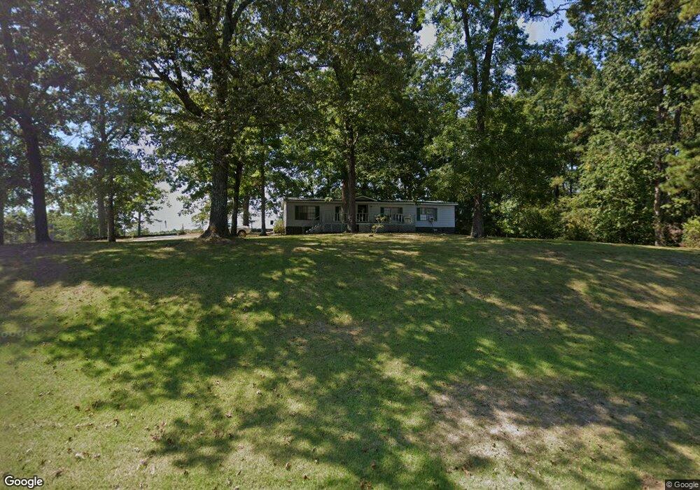
310 Thomas Powers Rd Newnan, GA 30263
Estimated Value: $121,000 - $258,000
3
Beds
2
Baths
1,593
Sq Ft
$128/Sq Ft
Est. Value
About This Home
This home is located at 310 Thomas Powers Rd, Newnan, GA 30263 and is currently estimated at $203,720, approximately $127 per square foot. 310 Thomas Powers Rd is a home located in Coweta County with nearby schools including Western Elementary School, Smokey Road Middle School, and Newnan High School.
Ownership History
Date
Name
Owned For
Owner Type
Purchase Details
Closed on
May 27, 2011
Sold by
Federal Natl Mtg Assn Fnma
Bought by
Willingham George H
Current Estimated Value
Purchase Details
Closed on
Mar 1, 2011
Sold by
Bac Home Loans Servicing
Bought by
Federal National Mortgage Assn
Purchase Details
Closed on
Sep 25, 2007
Sold by
Mcclain Essie V
Bought by
Drummond Jay R
Home Financials for this Owner
Home Financials are based on the most recent Mortgage that was taken out on this home.
Original Mortgage
$72,000
Interest Rate
6.57%
Mortgage Type
New Conventional
Purchase Details
Closed on
Jul 11, 1995
Bought by
Mcclain Essie V
Purchase Details
Closed on
Dec 18, 1991
Bought by
Mcclain Raymond E
Purchase Details
Closed on
Mar 31, 1983
Bought by
Mcclain Raymond E
Create a Home Valuation Report for This Property
The Home Valuation Report is an in-depth analysis detailing your home's value as well as a comparison with similar homes in the area
Home Values in the Area
Average Home Value in this Area
Purchase History
| Date | Buyer | Sale Price | Title Company |
|---|---|---|---|
| Willingham George H | $35,000 | -- | |
| Federal National Mortgage Assn | $59,900 | -- | |
| Drummond Jay R | $80,000 | -- | |
| Mcclain Essie V | -- | -- | |
| Mcclain Raymond E | -- | -- | |
| Mcclain Raymond E | -- | -- |
Source: Public Records
Mortgage History
| Date | Status | Borrower | Loan Amount |
|---|---|---|---|
| Previous Owner | Drummond Jay R | $72,000 |
Source: Public Records
Tax History Compared to Growth
Tax History
| Year | Tax Paid | Tax Assessment Tax Assessment Total Assessment is a certain percentage of the fair market value that is determined by local assessors to be the total taxable value of land and additions on the property. | Land | Improvement |
|---|---|---|---|---|
| 2025 | $258 | $39,649 | $10,850 | $28,799 |
| 2024 | $241 | $40,650 | $10,850 | $29,800 |
| 2023 | $241 | $32,300 | $6,593 | $25,706 |
| 2022 | $185 | $31,077 | $6,279 | $24,798 |
| 2021 | $175 | $28,720 | $6,279 | $22,441 |
| 2020 | $174 | $28,720 | $6,279 | $22,441 |
| 2019 | $179 | $26,466 | $11,648 | $14,818 |
| 2018 | $181 | $26,466 | $11,648 | $14,818 |
| 2017 | $181 | $26,466 | $11,648 | $14,818 |
| 2016 | $175 | $26,466 | $11,648 | $14,818 |
| 2015 | $166 | $26,466 | $11,648 | $14,818 |
| 2014 | $161 | $26,466 | $11,648 | $14,818 |
Source: Public Records
Map
Nearby Homes
- 192 Hawk Rd
- 0 Thomas Powers Rd Unit 10569332
- 0 Thomas Powers Rd Unit 5.54+/- ACRES
- 0 Thomas Powers Rd Unit 24228819
- 220 Dogwood Rd
- 19860 Georgia 34
- 19860 Ga Hwy 34
- 1227 J D Walton Rd
- 189 & 191 W Plantation Dr
- 642 Elm Rd
- 712 Boy Scout Rd
- 323 Newman Rd
- 0 Newman Rd Unit 10559645
- 4398 Georgia 34
- 927 Boy Scout Rd
- 260 Ancient Oak Ln
- 4230 Joe Stephens Rd
- 38 Daniel Cir
- 57 Scout Way
- 84 Pierce Chapel Rd
- 320 Thomas Powers Rd
- 269 Thomas Powers Rd
- 388 Thomas Powers Rd
- 295 Thomas Powers Rd
- 315 Thomas Powers Rd
- 198 Thomas Powers Rd
- 54 Hawk Rd
- 70 Hawk Rd
- 441 Thomas Powers Rd
- 133 Thomas Powers Rd
- 496 Thomas Powers Rd
- 491 Thomas Powers Rd
- 121 Thomas Powers Rd
- LL 125 Thomas Powers Rd
- LOT 125 Thomas Powers Rd
- 266 Thomas Powers Rd
- 101 Thomas Powers Rd
- 4597 Highway 34 W
- 181 Hawk Rd
- 47 Hawk Rd