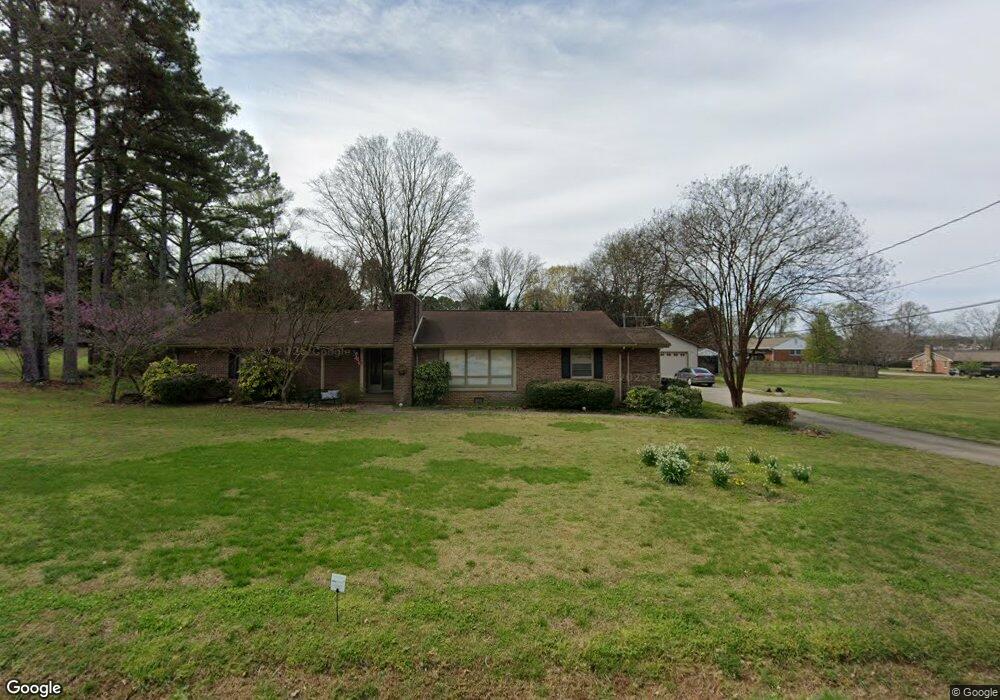
310 Vincent Rd SE Huntsville, AL 35802
Weatherly Heights NeighborhoodEstimated Value: $447,000 - $514,503
--
Bed
1
Bath
3,326
Sq Ft
$147/Sq Ft
Est. Value
About This Home
This home is located at 310 Vincent Rd SE, Huntsville, AL 35802 and is currently estimated at $489,376, approximately $147 per square foot. 310 Vincent Rd SE is a home located in Madison County with nearby schools including Whitesburg P-8 School, Whitesburg Elementary School, and Virgil Grissom High School.
Ownership History
Date
Name
Owned For
Owner Type
Purchase Details
Closed on
Mar 12, 2009
Sold by
Haragan Michael D and Haragan Nancy C
Bought by
Zibas James G and Zibas Lisa C
Current Estimated Value
Home Financials for this Owner
Home Financials are based on the most recent Mortgage that was taken out on this home.
Original Mortgage
$240,000
Outstanding Balance
$152,688
Interest Rate
5.14%
Mortgage Type
New Conventional
Estimated Equity
$336,688
Create a Home Valuation Report for This Property
The Home Valuation Report is an in-depth analysis detailing your home's value as well as a comparison with similar homes in the area
Home Values in the Area
Average Home Value in this Area
Purchase History
| Date | Buyer | Sale Price | Title Company |
|---|---|---|---|
| Zibas James G | -- | -- |
Source: Public Records
Mortgage History
| Date | Status | Borrower | Loan Amount |
|---|---|---|---|
| Open | Zibas James G | $240,000 |
Source: Public Records
Tax History Compared to Growth
Tax History
| Year | Tax Paid | Tax Assessment Tax Assessment Total Assessment is a certain percentage of the fair market value that is determined by local assessors to be the total taxable value of land and additions on the property. | Land | Improvement |
|---|---|---|---|---|
| 2024 | $2,150 | $37,900 | $2,920 | $34,980 |
| 2023 | $2,150 | $33,840 | $2,920 | $30,920 |
| 2022 | $1,770 | $31,340 | $2,920 | $28,420 |
| 2021 | $1,770 | $31,340 | $2,920 | $28,420 |
| 2020 | $1,689 | $29,920 | $2,910 | $27,010 |
| 2019 | $1,689 | $29,920 | $2,910 | $27,010 |
| 2018 | $1,680 | $29,800 | $0 | $0 |
| 2017 | $1,680 | $29,800 | $0 | $0 |
| 2016 | $1,680 | $29,800 | $0 | $0 |
| 2015 | $1,680 | $29,800 | $0 | $0 |
| 2014 | $1,549 | $27,540 | $0 | $0 |
Source: Public Records
Map
Nearby Homes
- 7119 Jones Valley Dr SE
- 709 Tannahill Dr SE
- 103 Four Mile Post Rd SE
- 1011 Cole Dr SE
- 705 Heath Dr SE
- 6824 Criner Rd SE
- 310 Drury Ln SW
- 6412 Chadwell Rd SW
- 604 Sanders Rd SW
- 7401 Hickory Hill Ln SE
- 806 Petitt Cir SE
- 322 Lady Jane Ct SW
- 344 Inverness Dr SW
- 248 Inverness Dr SW
- 235 Inverness Dr SW
- 325 Inverness Dr SW
- 2101 Sevenbark Branch SW
- Lot 1 Lendon Park Dr SE
- 7612 Holland Dr SW
- 2107 Byrd Spring Rd SW
- 302 Vincent Rd SE
- 316 Vincent Rd SE
- 211 Glencoe Rd SE
- 311 Vincent Rd SE
- 207 Glencoe Rd SE
- 301 Vincent Rd SE
- 215 Glencoe Rd SE
- 210 Vincent Rd SE
- 403 Vincent Rd SE
- 201 Glencoe Rd SE
- 400 Vincent Rd SE
- 209 Vincent Rd SE
- 410 Cole Dr SE
- 408 Vincent Rd SE
- 210 Glencoe Rd SE
- 301 Glencoe Rd SE
- 205 Oxford Dr SE
- 204 Glencoe Rd SE
- 204 Vincent Rd SE
- 502 Cole Dr SE