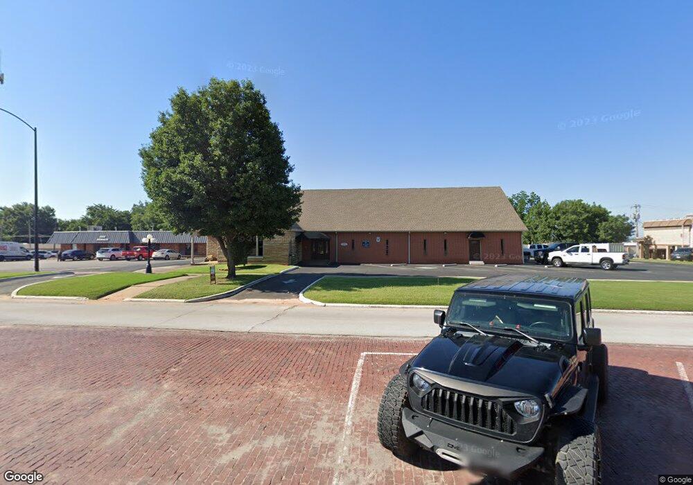
310 W Main St Purcell, OK 73080
Estimated Value: $514,113
--
Bed
--
Bath
6,598
Sq Ft
$78/Sq Ft
Est. Value
About This Home
This home is located at 310 W Main St, Purcell, OK 73080 and is currently priced at $514,113, approximately $77 per square foot. 310 W Main St is a home located in McClain County with nearby schools including Purcell Elementary School, Purcell Intermediate School, and Purcell Junior High School.
Ownership History
Date
Name
Owned For
Owner Type
Purchase Details
Closed on
Jun 7, 2024
Sold by
Washita Valley Business Center Llc
Bought by
First United Bk & Tr Company
Current Estimated Value
Purchase Details
Closed on
Jan 11, 2010
Sold by
Logan Jayne Martine and Logan Jayne Martine
Bought by
Washita Valley Business Center Llc
Purchase Details
Closed on
Dec 23, 2009
Sold by
Damet Charles Michael
Bought by
Damet Jayne M and Yoakum Funeral Home Trust
Create a Home Valuation Report for This Property
The Home Valuation Report is an in-depth analysis detailing your home's value as well as a comparison with similar homes in the area
Home Values in the Area
Average Home Value in this Area
Purchase History
| Date | Buyer | Sale Price | Title Company |
|---|---|---|---|
| First United Bk & Tr Company | $40,000 | American Eagle Title | |
| Washita Valley Business Center Llc | $65,000 | None Available | |
| Damet Jayne M | -- | Gao |
Source: Public Records
Tax History Compared to Growth
Tax History
| Year | Tax Paid | Tax Assessment Tax Assessment Total Assessment is a certain percentage of the fair market value that is determined by local assessors to be the total taxable value of land and additions on the property. | Land | Improvement |
|---|---|---|---|---|
| 2025 | $3,030 | $27,847 | $5,126 | $22,721 |
| 2024 | $2,881 | $26,521 | $5,126 | $21,395 |
| 2023 | $2,881 | $25,440 | $6,754 | $18,686 |
| 2022 | $2,601 | $24,227 | $6,238 | $17,989 |
| 2021 | $2,508 | $23,074 | $6,115 | $16,959 |
| 2020 | $2,366 | $21,975 | $6,105 | $15,870 |
| 2019 | $2,294 | $20,929 | $5,936 | $14,993 |
| 2018 | $2,166 | $19,933 | $5,758 | $14,175 |
| 2017 | $2,016 | $18,983 | $5,392 | $13,591 |
| 2016 | $1,943 | $18,080 | $5,135 | $12,945 |
| 2015 | $1,880 | $17,219 | $5,118 | $12,101 |
| 2014 | $1,772 | $16,398 | $4,966 | $11,432 |
Source: Public Records
Map
Nearby Homes
- 0 State Highway 74
- 124 W Brule St
- 24864 Norte Rd
- 515 S Lester Ln
- 504 W Adams St
- 406 S Canadian Ave
- 24906 Norte Rd
- 24956 Norte Rd
- 621 N 2nd Ave
- 1216 S Brook Dr
- 1225 Meadow Brook Dr
- 1233 S Brook Dr
- 1212 S Brook Dr
- 1229 Meadow Brook Dr
- 819 W Adams St
- 0000 Jackson St
- 832 W Adams St
- 517 Bob White Dr
- 1007 S Canadian Ave
- 302 W Harrison St