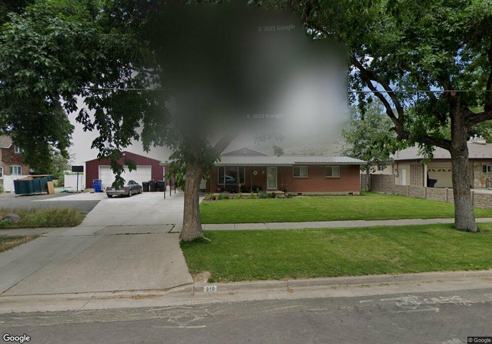
310 W State St Farmington, UT 84025
Estimated Value: $601,000 - $710,000
4
Beds
3
Baths
2,195
Sq Ft
$300/Sq Ft
Est. Value
About This Home
This home is located at 310 W State St, Farmington, UT 84025 and is currently estimated at $658,932, approximately $300 per square foot. 310 W State St is a home located in Davis County with nearby schools including Farmington Elementary School, Farmington High, and Farmington Junior High School.
Ownership History
Date
Name
Owned For
Owner Type
Purchase Details
Closed on
Apr 29, 2019
Sold by
Sj Property Group Llc
Bought by
Jessop Rodger and Jessop Cortney
Current Estimated Value
Home Financials for this Owner
Home Financials are based on the most recent Mortgage that was taken out on this home.
Original Mortgage
$202,500
Outstanding Balance
$178,396
Interest Rate
4.3%
Mortgage Type
New Conventional
Estimated Equity
$480,536
Purchase Details
Closed on
Jul 10, 2017
Sold by
Robinson Matthew L and Robinson Chyrese
Bought by
Robinson Cuyrese
Home Financials for this Owner
Home Financials are based on the most recent Mortgage that was taken out on this home.
Original Mortgage
$330,000
Interest Rate
3.94%
Mortgage Type
New Conventional
Create a Home Valuation Report for This Property
The Home Valuation Report is an in-depth analysis detailing your home's value as well as a comparison with similar homes in the area
Home Values in the Area
Average Home Value in this Area
Purchase History
| Date | Buyer | Sale Price | Title Company |
|---|---|---|---|
| Jessop Rodger | -- | Us Title Company | |
| Robinson Cuyrese | -- | Stewart Title |
Source: Public Records
Mortgage History
| Date | Status | Borrower | Loan Amount |
|---|---|---|---|
| Open | Jessop Rodger | $202,500 | |
| Previous Owner | Robinson Cuyrese | $330,000 |
Source: Public Records
Tax History Compared to Growth
Tax History
| Year | Tax Paid | Tax Assessment Tax Assessment Total Assessment is a certain percentage of the fair market value that is determined by local assessors to be the total taxable value of land and additions on the property. | Land | Improvement |
|---|---|---|---|---|
| 2024 | $2,932 | $293,151 | $225,550 | $67,601 |
| 2023 | $2,816 | $513,000 | $272,735 | $240,265 |
| 2022 | $2,871 | $297,000 | $149,943 | $147,057 |
| 2021 | $2,688 | $414,000 | $223,020 | $190,980 |
| 2020 | $2,004 | $301,000 | $189,887 | $111,113 |
Source: Public Records
Map
Nearby Homes
- 38 S 300 W
- 52 N 400 W
- 372 W Clark Cir
- 21 N 100 W Unit 3
- 2 Grayson Way N Unit 11
- 1504 W Kiera Court Ct N Unit 150
- 170 N Main St
- 442 W Randys Ct Unit 808
- 554 W Cottle Ln
- 250 S 200 W
- 69 W Grove Creek Cir
- 626 W Cottle Ln
- 434 W 450 S Unit 815
- 1460 W 550 N Unit 166
- 139 E 400 N
- 514 Rigby Rd
- 79 S 300 E
- 334 E Cottrell Ln
- 292 N Flag Rock Dr
- 13 Sunset Dr
- 302 W State St
- 340 W State St
- 290 W State St
- 337 W Pioneer Ln
- 307 W State St
- 368 W State St
- 335 W State St
- 54 N Rodeo Ct
- 40 N Rodeo Ct
- 349 W Pioneer Ln
- 291 W State St
- 268 W State St
- 361 W State St
- 359 W State St Unit 110
- 359 W State St
- 363 W Pioneer Ln
- 314 W Pioneer Ln
- 382 W State St
- 269 W State St
- 330 W Pioneer Ln