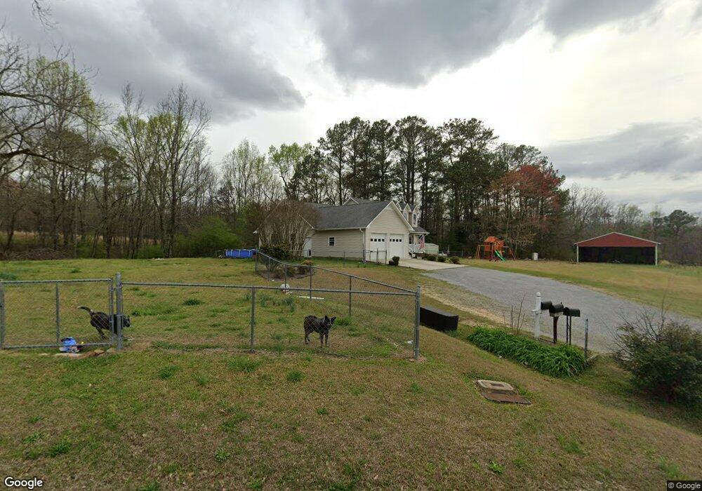
310 Walls Rd Remlap, AL 35133
Estimated Value: $286,000 - $406,000
--
Bed
1
Bath
3,318
Sq Ft
$110/Sq Ft
Est. Value
About This Home
This home is located at 310 Walls Rd, Remlap, AL 35133 and is currently estimated at $365,555, approximately $110 per square foot. 310 Walls Rd is a home with nearby schools including Locust Fork Elementary School and Locust Fork High School.
Ownership History
Date
Name
Owned For
Owner Type
Purchase Details
Closed on
Dec 30, 2014
Sold by
Carl Carl and Richey Linda
Bought by
Watwood Johnny Ray and Watwood Leslie Ann
Current Estimated Value
Purchase Details
Closed on
Sep 19, 2006
Sold by
Washburn Kenny and Washburn Kenny
Bought by
Washburn Leslie A
Home Financials for this Owner
Home Financials are based on the most recent Mortgage that was taken out on this home.
Original Mortgage
$103,000
Outstanding Balance
$61,145
Interest Rate
6.46%
Mortgage Type
Purchase Money Mortgage
Estimated Equity
$304,410
Create a Home Valuation Report for This Property
The Home Valuation Report is an in-depth analysis detailing your home's value as well as a comparison with similar homes in the area
Home Values in the Area
Average Home Value in this Area
Purchase History
| Date | Buyer | Sale Price | Title Company |
|---|---|---|---|
| Watwood Johnny Ray | $207,000 | -- | |
| Washburn Leslie A | $103,000 | -- |
Source: Public Records
Mortgage History
| Date | Status | Borrower | Loan Amount |
|---|---|---|---|
| Open | Washburn Leslie A | $103,000 |
Source: Public Records
Tax History Compared to Growth
Tax History
| Year | Tax Paid | Tax Assessment Tax Assessment Total Assessment is a certain percentage of the fair market value that is determined by local assessors to be the total taxable value of land and additions on the property. | Land | Improvement |
|---|---|---|---|---|
| 2024 | $1,387 | $42,380 | $2,200 | $40,180 |
| 2023 | $1,404 | $39,680 | $2,200 | $37,480 |
| 2022 | $1,106 | $34,040 | $2,200 | $31,840 |
| 2021 | $915 | $28,160 | $1,680 | $26,480 |
| 2020 | $884 | $25,120 | $1,600 | $23,520 |
| 2019 | $816 | $25,120 | $1,600 | $23,520 |
| 2018 | $1,244 | $38,280 | $1,600 | $36,680 |
| 2017 | $1,214 | $37,340 | $0 | $0 |
| 2015 | $1,300 | $37,340 | $0 | $0 |
| 2014 | -- | $37,340 | $0 | $0 |
| 2013 | -- | $7,240 | $0 | $0 |
Source: Public Records
Map
Nearby Homes
- 55 Honeycutt Rd
- 496 Tawbush Rd
- 25942 Alabama 79
- 4540 Spunky Hollow Rd
- 89 Pine Tree Dr
- 25465 Alabama 79
- 25335 Alabama 79
- 25335 State Highway 79
- 87 Youngblood Ln
- 63 Avery Hancock Dr
- 159 Ray Dr
- 312 Lehigh Rd
- 0 Center Hill Rd
- 4216 Sand Valley Rd
- 60 Wortham Rd
- 29542 Alabama 79
- 61 Cedar Cir
- 148 Willow Ln
- 11 Mccay Rd
- 587 Mountain Dr
- 311 Walls Rd
- 280 Pine View Dr
- 377 Honeycutt Rd
- 355 Honeycutt Rd
- 377 Honeycutt Rd
- 198 Pine View Dr
- 131 Tawbush Ln
- 480 Honeycutt Rd
- 164 Pine View Dr
- 12 Walls Rd
- 730 Honeycutt Rd
- 700 Honeycutt Rd
- 550 Honeycutt Rd
- 670 Honeycutt Rd
- 118 Tawbush Ln
- 109 Pine View Dr
- 183 Honeycutt Rd
- 9 Tawbush Ln
- 350 Holt Dr
- 880 Honeycutt Rd