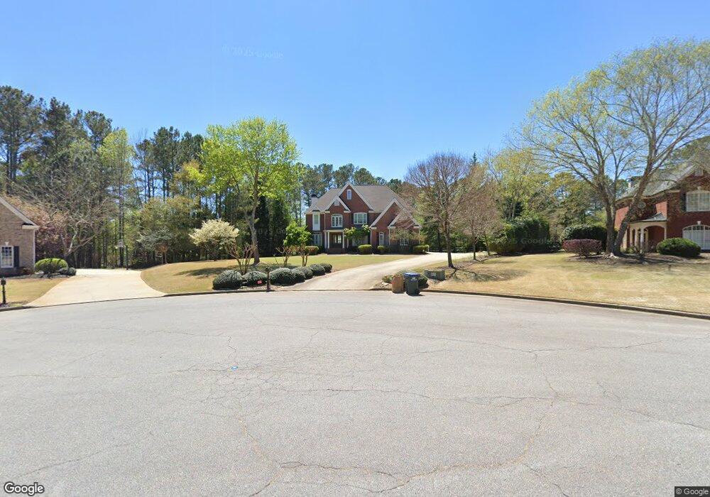
310 Wigton Dr Alpharetta, GA 30004
Estimated Value: $955,817 - $1,110,000
4
Beds
3
Baths
3,535
Sq Ft
$294/Sq Ft
Est. Value
About This Home
This home is located at 310 Wigton Dr, Alpharetta, GA 30004 and is currently estimated at $1,040,454, approximately $294 per square foot. 310 Wigton Dr is a home located in Fulton County with nearby schools including Summit Hill Elementary School, Hopewell Middle School, and Cambridge High School.
Ownership History
Date
Name
Owned For
Owner Type
Purchase Details
Closed on
May 25, 2001
Sold by
D R Horton Inc
Bought by
Cousins Garfield W and Cousins Joan M
Current Estimated Value
Home Financials for this Owner
Home Financials are based on the most recent Mortgage that was taken out on this home.
Original Mortgage
$316,000
Outstanding Balance
$118,693
Interest Rate
7.11%
Mortgage Type
New Conventional
Estimated Equity
$921,761
Create a Home Valuation Report for This Property
The Home Valuation Report is an in-depth analysis detailing your home's value as well as a comparison with similar homes in the area
Home Values in the Area
Average Home Value in this Area
Purchase History
| Date | Buyer | Sale Price | Title Company |
|---|---|---|---|
| Cousins Garfield W | $395,000 | -- |
Source: Public Records
Mortgage History
| Date | Status | Borrower | Loan Amount |
|---|---|---|---|
| Open | Cousins Garfield W | $316,000 |
Source: Public Records
Tax History Compared to Growth
Tax History
| Year | Tax Paid | Tax Assessment Tax Assessment Total Assessment is a certain percentage of the fair market value that is determined by local assessors to be the total taxable value of land and additions on the property. | Land | Improvement |
|---|---|---|---|---|
| 2025 | $956 | $373,920 | $115,520 | $258,400 |
| 2023 | $6,487 | $229,840 | $73,800 | $156,040 |
| 2022 | $5,090 | $229,840 | $73,800 | $156,040 |
| 2021 | $5,083 | $223,120 | $71,640 | $151,480 |
| 2020 | $5,138 | $220,480 | $70,800 | $149,680 |
| 2019 | $956 | $216,600 | $69,560 | $147,040 |
| 2018 | $5,445 | $211,520 | $67,920 | $143,600 |
| 2017 | $4,976 | $182,480 | $54,600 | $127,880 |
| 2016 | $4,975 | $182,480 | $54,600 | $127,880 |
| 2015 | $5,787 | $182,480 | $54,600 | $127,880 |
| 2014 | $5,203 | $182,480 | $54,600 | $127,880 |
Source: Public Records
Map
Nearby Homes
- 0 State Highway 9 Hwy Unit 10257856
- 0 NE Clan St Unit 7505718
- 13920 Cowart Tract 1 Rd
- 240 Thompson Trail
- 210 Thompson Trail
- 14801 Hopewell Rd
- 1010 Homestead Dr
- 15235 Fairfax Ln
- 615 Claxton Ln
- 720 Oaks Trail
- 720 Oaks Trail W
- 750 Oaks Trail W
- 750 Oaks Trail W Unit 6
- 14200 Hopewell Rd
- 1053 Homestead Dr
- 3700 Muirfield Dr
- 2270 Dinsmore Rd
- 1940 Dinsmore Rd
- 15260 Thompson Oak Rd
- 1080 Homestead Dr
- 320 Wigton Dr
- 300 Wigton Dr Unit 27
- 300 Wigton Dr
- 2120 Country Ridge Rd
- 2110 Country Ridge Rd
- 2100 Country Ridge Rd
- 330 Wigton Dr
- 2130 Country Ridge Rd
- 0 Country Ridge Rd Unit 7528141
- 0 Country Ridge Rd Unit 8986764
- 0 Country Ridge Rd Unit 8797967
- 305 Wigton Dr
- 1008 Crossroads Trail
- 2090 Country Ridge Rd
- 3490 Cottage Park Ct
- 1060 Crossroads Trail Unit 17
- 1060 Crossroads Trail
- 315 Wigton Dr
- 325 Wigton Dr
- 2140 Country Ridge Rd