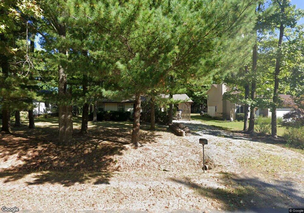
310 William Way Stevensville, MD 21666
Estimated Value: $341,455 - $414,000
--
Bed
2
Baths
1,008
Sq Ft
$371/Sq Ft
Est. Value
About This Home
This home is located at 310 William Way, Stevensville, MD 21666 and is currently estimated at $374,114, approximately $371 per square foot. 310 William Way is a home located in Queen Anne's County with nearby schools including Matapeake Elementary School, Matapeake Middle School, and Kent Island High School.
Ownership History
Date
Name
Owned For
Owner Type
Purchase Details
Closed on
Oct 21, 1999
Sold by
Marciniak Gregory John
Bought by
Randle Gene S
Current Estimated Value
Purchase Details
Closed on
May 23, 1996
Sold by
Santmyer Joan E
Bought by
Marciniak Gregory John
Purchase Details
Closed on
Jan 15, 1985
Sold by
Tyler George and Karen Paape
Bought by
Santmyer Joan E
Home Financials for this Owner
Home Financials are based on the most recent Mortgage that was taken out on this home.
Original Mortgage
$40,000
Interest Rate
13.12%
Create a Home Valuation Report for This Property
The Home Valuation Report is an in-depth analysis detailing your home's value as well as a comparison with similar homes in the area
Home Values in the Area
Average Home Value in this Area
Purchase History
| Date | Buyer | Sale Price | Title Company |
|---|---|---|---|
| Randle Gene S | $113,200 | -- | |
| Marciniak Gregory John | $101,000 | -- | |
| Santmyer Joan E | $50,000 | -- |
Source: Public Records
Mortgage History
| Date | Status | Borrower | Loan Amount |
|---|---|---|---|
| Previous Owner | Santmyer Joan E | $40,000 | |
| Closed | Marciniak Gregory John | -- |
Source: Public Records
Tax History Compared to Growth
Tax History
| Year | Tax Paid | Tax Assessment Tax Assessment Total Assessment is a certain percentage of the fair market value that is determined by local assessors to be the total taxable value of land and additions on the property. | Land | Improvement |
|---|---|---|---|---|
| 2025 | $2,769 | $294,000 | $0 | $0 |
| 2024 | $2,575 | $273,400 | $0 | $0 |
| 2023 | $2,381 | $252,800 | $161,000 | $91,800 |
| 2022 | $2,336 | $248,033 | $0 | $0 |
| 2021 | $2,287 | $243,267 | $0 | $0 |
| 2020 | $2,287 | $238,500 | $161,000 | $77,500 |
| 2019 | $2,221 | $231,600 | $0 | $0 |
| 2018 | $2,155 | $224,700 | $0 | $0 |
| 2017 | $2,089 | $217,800 | $0 | $0 |
| 2016 | -- | $213,133 | $0 | $0 |
| 2015 | $991 | $208,467 | $0 | $0 |
| 2014 | $991 | $203,800 | $0 | $0 |
Source: Public Records
Map
Nearby Homes
- 312 William Way
- 526 Victoria Dr
- 412 Bay City Rd
- 802 Broadcreek Dr
- 418 Bay City Rd
- 410 Stafford Rd
- 306 Irene Way
- 103 Irene Way
- 914 Chesapeake Dr
- 1000 Chesapeake Dr
- 298 Moorings Cir
- 312 Topside Dr Unit 223
- 349 Topside Dr
- 736 Moorings Cir Unit 35
- 858 Moorings Cir Unit 11
- 0 Sunset Wharf Lot D-3 Unit MDQA2010280
- 0 Sunset Wharf Lot D-1 Unit MDQA2010276
- 119 Keenan Way
- 111 Keenan Way
- 241 Jessica Lyn Ave
- 308 William Way
- 314 William Way
- 306 William Way
- 315 Chenowith Dr
- 313 Chenowith Dr
- 316 William Way
- 317 Chenowith Dr
- 311 Chenowith Dr
- 311 William Way
- 309 William Way
- 302 William Way
- 319 Chenowith Dr
- 307 William Way
- 309 Chenowith Dr
- 318 William Way
- 315 William Way
- 305 William Way
- 321 Chenowith Dr
- 307 Chenowith Dr
- 317 William Way