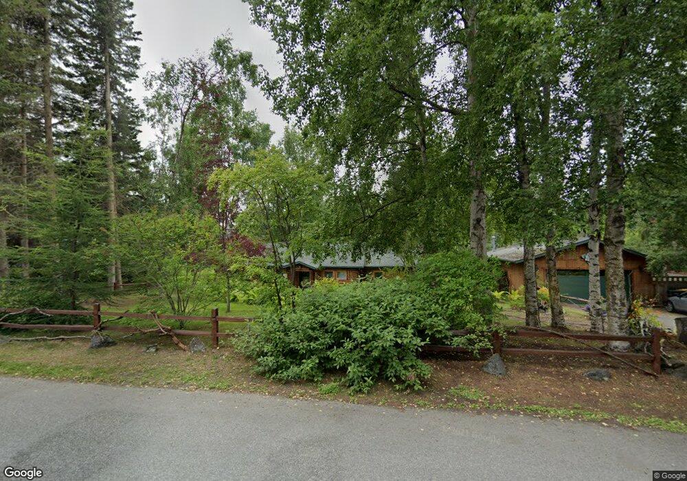
3100 Brookside Dr Anchorage, AK 99517
Spenard NeighborhoodEstimated Value: $224,000 - $452,000
2
Beds
2
Baths
1,840
Sq Ft
$196/Sq Ft
Est. Value
About This Home
This home is located at 3100 Brookside Dr, Anchorage, AK 99517 and is currently estimated at $361,341, approximately $196 per square foot. 3100 Brookside Dr is a home located in Anchorage Municipality with nearby schools including Turnagain Elementary School, Romig Middle School, and West High School.
Ownership History
Date
Name
Owned For
Owner Type
Purchase Details
Closed on
Oct 26, 2010
Sold by
Blessing Brooke R
Bought by
Blessing Brooke R
Current Estimated Value
Purchase Details
Closed on
Jun 17, 2003
Sold by
Marchant Family Trust
Bought by
Blessing Todd C and Blessing Brooke R
Home Financials for this Owner
Home Financials are based on the most recent Mortgage that was taken out on this home.
Original Mortgage
$209,950
Outstanding Balance
$86,363
Interest Rate
5.53%
Mortgage Type
Purchase Money Mortgage
Estimated Equity
$274,978
Purchase Details
Closed on
Jun 16, 2003
Sold by
Marchant Family Trust
Bought by
Blessing Todd C and Blessing Brooke R
Home Financials for this Owner
Home Financials are based on the most recent Mortgage that was taken out on this home.
Original Mortgage
$209,950
Outstanding Balance
$86,363
Interest Rate
5.53%
Mortgage Type
Purchase Money Mortgage
Estimated Equity
$274,978
Create a Home Valuation Report for This Property
The Home Valuation Report is an in-depth analysis detailing your home's value as well as a comparison with similar homes in the area
Home Values in the Area
Average Home Value in this Area
Purchase History
| Date | Buyer | Sale Price | Title Company |
|---|---|---|---|
| Blessing Brooke R | -- | Alyeska Title Guaranty Agenc | |
| Blessing Todd C | -- | -- | |
| Blessing Todd C | -- | Stewart Title Of Alaska |
Source: Public Records
Mortgage History
| Date | Status | Borrower | Loan Amount |
|---|---|---|---|
| Open | Blessing Todd C | $209,950 | |
| Closed | Blessing Todd C | $209,950 |
Source: Public Records
Tax History
| Year | Tax Paid | Tax Assessment Tax Assessment Total Assessment is a certain percentage of the fair market value that is determined by local assessors to be the total taxable value of land and additions on the property. | Land | Improvement |
|---|---|---|---|---|
| 2025 | $4,488 | $366,200 | $141,600 | $224,600 |
| 2024 | $4,488 | $353,000 | $141,600 | $211,400 |
| 2023 | $5,700 | $334,700 | $141,600 | $193,100 |
| 2022 | $4,804 | $335,300 | $141,600 | $193,700 |
| 2021 | $5,330 | $295,800 | $141,600 | $154,200 |
| 2020 | $4,259 | $300,800 | $141,600 | $159,200 |
| 2019 | $4,110 | $301,200 | $141,600 | $159,600 |
| 2018 | $4,197 | $305,900 | $141,600 | $164,300 |
| 2017 | $4,646 | $316,700 | $141,600 | $175,100 |
| 2016 | $4,143 | $309,800 | $143,800 | $166,000 |
| 2015 | $4,143 | $305,100 | $137,100 | $168,000 |
| 2014 | $4,143 | $287,000 | $137,100 | $149,900 |
Source: Public Records
Map
Nearby Homes
- Tr A W Northern Lights Blvd
- 2511 Abbey Ln
- 2906 W 29th Ave
- 2543 La Honda Dr Unit 7
- 2921 W 29th Ave Unit 5B
- 3517 Vintage Cir
- 2540 Lord Baranof Dr
- 3409 Oregon Dr
- 3406 Wyoming Dr
- 2064 Belair Dr
- 2335 Lord Baranof Dr
- 3605 Oregon Dr Unit 4
- 3507 Greenland Dr
- 4000 Iowa Dr
- 1508 W 31st Ave
- 2140 Atwood Dr
- 3240 Wiley Post Loop
- 000 Anchorage
- 2201 Belmont Dr
- NHN Northwood Dr
- 3100 Brookside Dr
- 3104 Brookside Dr
- 3008 Brookside Dr
- 3004 Brookside Dr
- 3007 Barbara St
- 3007 Barbara St
- 3105 Barbara St
- 3101 Brookside Dr
- 3005 Barbara St
- 3009 Brookside Dr
- 3000 Brookside Dr
- 2506 W 30th Ave
- 3006 Barbara St
- 3107 Brookside Dr
- 2540 W 30th Ave
- 2600 W 31st Ave
- 2205 Brookside Dr
- 3004 Barbara St
- L3 Brookside Dr
- L15 Brookside Dr
Your Personal Tour Guide
Ask me questions while you tour the home.