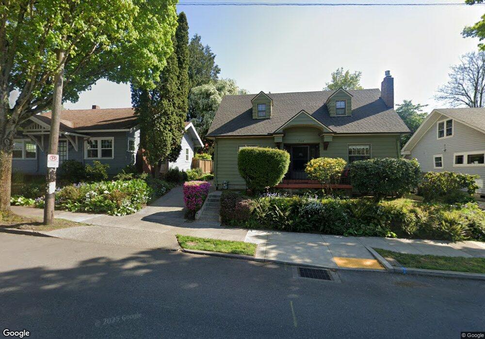
3100 E Burnside St Portland, OR 97214
Kerns NeighborhoodEstimated Value: $615,372 - $749,000
2
Beds
1
Bath
1,376
Sq Ft
$480/Sq Ft
Est. Value
About This Home
This home is located at 3100 E Burnside St, Portland, OR 97214 and is currently estimated at $660,843, approximately $480 per square foot. 3100 E Burnside St is a home located in Multnomah County with nearby schools including Sunnyside Environmental School, Franklin High School, and Le Monde French Immersion Public Charter School.
Ownership History
Date
Name
Owned For
Owner Type
Purchase Details
Closed on
Mar 8, 2005
Sold by
Kirstein Kathryn L
Bought by
Benedict Sharon
Current Estimated Value
Home Financials for this Owner
Home Financials are based on the most recent Mortgage that was taken out on this home.
Original Mortgage
$201,600
Outstanding Balance
$69,900
Interest Rate
1%
Mortgage Type
Purchase Money Mortgage
Estimated Equity
$590,943
Purchase Details
Closed on
Feb 28, 2001
Sold by
Smith Betty Ann
Bought by
Murray Joelle L
Home Financials for this Owner
Home Financials are based on the most recent Mortgage that was taken out on this home.
Original Mortgage
$92,000
Interest Rate
6.98%
Mortgage Type
Purchase Money Mortgage
Create a Home Valuation Report for This Property
The Home Valuation Report is an in-depth analysis detailing your home's value as well as a comparison with similar homes in the area
Home Values in the Area
Average Home Value in this Area
Purchase History
| Date | Buyer | Sale Price | Title Company |
|---|---|---|---|
| Benedict Sharon | $252,000 | Transnation Title Agency Or | |
| Murray Joelle L | $163,000 | Fidelity National Title Co |
Source: Public Records
Mortgage History
| Date | Status | Borrower | Loan Amount |
|---|---|---|---|
| Open | Benedict Sharon | $201,600 | |
| Previous Owner | Murray Joelle L | $92,000 |
Source: Public Records
Tax History Compared to Growth
Tax History
| Year | Tax Paid | Tax Assessment Tax Assessment Total Assessment is a certain percentage of the fair market value that is determined by local assessors to be the total taxable value of land and additions on the property. | Land | Improvement |
|---|---|---|---|---|
| 2025 | $6,060 | $224,890 | -- | -- |
| 2024 | $5,842 | $218,340 | -- | -- |
| 2023 | $5,617 | $211,990 | $0 | $0 |
| 2022 | $5,496 | $205,820 | $0 | $0 |
| 2021 | $5,403 | $199,830 | $0 | $0 |
| 2020 | $4,956 | $194,010 | $0 | $0 |
| 2019 | $4,774 | $188,360 | $0 | $0 |
| 2018 | $4,634 | $182,880 | $0 | $0 |
| 2017 | $4,441 | $177,560 | $0 | $0 |
| 2016 | $4,065 | $172,390 | $0 | $0 |
| 2015 | $3,958 | $167,370 | $0 | $0 |
| 2014 | $3,898 | $162,500 | $0 | $0 |
Source: Public Records
Map
Nearby Homes
- 117 SE 30th Place
- 3360 SE Ankeny St
- 2947 SE Stark St
- 423 SE 28th Ave Unit 429
- 2938 SE Washington St Unit 2944
- 2507 E Burnside St
- 716 SE 33rd Place
- 3709 NE Couch St
- 2342 SE Ankeny St
- 623 NE Randall Ave
- 2544 NE Hoyt St Unit 2548
- 2536 NE Hoyt St Unit 2540
- 711 NE Randall Ave Unit 203
- 2232 SE Ankeny St Unit 2
- 2234 SE Ankeny St Unit 3
- 3527 SE Belmont St Unit 3529
- 2250 NE Flanders St Unit 3
- 3236 SE Yamhill St
- 2430 SE Morrison St Unit 2432
- 0 SE Yamhill St Unit 611122058
- 3110 E Burnside St
- 3088 E Burnside St
- 3076 E Burnside St
- 3120 E Burnside St
- 3101 SE Ankeny St Unit 3109
- 3087 SE Ankeny St Unit 14
- 3087 SE Ankeny St Unit 6
- 3087 SE Ankeny St Unit 5
- 3087 SE Ankeny St
- 3087 SE Ankeny St Units 1-15 Unit s 1-15
- 3068 E Burnside St Unit 3070
- 3117 SE Ankeny St
- 3136 E Burnside St
- 214 NE 31st Ave
- 3067 SE Ankeny St
- 3129 SE Ankeny St
- 3129 SE Ankeny St Unit B
- 3115 E Burnside St
- 14 SE 30th Place
- 4 SE 30th Place