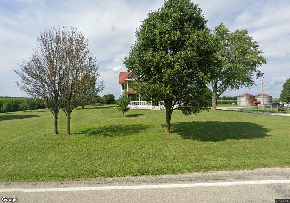
3100 Norton Rd Radnor, OH 43066
Estimated Value: $400,000 - $491,000
4
Beds
2
Baths
2,706
Sq Ft
$162/Sq Ft
Est. Value
About This Home
This home is located at 3100 Norton Rd, Radnor, OH 43066 and is currently estimated at $438,416, approximately $162 per square foot. 3100 Norton Rd is a home located in Delaware County with nearby schools including Buckeye Valley High School.
Ownership History
Date
Name
Owned For
Owner Type
Purchase Details
Closed on
Mar 30, 2006
Sold by
Thomson Kurt A and Thomson Laura L
Bought by
Lowe Matthew D and Lowe Christine M
Current Estimated Value
Home Financials for this Owner
Home Financials are based on the most recent Mortgage that was taken out on this home.
Original Mortgage
$29,250
Outstanding Balance
$22,972
Interest Rate
6.34%
Mortgage Type
Unknown
Estimated Equity
$415,444
Purchase Details
Closed on
Mar 6, 1997
Sold by
Barnes Timothy A
Bought by
Selfridge Gary and Selfridge Jan M
Create a Home Valuation Report for This Property
The Home Valuation Report is an in-depth analysis detailing your home's value as well as a comparison with similar homes in the area
Home Values in the Area
Average Home Value in this Area
Purchase History
| Date | Buyer | Sale Price | Title Company |
|---|---|---|---|
| Lowe Matthew D | $195,000 | Talon Group | |
| Selfridge Gary | $50,000 | -- |
Source: Public Records
Mortgage History
| Date | Status | Borrower | Loan Amount |
|---|---|---|---|
| Open | Lowe Matthew D | $29,250 | |
| Open | Lowe Matthew D | $156,000 | |
| Closed | Selfridge Gary | $0 |
Source: Public Records
Tax History Compared to Growth
Tax History
| Year | Tax Paid | Tax Assessment Tax Assessment Total Assessment is a certain percentage of the fair market value that is determined by local assessors to be the total taxable value of land and additions on the property. | Land | Improvement |
|---|---|---|---|---|
| 2024 | $4,346 | $117,960 | $10,330 | $107,630 |
| 2023 | $4,344 | $117,960 | $10,330 | $107,630 |
| 2022 | $4,025 | $96,600 | $10,360 | $86,240 |
| 2021 | $4,030 | $96,600 | $10,360 | $86,240 |
| 2020 | $4,048 | $96,600 | $10,360 | $86,240 |
| 2019 | $3,438 | $80,860 | $9,000 | $71,860 |
| 2018 | $3,488 | $80,860 | $9,000 | $71,860 |
| 2017 | $3,133 | $63,640 | $7,460 | $56,180 |
| 2016 | $2,464 | $63,640 | $7,460 | $56,180 |
| 2015 | $2,132 | $52,820 | $7,460 | $45,360 |
| 2014 | $2,003 | $52,820 | $7,460 | $45,360 |
| 2013 | $2,006 | $50,270 | $7,460 | $42,810 |
Source: Public Records
Map
Nearby Homes
- 0 Norton Rd Unit 225044832
- 0 Norton Rd Unit 225044831
- 0 Norton Rd
- 0 Norton Rd Unit 225044837
- 0 Norton Rd Unit 225044834
- 0 Norton Rd Unit 225044830
- 0 Norton Rd Unit 225044835
- 6412 Troy Rd
- 2217 Radnor Rd
- 206 S East St
- 303 Park Ave
- 0 Casey St
- 3935 N Section Line Rd
- 4518 State Route 257
- 3414 State Route 203
- 2390 Penry Rd
- 541 Willey Rd
- 4093 State Route 257
- 4808 Hughes Rd
- 3232 Gallant Rd
- 0 Norton Rd Unit 214028362
- 3203 Norton Rd
- 2909 Norton Rd
- 2807 Norton Rd
- 3473 Norton Rd
- 2610 Norton Rd
- 2021 Norton Rd
- 7626 Thomas Rd
- 1282 Prospect Norton Rd
- 3808 Norton Rd
- 1456 Prospect Norton Rd
- 7210 Thomas Rd
- 2341 Norton Rd
- 3883 Norton Rd
- 3995 Norton Rd
- 7366 Smeltzer Rd
- 8416 N Section Line Rd
- 3304 Peel Rd
- 1057 Prospect Norton Rd
- 7780 N Section Line Rd