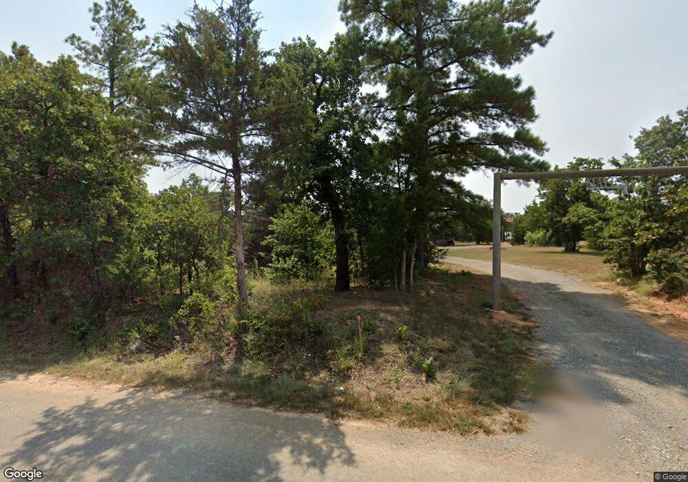
31007 Clearpond Rd Shawnee, OK 74801
Estimated Value: $208,000 - $261,000
3
Beds
2
Baths
1,174
Sq Ft
$193/Sq Ft
Est. Value
About This Home
This home is located at 31007 Clearpond Rd, Shawnee, OK 74801 and is currently estimated at $227,048, approximately $193 per square foot. 31007 Clearpond Rd is a home located in Pottawatomie County with nearby schools including Bethel Elementary School, Bethel Middle School, and Bethel High School.
Ownership History
Date
Name
Owned For
Owner Type
Purchase Details
Closed on
Feb 7, 2024
Sold by
Smih Dennis E
Bought by
Smith Dennis E and Smith Shirley A
Current Estimated Value
Purchase Details
Closed on
Dec 6, 2008
Sold by
Smith Camille M and Smith Dennis E
Bought by
Smith Dennis E
Home Financials for this Owner
Home Financials are based on the most recent Mortgage that was taken out on this home.
Original Mortgage
$79,133
Interest Rate
5.48%
Mortgage Type
FHA
Purchase Details
Closed on
Feb 25, 1999
Sold by
Molder Larry
Bought by
Smith Camille and Smith Chester
Create a Home Valuation Report for This Property
The Home Valuation Report is an in-depth analysis detailing your home's value as well as a comparison with similar homes in the area
Home Values in the Area
Average Home Value in this Area
Purchase History
| Date | Buyer | Sale Price | Title Company |
|---|---|---|---|
| Smith Dennis E | -- | None Listed On Document | |
| Smith Dennis E | -- | First American Title | |
| Smith Camille | $79,000 | -- |
Source: Public Records
Mortgage History
| Date | Status | Borrower | Loan Amount |
|---|---|---|---|
| Previous Owner | Smith Dennis E | $79,133 |
Source: Public Records
Tax History Compared to Growth
Tax History
| Year | Tax Paid | Tax Assessment Tax Assessment Total Assessment is a certain percentage of the fair market value that is determined by local assessors to be the total taxable value of land and additions on the property. | Land | Improvement |
|---|---|---|---|---|
| 2024 | $1,218 | $12,551 | $2,784 | $9,767 |
| 2023 | $1,199 | $12,186 | $2,520 | $9,666 |
| 2022 | $1,174 | $12,186 | $2,520 | $9,666 |
| 2021 | $1,197 | $12,186 | $2,520 | $9,666 |
| 2020 | $1,151 | $11,629 | $2,335 | $9,294 |
| 2019 | $1,115 | $11,290 | $2,235 | $9,055 |
| 2018 | $1,066 | $10,961 | $2,149 | $8,812 |
| 2017 | $930 | $10,641 | $2,048 | $8,593 |
| 2016 | $906 | $10,332 | $1,935 | $8,397 |
| 2015 | $879 | $10,031 | $2,085 | $7,946 |
| 2014 | $851 | $9,739 | $2,051 | $7,688 |
Source: Public Records
Map
Nearby Homes
- 31 Amber Ridge
- 210 Amber Ridge
- 31706 Hardesty Rd
- 17809 Deer Trail
- 17935 Fishmarket Rd
- 36 Limberlost
- 0 NE Corner of Walker & Waco Rd Unit 1177663
- 0 Tract 7 Waco Rd Unit 1177701
- 0 Tract 4 Waco Rd Unit 1177677
- 30303 Homer Lane Rd
- 15969 Pecan Rd
- 29192 Osage Hills Dr
- 15957 Pecan Rd
- 15951 Pecan Rd
- 29174 Osage Hills Dr
- 29168 Osage Hills Dr
- 29708 Waco Rd
- 33109 Hardesty Rd
- 189 Terry Ln
- 30002 Homer Lane Rd
- 17009 Walker Rd
- 0 N South 331
- 17105 Walker Rd
- 17006 Walker Rd
- 31063 Manuel Dr
- 31063 Manuel Dr
- 31204 Clearpond Rd
- 17201 Walker Rd
- 31108 Manuel Dr
- 30803 Clearpond Rd
- 31296 Clearpond Rd
- 4 Post Oak Rd
- 16802 Walker Rd
- 16619 Walker Rd
- 2 Post Oak Rd
- 31302 Clearpond Rd
- 17206 Walker Rd
- 17301 Walker Rd
- 17202 Walker Rd
- 8 Post Oak Rd
